|
|
 |
FTF: Zieverer |
STF: OHMPKL + wehor |
TTF: PepeBoommm |
| |
 Άλλα δημοσιευμένα στάδια του "Corfu Trail"
  Other published stages of the "Corfu Trail"
  Weitere veröffentlichte Etappen des „Corfu Trail“
Το Corfu Trail είναι μια μεγάλη απόσταση με τα πόδια από τον Κάβο στα νότια της Κέρκυρας μέχρι τον Άγιο Σπυρίδωνα στα βόρεια.
Δημιουργήθηκε από τον Hilary Paipeti τον Μάιο του 2001 και έχει μήκος περίπου 220 χιλιόμετρα.
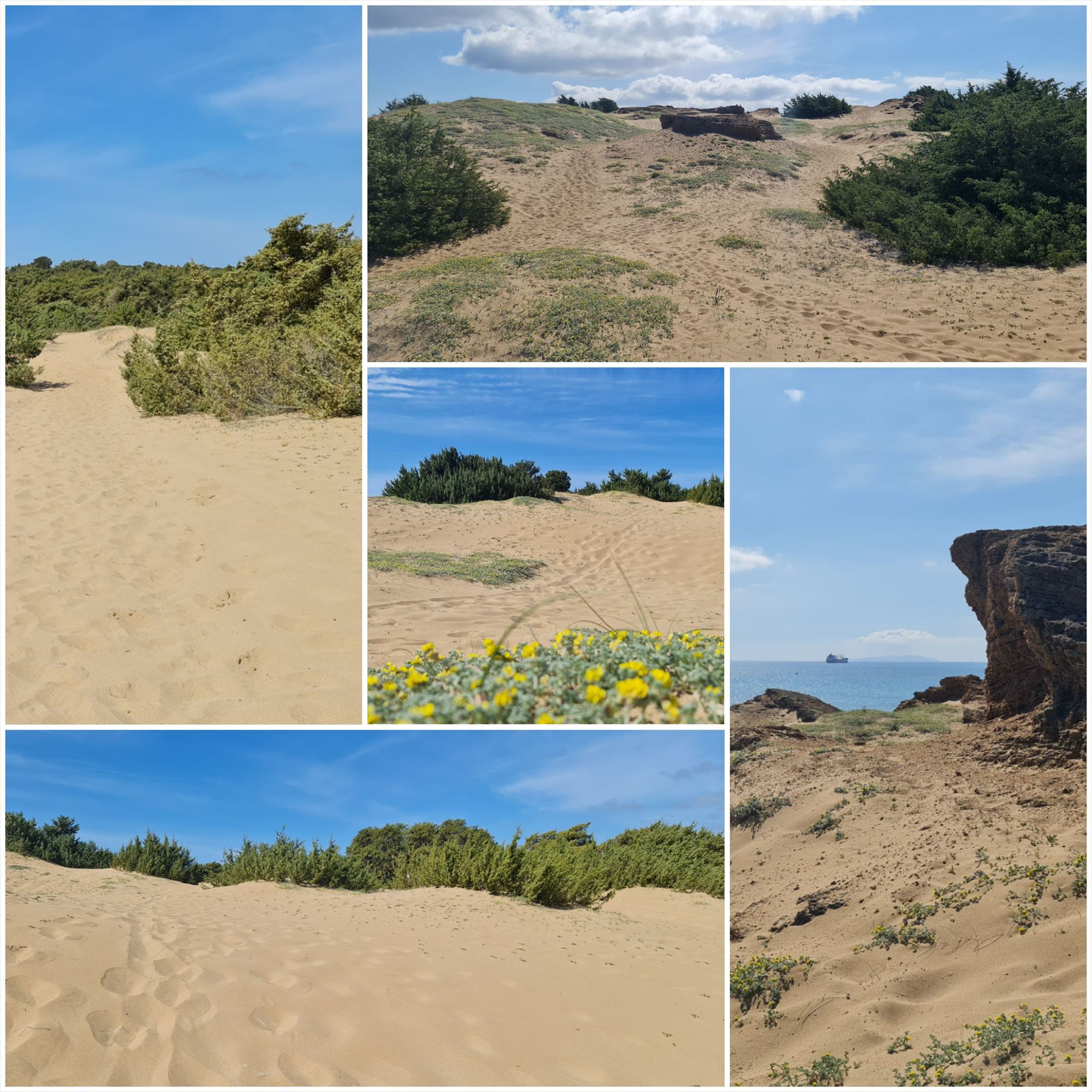
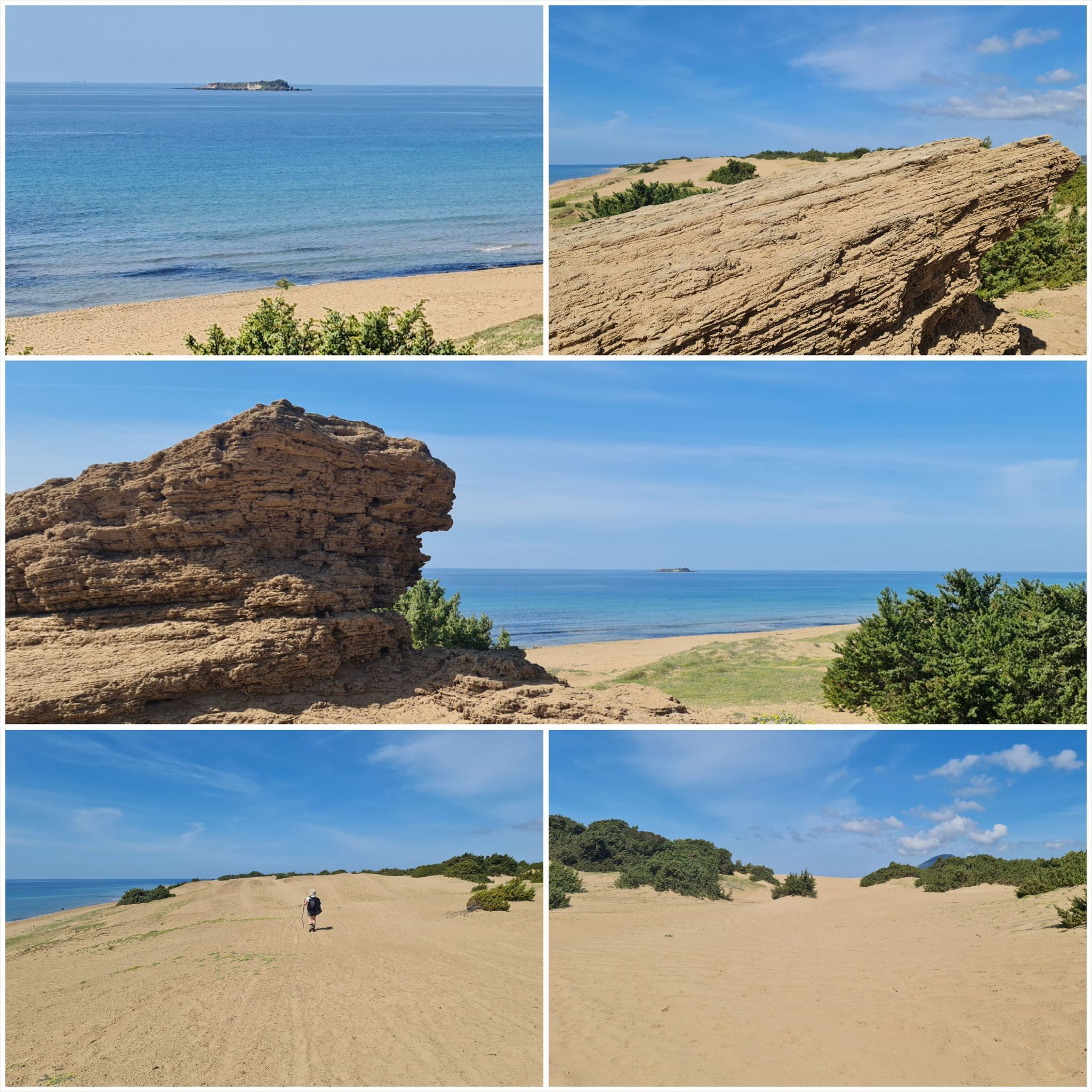
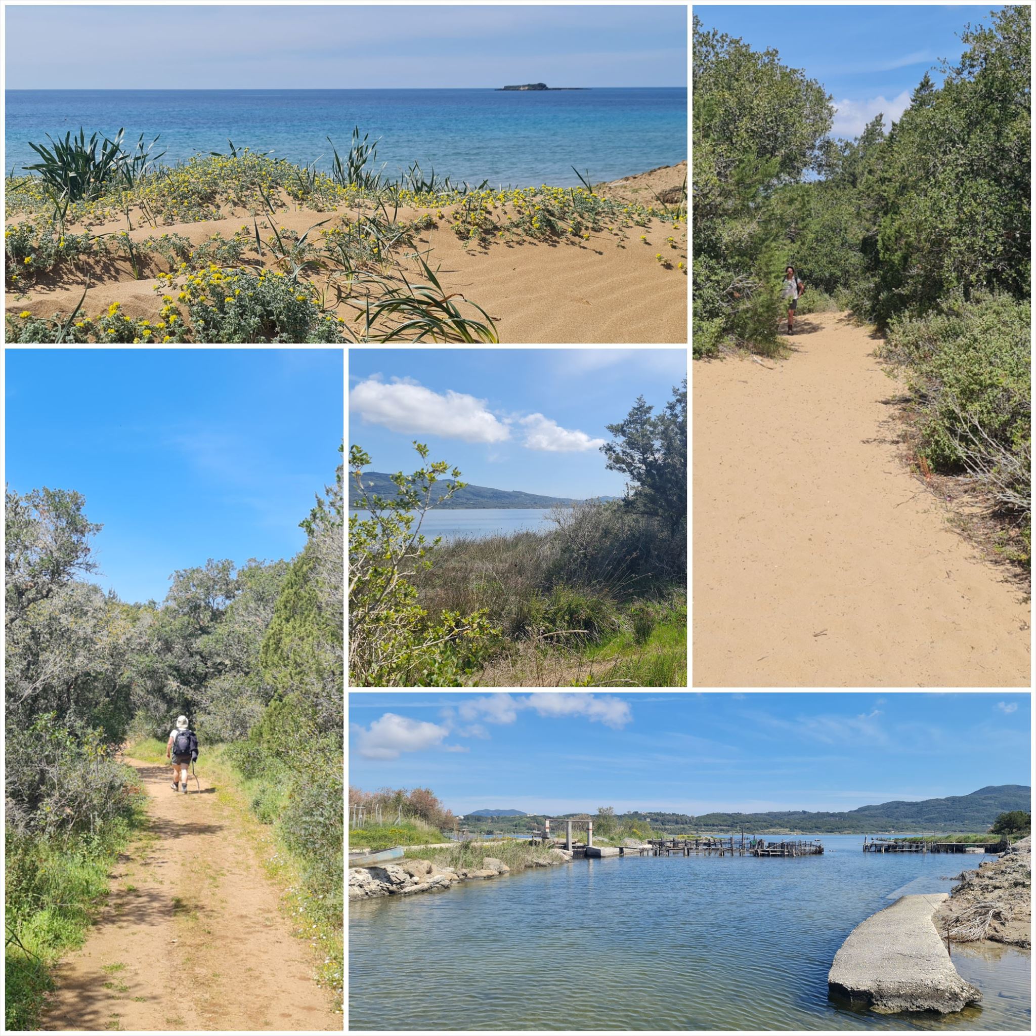
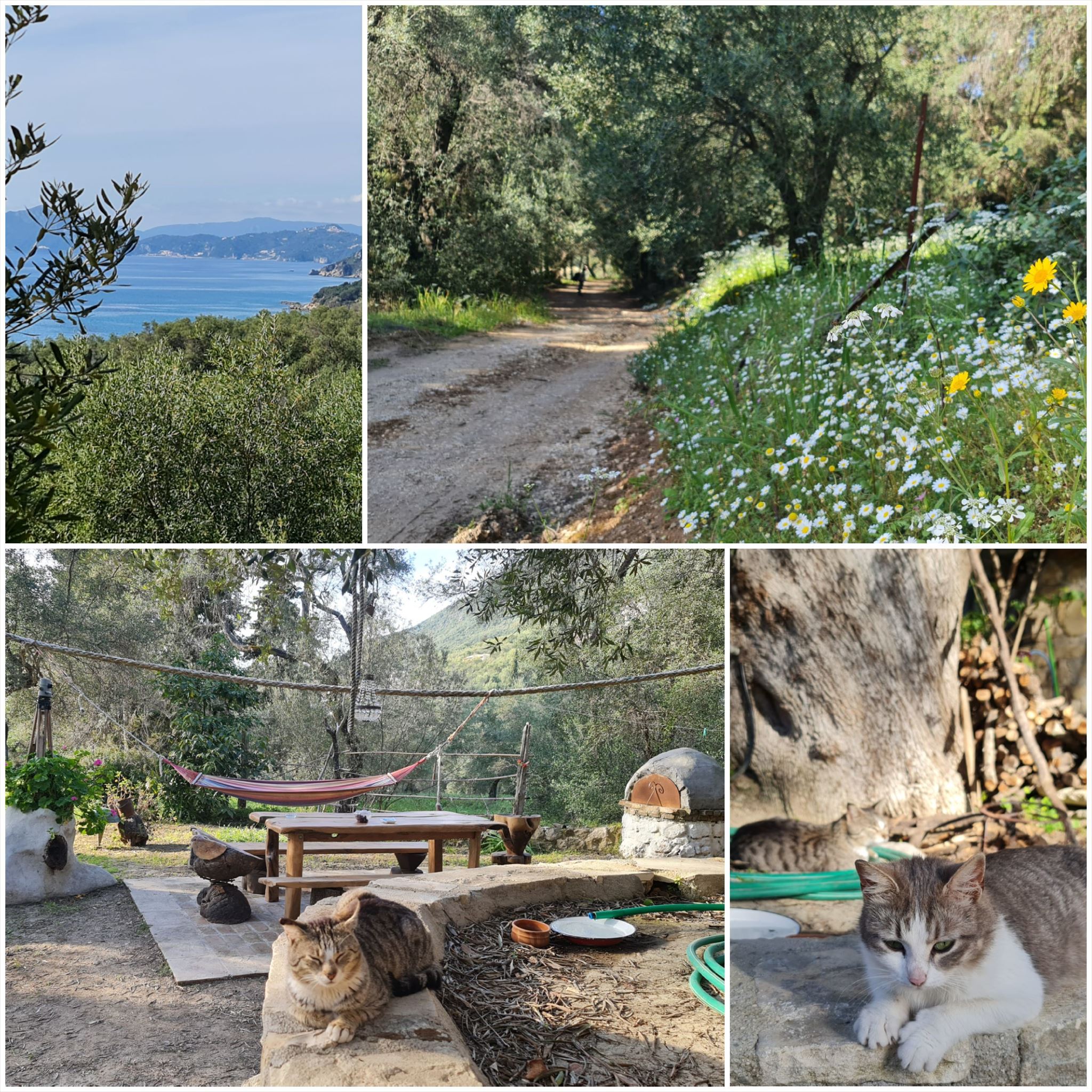
Το τοπίο αλλάζει από αμμώδεις παραλίες και αμμόλοφους στο νότο σε ελαιώνες και βουνά στη μέση και όμορφες παραλίες στα βόρεια.
Τα στάδια έχουν μήκος μεταξύ 10 και 18 χιλιομέτρων και πάντα ξεκινούν ή τελειώνουν εκεί όπου μπορείτε να βρείτε ένα δωμάτιο για τη νύχτα.
Από τον Άγιο Γεώργιο στον Παραμόνα (#3)
Διαμονή (προαιρετικό και δεν απαιτείται για την εύρεση του geocache):
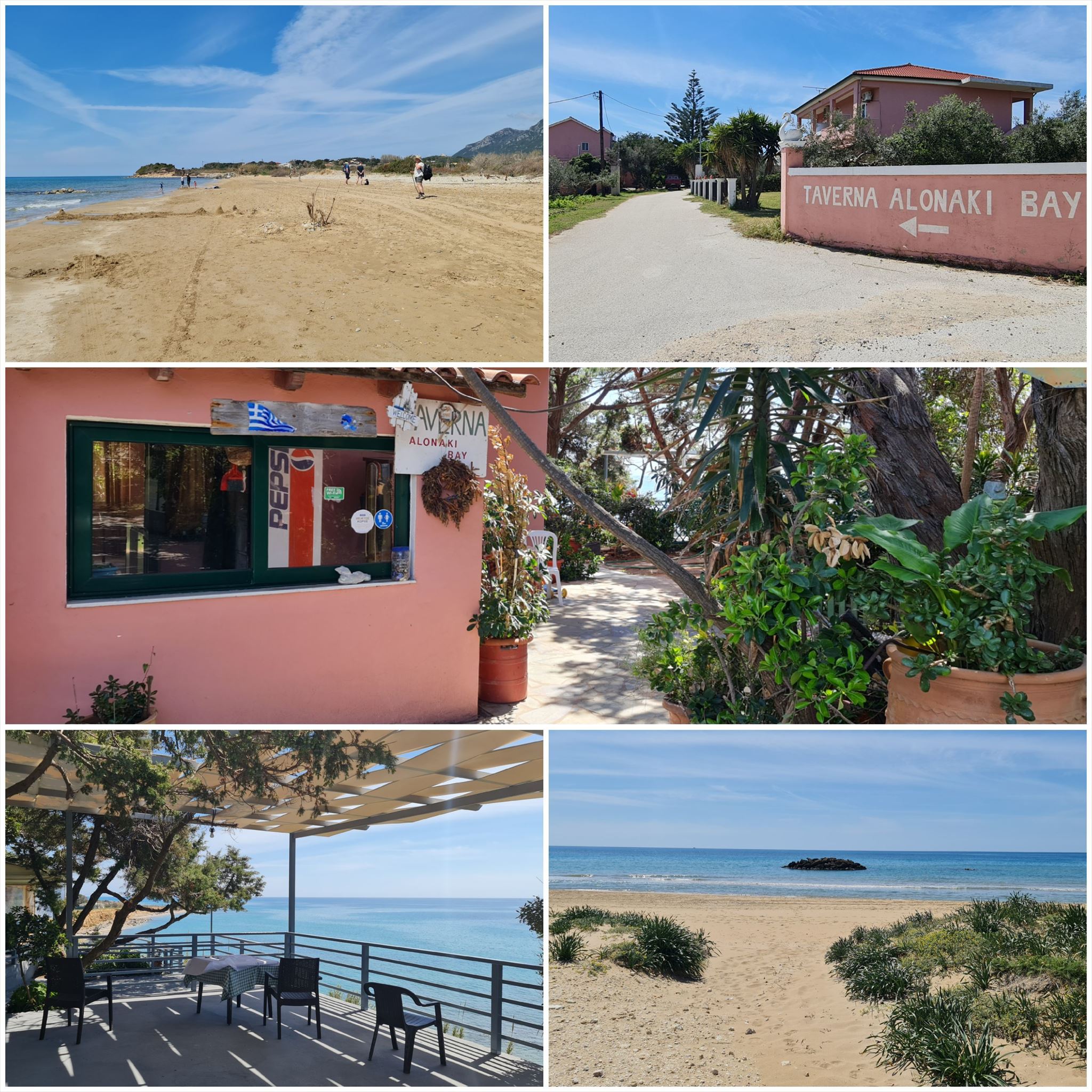
Άγιος Γεώργιος: Andriana
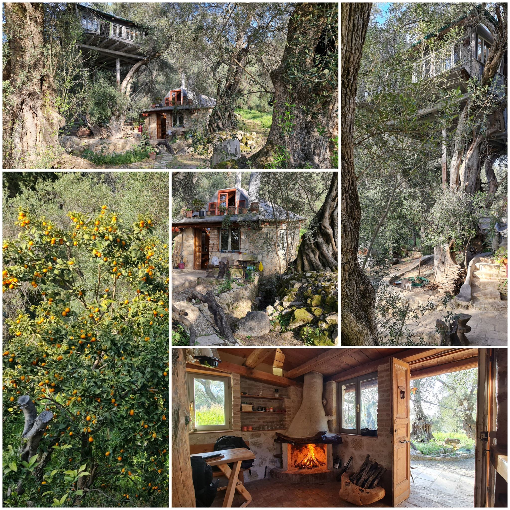
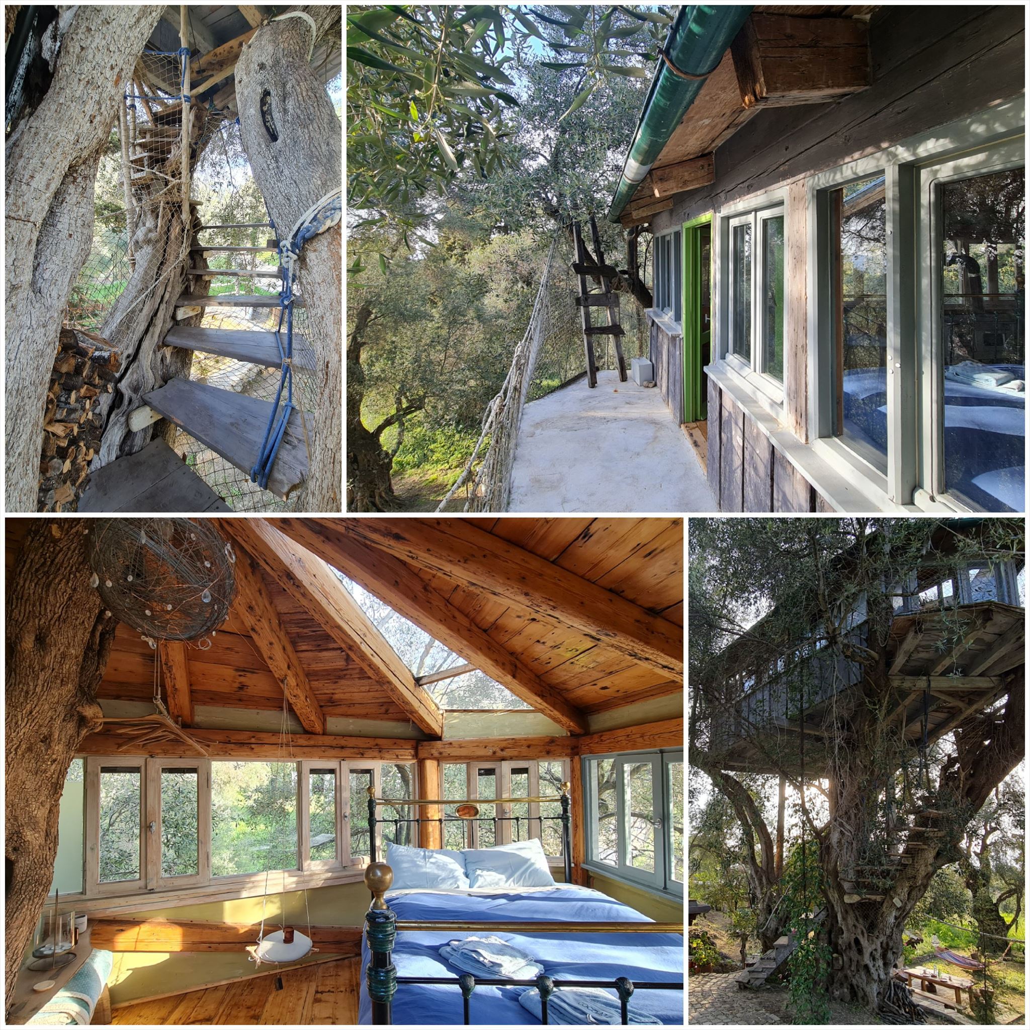
Παραμόν: Margaritis's Treehouse
1. εργασία (Andriana):
N39° 25.524 E19° 57.589
A = Μετρήστε τις ελληνικές ανδρικές φιγούρες που στέκονται στα αμπέλια μέσα στην πόρτα.
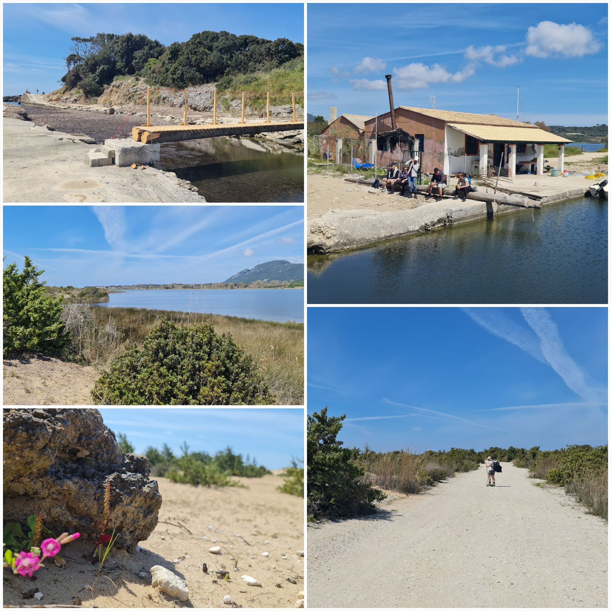
2. εργασία (Πινακίδα «Η εγκατάσταση υδατοκαλλιέργειας (vivari) στο τάγιο»):
N39° 26.457 E19° 54.075
B = Αριθμός της εικόνας που δείχνει "Κέφαλος Flathead από τη λίμνη".
3. εργασία (Σιδερένια πόρτα):
N39° 28.340 E19° 52.166
C = Μετρήστε τα βέλη στο επάνω μέρος της σιδερένιας πόρτας.
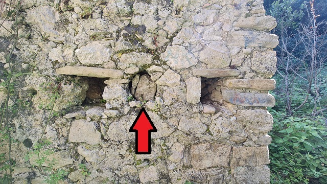
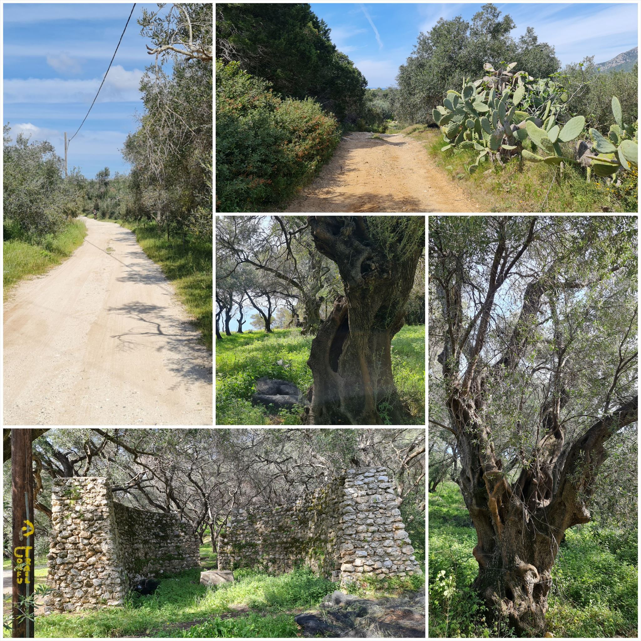
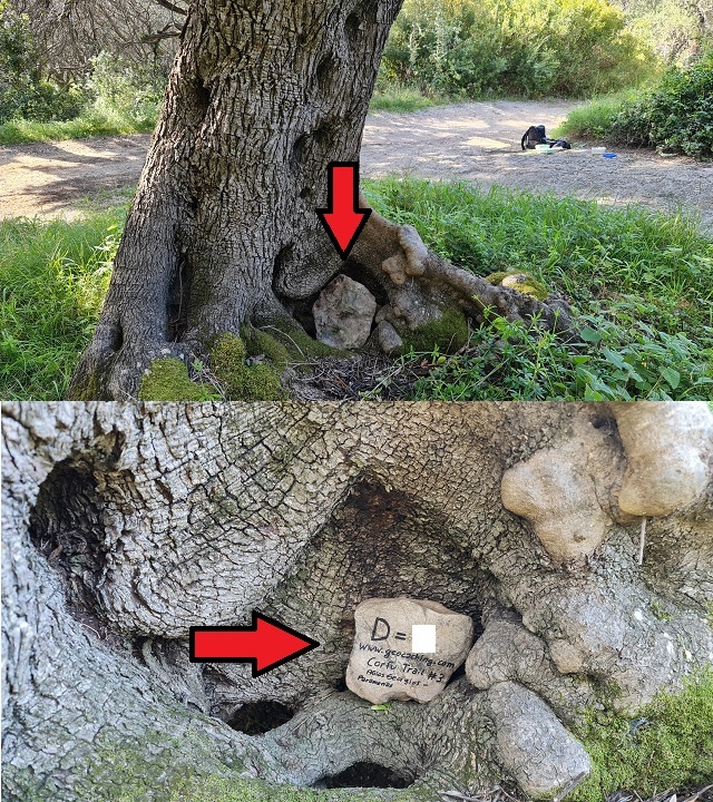
4. εργασία (Πέτρα στην ελιά):
N39° 29.837 E19° 51.365
D = Αριθμός γραμμένος με μόνιμο μαρκαδόρο σε μια πέτρα σε μια ελιά (βλ. spoiler)
Τελικές συντεταγμένες:
"N39° 30.0" A*B+50 "E19° 51." C*D+481

The Corfu Trail is a long distance walking route from Kavos in the south of Corfu to Agios Spiridon in the north.
It was created by Hilary Paipeti in May 2001 and is about 220 km long.
The landscape changes from sandy beaches and dunes in the south to olive groves and mountains in the middle and beautiful beaches in the north.
The stages are between 10 and 18 kilometers long and always starts and ends where you can find a room for the night.
From Agios Georgios to Paramonas (#3)
Accommodation (optional and not needed to find the geocache):
Agios Georgios: Andriana
Paramonas: Margaritis's Treehouse
1. task (Andriana):
N39° 25.524 E19° 57.589
A = Count the greek male figures standing on the grapevines within the door.
2. task (Sign "The aquaculture facility (vivari) at tagio"):
N39° 26.457 E19° 54.075
B = Number of the picture that shows "Flathead mullet from the lake".
3. task (Iron door):
N39° 28.340 E19° 52.166
C = Count the arrows on the top of the iron door.
4. task (Stone in olive tree):
N39° 29.837 E19° 51.365
D = Number written with permanent marker on a stone in a olive tree (see spoiler)
Final coordinates:
"N39° 30.0" A*B+50 " E19° 51." C*D+481
Der Corfu Trail ist ein Fernwanderweg von Kavos im Süden von Korfu nach Agios Spiridon im Norden.
Er wurde im Mai 2001 von Hilary Paipeti angelegt und ist etwa 220 km lang.
Die Landschaft wechselt von Sandstränden und Dünen im Süden zu Olivenhainen und Bergen in der Mitte und wunderschönen Stränden im Norden.
Die Etappen sind zwischen 10 und 18 Kilometer lang und beginnen bzw. enden immer dort wo man ein Zimmer für die Nacht finden kann.
Von Agios Georgios nach Paramonas (#3)
Unterkünfte (optional und nicht notwendig um den Geocache zu finden):
Agios Georgios: Andriana
Paramonas: Margaritis's Treehouse
1. Aufgabe (Andriana):
N39° 25.524 E19° 57.589
A = Zähle die griechischen Männerfiguren, die auf den Weinreben innerhalb der Tür stehen.
2. Aufgabe (Schild „Die Aquakulturanlage (vivari) bei tagio“):
N39° 26.457 E19° 54.075
B = Nummer des Bildes, das „Flathead mullet from the sea“ zeigt.
3. Aufgabe (Eisentür):
N39° 28.340 E19° 52.166
C = Zähle die Pfeile oben auf der Eisentür.
4. Aufgabe (Stein im Olivenbaum):
N39° 29.837 E19° 51.365
D = Nummer mit Permanentmarker auf einen Stein in einem Olivenbaum geschrieben (siehe Spoiler)
Endgültige Koordinaten:
"N39° 30.0" A*B+50 " E19° 51." C*D+481
Πανό για το προφίλ σας: Banner for your profile: Banner für Dein Profil:
<a href="http://coord.info/GC9REMZ><img src="https://img.geocaching.com:443/7f0da488-9d29-4431-be6e-da55a98a0481.png" width="300" height="169" /></a>

Φθείρων Στάδιο 4: spoiler stage 4: Spoiler Station 4:
Φθείρων Τελικός: spoiler final: spoiler Final: