|
|
 |
FTF: pceric |
STF: Zieverer |
TTF: PPasjes + BernPas |
| |
 Άλλα δημοσιευμένα στάδια του "Corfu Trail"
  Other published stages of the "Corfu Trail"
  Weitere veröffentlichte Etappen des „Corfu Trail“
Το Corfu Trail είναι μια μεγάλη απόσταση με τα πόδια από τον Κάβο στα νότια της Κέρκυρας μέχρι τον Άγιο Σπυρίδωνα στα βόρεια.
Δημιουργήθηκε από τον Hilary Paipeti τον Μάιο του 2001 και έχει μήκος περίπου 220 χιλιόμετρα.
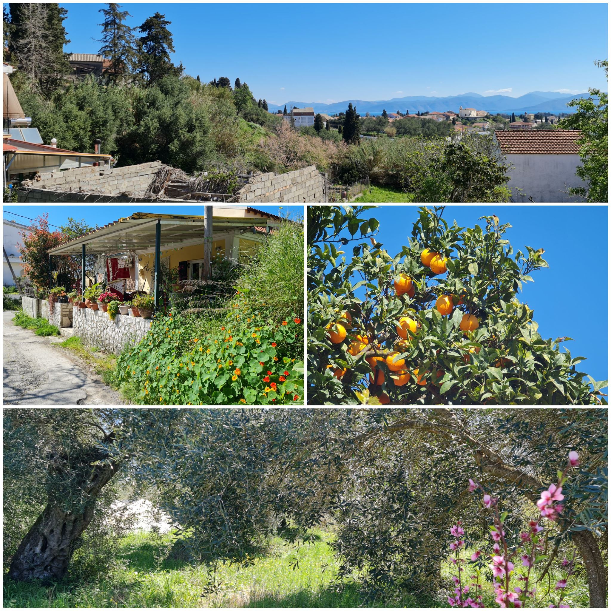
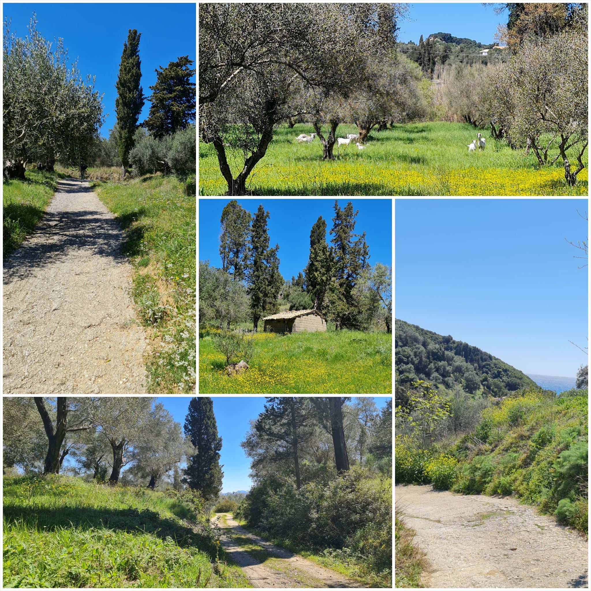
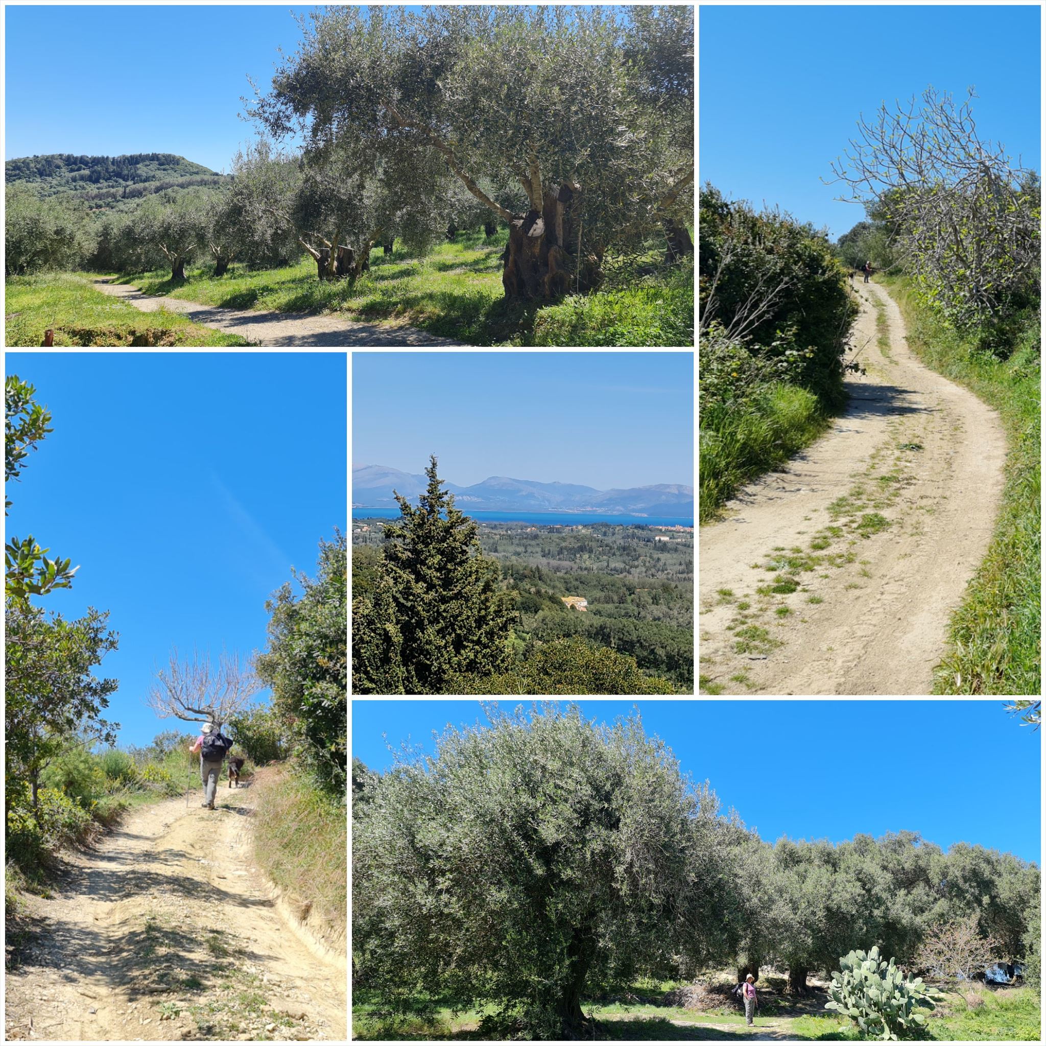
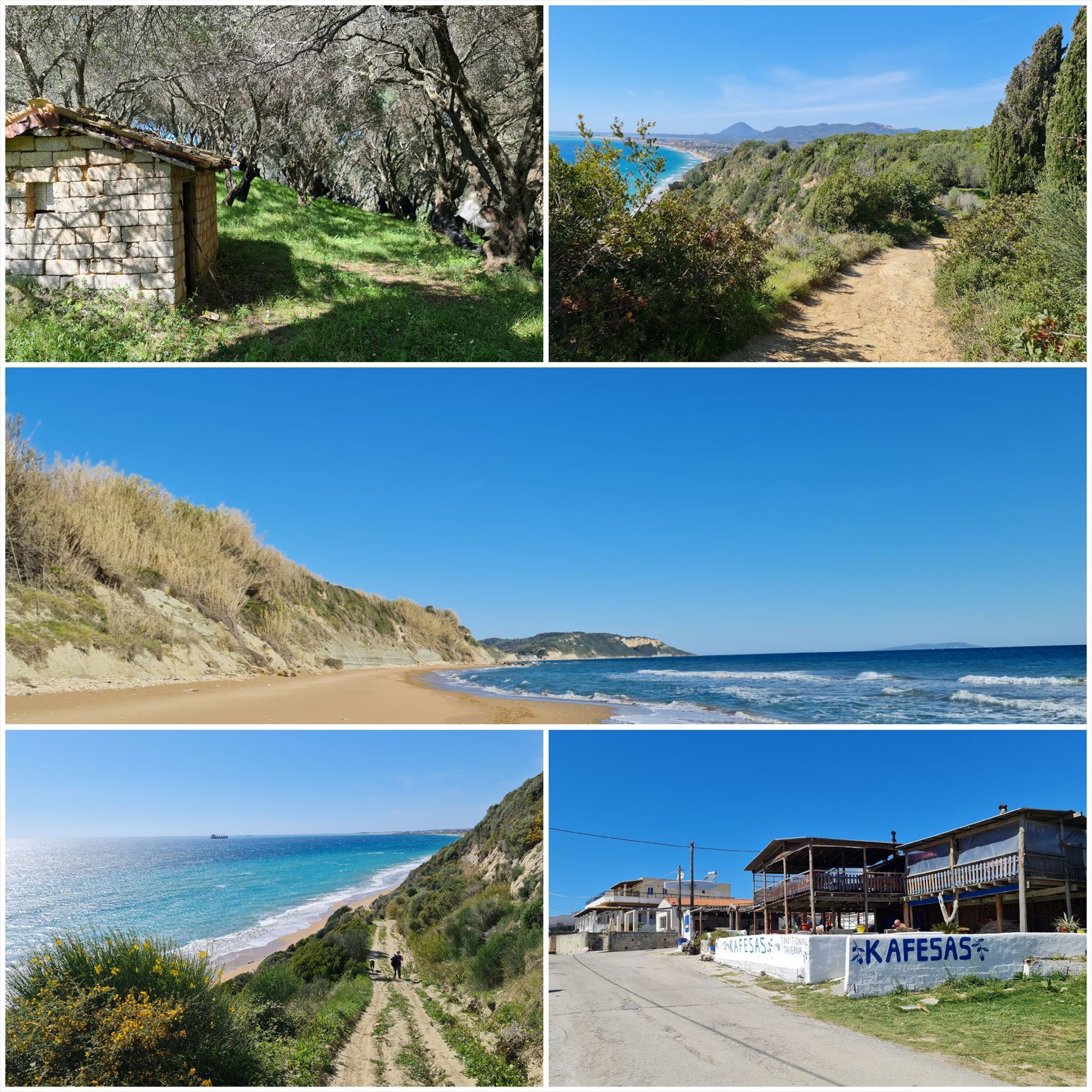
Το τοπίο αλλάζει από αμμώδεις παραλίες και αμμόλοφους στο νότο σε ελαιώνες και βουνά στη μέση και όμορφες παραλίες στα βόρεια.
Τα στάδια έχουν μήκος μεταξύ 10 και 18 χιλιομέτρων και πάντα ξεκινούν ή τελειώνουν εκεί όπου μπορείτε να βρείτε ένα δωμάτιο για τη νύχτα.
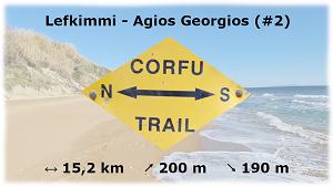
Από Λευκίμμη στον Άγιο Γεώργιο (#2)
Διαμονή (προαιρετικό και δεν απαιτείται για την εύρεση του geocache):
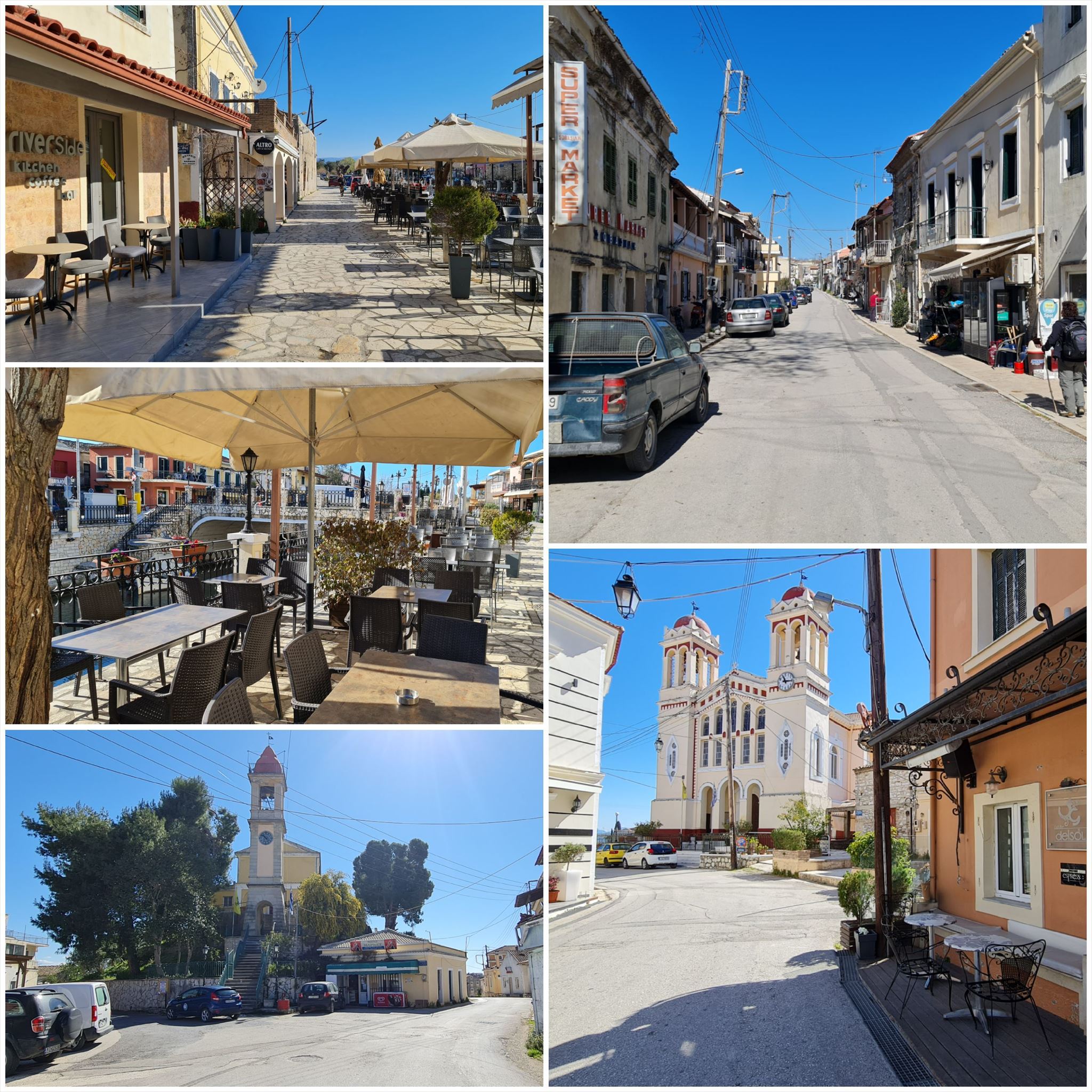
Λευκίμμη: The River Cost House
Άγιος Γεώργιος: Andriana
1η εργασία (Εκκλησία):
N39° 25.282 E20° 4.669
Α = Μετρήστε τα σπίτια κατά μήκος του ποταμού που βλέπει η Μαρία στην εικόνα πάνω από την πόρτα.
2η εργασία (καπέλο Olive Grove):
N39° 24.188 E20° 2.360
B = 4ο ψηφίο στην κλειδαριά στην πόρτα (xxx/Bx).
3. Εργασία (Δύο λέξεις σε μια πινακίδα):
N39° 24.037 E20° 1.113
C = Μετρήστε τα γράμματα της δεύτερης λέξης.
4η εργασία (Ένα άλλο καπέλο ελαιώνα):
N39° 24,258 E20° 0,075
D = Τρίτο ψηφίο του αριθμού του σπιτιού στη μεταλλική πινακίδα στην πόρτα.
Τελικές συντεταγμένες:
"N39° 25." A*B+406 "E19° 57." C*D+554

The Corfu Trail is a long distance walking route from Kavos in the south of Corfu to Agios Spiridon in the north.
It was created by Hilary Paipeti in May 2001 and is about 220 km long.
The landscape changes from sandy beaches and dunes in the south to olive groves and mountains in the middle and beautiful beaches in the north.
The stages are between 10 and 18 kilometers long and always starts and ends where you can find a room for the night.
From Lefkimmi to Agios Georgios (#2)
Accommodation (optional and not needed to find the geocache):
Lefkimmi: The River Cost House
Agios Georgios: Andriana
1. task (Church):
N39° 25.282 E20° 4.669
A = Count the houses along the river Maria is overlooking in the picture above the door.
2. task (Olive grove hut):
N39° 24.188 E20° 2.360
B = 4th digit on the lock at the door (xxx/Bx).
3. task (Two words on a sign):
N39° 24.037 E20° 1.113
C = Count letters of the second word.
4. task (Another olive grove hut):
N39° 24.258 E20° 0.075
D = Third digit of house number on metal sign at the door.
Final coordinates:
"N39° 25." A*B+406 " E19° 57." C*D+554
Der Corfu Trail ist ein Fernwanderweg von Kavos im Süden von Korfu nach Agios Spiridon im Norden.
Er wurde im Mai 2001 von Hilary Paipeti angelegt und ist etwa 220 km lang.
Die Landschaft wechselt von Sandstränden und Dünen im Süden zu Olivenhainen und Bergen in der Mitte und wunderschönen Stränden im Norden.
Die Etappen sind zwischen 10 und 18 Kilometer lang und beginnen bzw. enden immer dort wo man ein Zimmer für die Nacht finden kann.
Von Lefkimmi nach Agios Georgios (#2)
Unterkünfte (optional und nicht notwendig um den Geocache zu finden):
Lefkimmi: The River Cost House
Agios Georgios: Andriana
1. Aufgabe (Kirche):
N39° 25.282 E20° 4.669
A = Zähle die Häuser entlang des Flusses die Maria überblickt auf dem Bild über der Tür.
2. Aufgabe (Olivenhainhütte):
N39° 24.188 E20° 2.360
B = 4. Ziffer auf dem Schloss an der Tür (xxx / Bx).
3. Aufgabe (zwei Wörter auf einem Schild):
N39° 24.037 E20° 1.113
C = Zähle die Buchstaben des zweiten Wortes.
4. Aufgabe (Noch eine Olivenhainhütte):
N39° 24,258 E20° 0,075
D = Dritte Ziffer der Hausnummer auf dem Metallschild an der Tür.
Endgültige Koordinaten:
"N39°25." A * B + 406 "E19 ° 57." C * D + 554
Πανό για το προφίλ σας: Banner for your profile: Banner für Dein Profil:
<a href="http://coord.info/GC9REJ0><img src="https://img.geocaching.com:443/d345f1a4-dbd8-4e01-85a1-9f6c848c3278.png" width="300" height="169" /></a>