The Geo Boo Gang is a social group made up of geocachers from northeastern New Jersey and the Lower Hudson Valley of New York. The Geo Boo Gang holds regular events, including monthly ice cream socials and quarterly dinners. They race each other for First to Finds and often run into each other on local trails.
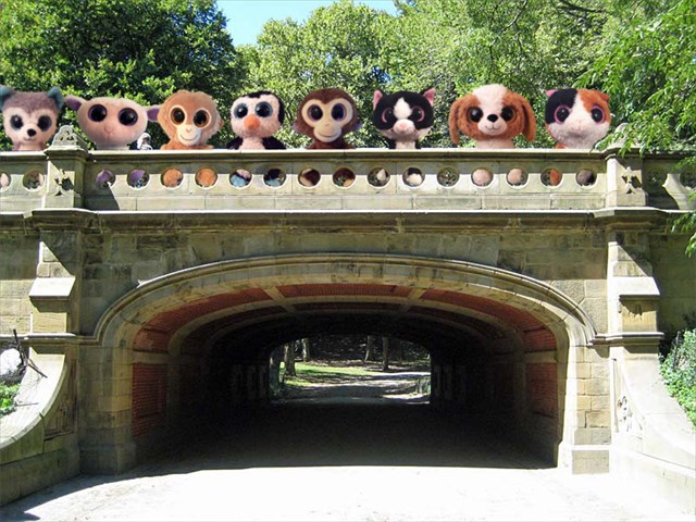
The Geo Boo Gang at the Dalehead Arch while working on Bridges & Arches of Central Park (GC17MX1)
l-r: Balto Kaasen, Bo Woolensworth, Caesar Taylor, Cody Cook, Cornelius Taylor, Felicia Furrball, Jack Russell, Olga Caramel
It was during one of their ice cream socials that the following conversation occurred:
Olga: ... and that's how I developed a love for cooking.
Bo: Wait, I love to cook too. How did I never know this about you?
Cody: Well, all we usually talk about is geocaching. I don't think I really know much about any of you, besides the fact that you enjoy finding Tupperware in the woods using a super-expensive satellite system!
Felicia: Hey, that gives me an idea! Why don't we create a puzzle series together; each of us would create a puzzle based on something that interests him or her? Olga or Bo could use cooking if they wanted to, for example, since they both love cooking. And then together we can create a final, bonus puzzle, based on all our individual puzzles. This will be a fun way to get to know each other better.
Cornelius: Caesar and I are brothers. Can we put together a puzzle as a team?
Balto: Jack and I hang out all the time. Can we create a puzzle together too?
Felicia: That sounds great guys! So we'll have six puzzles, which works out perfectly. Let's coordinate the bonus puzzle, and then we'll go create our individual puzzles on our own.
And that's how the Geo Boo Gang puzzle series was born.
Cody Cook
Cody Cook is a geocacher with a STEM education, and loves integrating the four disciplines - Science, Technology, Engineering, and Mathematics - in everything he does. He learned about geocaching through a technology podcast with an episode devoted to games based on GPS, the Global Positioning System, and hasn't looked back since.
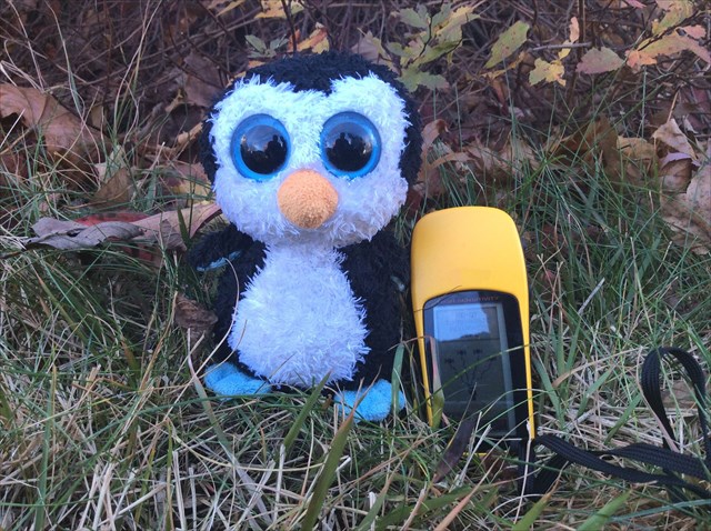
Cody Cook with his GPS receiver
Today is International Geocaching Day 2015, and Cody has been inspired to create his entry in the Geo Boo Gang puzzle series. He likes to find a good final location and have it approved with his local reviewer before creating his puzzles; he figures there is no point in putting effort into the details of a puzzle if the location isn't going to work out!
Unfortunately, Cody is having a problem with his GPS receiver. He found a great hiding spot, but his receiver started acting up! He had been using the receiver without issue for years, but after marking the waypoint for the puzzle final, instead of showing a GPS coordinate, the receiver showed the following information:
$GPS11,160230.0829041384,4063.0000,N,05299.0000,W,19808.1,KM
$GPS01,160230.0813097068,2758.0000,N,05484.0000,W,20072.3,KM
$GPS30,160230.0809520507,2701.0000,N,09349.0000,W,20153.9,KM
$GPS04,160230.0801554947,4343.0000,N,03386.0000,W,19884.1,KM
$GPS28,160230.0772779343,5607.0000,N,11462.0000,W,20715.9,KM
"What on Earth!" exclaimed Cody. "What happened to my receiver? I'd better bring this down to the repair shop, and pronto!"
Cody arrived at Ulmer's GPS Repair Shop and met with the store's owner / chief GPS repairman.
"Welcome to Ulmer's GPS Repair Shop," said Mr. Ulmer. "What seems to be the problem?"
"Hi Mr. Ulmer, my name is Cody, and my GPS receiver seems to be broken! I was trying to mark a waypoint for a geocaching puzzle final, but after I took the reading, the receiver gave me an error!" replied Cody.
"May I see the error you received?" asked Mr. Ulmer.
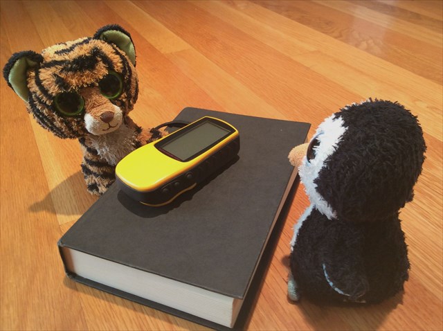
Cody Cook meeting with Mr. Ulmer at Ulmer's GPS Repair Shop
Cody handed over his GPS receiver and Mr. Ulmer took a look. "That's not an error, Cody. What you have here is raw GPS data; the information your receiver uses to calculate the coordinate. Do you know how the Global Positioning System works?" asked Mr. Ulmer.
"Somewhat," replied Cody. "Can you tell me what this information means?"
"Sure," said Mr. Ulmer. "But first, let me tell you a bit about how GPS works, so you understand what the information means. The Global Positioning System is a series of 24 or more satellites, called a constellation. The satellites are divided up into six different orbits, with each satellite orbiting the Earth twice per day at an altitude of around 20,000 kilometers. The satellites follow a pattern that guarantees that at least four satellites are visible at any time from any point on the Earth. There's a reason your receiver needs to be able to see four satellites, and I'll get into that in a minute."
"Each satellite periodically broadcasts information about itself, and these signals are picked up by receivers on and above the Earth," continued Mr. Ulmer. "The information that is broadcast includes the satellite's position and the time the information was transmitted. The satellite contains an atomic clock that is very precise, and updates are made periodically from ground stations."
"Why does a receiver need to use four satellites to find its position?" asked Cody. "I know that with three unknown variables, latitude, longitute, and altitude, the receiver should only need to use information from three satellites."
"That's right Cody," replied Mr. Ulmer, "but you're forgetting the fourth variable: the current time. Your receiver not only doesn't know where it is without GPS signals, it also doesn't know what time it is either. Think of the broadcasts of the four satellites as four stones being thrown simultaneously into different places in a pond, with the signal moving away from the satellite like the ripple the stone makes in the pond. Each satellite knows the time that it broadcast its signal, but it takes time for the signal, moving at the speed of light, to reach your receiver. Four satellites broadcasting signals at the same time will reach the receiver at four different times; to think of that the other way, four signals picked up by the receiver at one time were broadcast by four satellites at four different times. The signal from the closest satellite will be received first, and the signal from the farthest satellite will be received last. Going back to the pond analogy: it takes time for each ripple to reach a point, and a fixed point in the pond will see ripples from different times after a splash because of that effect."
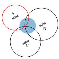
GPS signals determine your location on Earth; the bigger the circle's diameter, the longer the signal took to reach your GPS receiver (diagram from physics.org)
"Now let's take a look at the first line of the data," said Mr. Ulmer.
$GPS11,160230.0829041384,4063.0000,N,05299.0000,W,19808.1,KM
"The data is separated by commas, so it can be understood by software easier. Each line represents a single signal transmission; we'll assume that each of the signals was received simultaneously by the receiver, and we'll be able to figure out the location of your waypoint. The first value on each line is the GPS satellite identifier; the second is the time the signal was broadcast from the satellite; the third and fourth represent the latitude of the satellite, the fifth and sixth the longitude of the satellite, and the last two the altitude of the satellite. Let's make this easier to understand by putting the data in a table. We can get more information about each satellite by looking up the GPS satellite identifier online."
| Satellite Name |
NORAD Number |
Tx Time (GMT) |
Latitude |
Longitude |
Altitude (km) |
| GPS BIIR-3 (PRN 11) |
25933 |
16:02:30.0829041384 |
40.63 |
-52.99 |
19808.1 |
| GPS BIIF-2 (PRN 01) |
37753 |
16:02:30.0813097068 |
27.58 |
-54.84 |
20072.3 |
| GPS BIIF-5 (PRN 30) |
39533 |
16:02:30.0809520507 |
27.01 |
-93.49 |
20153.9 |
| GPS BIIA-23 (PRN 04) |
22877 |
16:02:30.0801554947 |
43.43 |
-33.86 |
19884.1 |
| GPS BIIR-5 (PRN 28) |
26407 |
16:02:30.0772779343 |
56.07 |
-114.62 |
20715.9 |
"When did you take this waypoint?" asked Mr. Ulmer.
"Earlier today," replied Cody. "Close to noon. Why?"
"We can look online at a map that shows where all the satellites were in space at the time you took your waypoint," said Mr. Ulmer. "Here we go; take a look."

GPS satellites over North America when Cody took the waypoint (from in-the-sky.org)
"Wow, that's awesome!" exclaimed Cody. "Are those the satellites that sent the data my receiver picked up?"
"Yes they are," replied Mr. Ulmer. "Even though your receiver needs four satellites to determine its location and the time, your receiver picked up five satellites, which makes determining your position and time even easier! Take a look at how your data lines up with the map. Satellite 11 is over the Atlantic Ocean, close to due east of us. Satellite 01 is also over the Atlantic Ocean, south of the first satellite. Satellite 30 is over the Gulf of Mexico, Satellite 28 is over Canada, and Satellite 04 is way out over the Atlantic, east and a little north of Satellite 11."
"That's so cool!" said Cody. "I love math and physics; I bet I can figure out not only the location of my waypoint from this information, but the time I took the waypoint as well! Are there any assumptions I should use in my calculations?"
"Yes," replied Mr. Ulmer. "Let's talk about them. You should assume:
- All four signals reached your GPS receiver simultaneously
- The waypoint is at sea level
- The Earth's atmosphere has no effect on the GPS signal
- The Earth is a perfect sphere, with a radius of 6370 kilometers
- The speed of light is 3.00E+08 meters per second
- Your GPS receiver has no time differential error"
"Thank you," said Cody. "Let me go home and work on this. I'll let you know if I figure out the coordinate at which I took the waypoint."
Cody went home and got to work. He thought it would be an easy effort to find the waypoint coordinate, but had an unexpected amount of trouble. He called his friend Jen Ithacow, a geocaching puzzle expert, who stopped by to help Cody with the calculations. The math wasn't easy but it turned out to be straightforward, and after some time, they came up with a coordinate. Cody and Jen checked their work on Google Maps and saw the answer looked correct. Cody thanked Jen for all her help, and as she left to go home, promised to let her know what Mr. Ulmer said. The next morning, Cody returned to Ulmer's GPS Repair Shop.

Cody Cook working with his friend Jen Ithacow on solving the GPS equations
"Mr. Ulmer," said Cody. My friend Jen and I think we figured out the coordinate! Does this look right?" Cody handed over his work.
Mr. Ulmer checked Cody's math. "It looks correct, Cody. Great job!"
"Thank you Mr. Ulmer!" replied Cody. "I'm going to use this problem as my puzzle in the Geo Boo Gang series! Hopefully the geocachers trying to find my cache can solve this puzzle too!"
Can YOU find the geocache?
Per the rules of geocaching, a Found It log must correspond to a signed logbook.
You can check your answers for this puzzle on GeoChecker.com.
BONUS: the cache container will have written in it a note with part of the coordinate for the puzzle series bonus cache, of the form LETTER=COORDINATE PIECE. Save these pieces of the bonus coordinate for use in geocache GC62D9P.
I hope you enjoy the entire Geo Boo Gang puzzle series! The series consists of the following caches:
GC62D9B: Geo Boo Gang Series: Caesar and Cornelius Taylor
GC62D9D: Geo Boo Gang Series: Balto Kaasen and Jack Russell
GC62D9F: Geo Boo Gang Series: Cody Cook
GC62D9G: Geo Boo Gang Series: Olga Caramel
GC62D9J: Geo Boo Gang Series: Felicia Furrball
GC62D9M: Geo Boo Gang Series: Bo Woolensworth
GC62D9P: Geo Boo Gang Series: Bonus
Happy caching!