 This cache is the sister cache to my A Walk in the Dell cache which is a
long walk through the dell.
This cache is the sister cache to my A Walk in the Dell cache which is a
long walk through the dell.
This cache is a slightly shorter walk that starts at the Water
of Leith Visitor’s centre (next to the Dell Inn). There are 6
caches to do along the way. It follows a different route through
the dell; this time mostly on the other side of the river which I
think is the less well known side of the river. So here is a great
excuse to do so!
I have included additional waypoints for each stage. Please
use them. For waypints 3 and 4 there are other similar objects
nearby that could be confused with the real place of the waypoint.
They are there to help you find the correct place. They should all
bring you to within 3 or 4m of the place or object. In the
additional waypoints the Prefix 'W' is the waypoint number. And one
other thing – you may need a calculator!
The posted coordinates take you to an information board, which
is also Waypoint 1. Look at the notice board.
[Clue A: How many National Cycle symbols are on
the map?]
[Clue B: Redhall mill dates back to
17?]
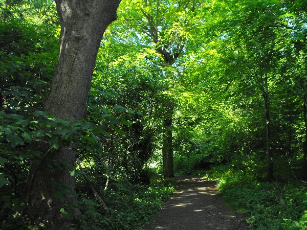
Now you continue walking along and up the path. When you reach
the fork take the right, keeping to the riverside. Soon you will
come across the little grotto where GCTHDY is. If you have already done
‘A Walk in the Dell’ you will recognise this area.
Continue on the path until you get to the bridge, cross over it
onto the other side of the river. You will come to a tree stump.
This is Waypoint 2.
[Clue C: When was Redhall Walled garden
constructed? 17?]
[Clue D: How many red berries are on the yew
branch?]
Now continue on the path heading upriver. You will pass by
GC1T4VH on your way.
This is the path near to GC1T4VH. Keep going along this
path.
Keep going on this path until you get to a road next to a house.
This is Waypoint 3. Look at the lamppost.
[Clue E: How many letters and numbers are there
going vertically down?]
[Clue F: What is the only number on the
lamppost?]
From here head towards the bridge, but turn right just before
the bridge, do not go over the bridge. You will recognise
this path from ‘A Walk in the Dell’ (well I hope you do
if you’ve already done it!). Keep on this path, and when the
path rises up to meet the old railway line, keep going on straight
down the path. You will emerge at a field. This is waypoint
4.
[Clue G: How many large trees (one has a
rope hanging from it; this kind of size...  ) are at the coords? Take 1 away from
this number.]
) are at the coords? Take 1 away from
this number.]
[Clue H: Take the number for G,
and multiply it by 4.]
Continue on through the field. You will glimpse Katesmill Bridge
through the trees, and if you just quickly go across this bridge
you can get cache GC1R6E8
as well. The path goes up and joins the old Railway line here as
well, so head up here to waypoint 5, the final waypoint. It is a
telegraph pole you are looking for. Look at the pole.
[Clue I: What is the number on the pole
plus the number on the 4th line of the carving?]
[Clue J: What is the number on the 2nd line? BT
?L 00 ?I]
Now set your GPS to find the cache. This is where the calculator
may come in handy, so here goes!
The cache can be found at:
N 55° 55.X W 003° 15.Y where
X = ((B+C) + (E×F)) × D + ((H×J)-G)
and
Y = (A×B) + (D×I)
Keep following the old Railway line (in the opposite direction
from Colinton) until you get to the canal. The cache is somewhere
nearby (when you reach the canal, GC1YVWY is very nearby).
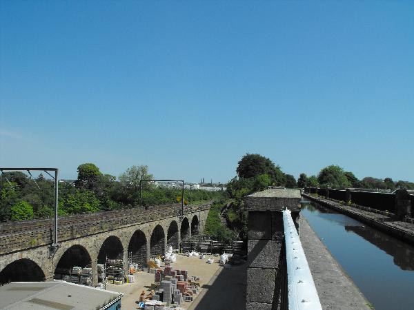
Slateford Viaduct and Slateford Aqueduct, 1st June 2009.
Once you have found the cache, simply walk over the Slateford
Aqueduct and on the other side is some steps down to the boardwalk
and the Water of Leith Walkway again.
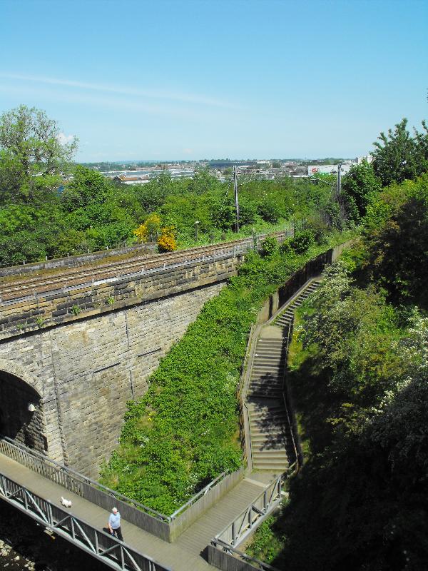
Go down these steps to get to the Water of Leith Walkway.
At the bottom of the steps you can quickly find cache GCK1T2 as well – it is very
close at this point.
It is now a simple 200m walk back to your starting point –
just set your GPS to find WP1. I hope you enjoyed the walk!