 A Wales Coast Path Tag 2016
| Trackable Options |
 Found this item? Log in.
 |
 Printable information sheet to attach to A Wales Coast Path Tag 2016
Print Info Sheet
Printable information sheet to attach to A Wales Coast Path Tag 2016
Print Info Sheet |
|
-
Owner:
-
WalksTheSurf
Message this owner
-
Released:
-
Tuesday, December 29, 2015
-
Origin:
-
South Wales, United Kingdom
-
Recently Spotted:
-
In the hands of cumplice.
This is not collectible.
Use TB7AK61 to reference this item.
First time logging a Trackable? Click here.
Main mission: To visit geocaches along the Wales Coast Path
Secondary mission: To travel the world's geocaches telling tales of the Wales Coast Path, collecting photos of exotic (and interesting) places visited.
This TB is released in celebration of the Wales Coast Path (WCP) (particularly in Pembrokeshire) and the spectacular Wales coast. The Wales Coast Path is waymarked with this ‘dragon shell’ logo.
The WCP enables quality walking around almost any part of the Wales Coast. It also enables a massive circular walk around the shape of Wales using Offa’s Dyke Path National Trail to join the ends of the WCP. Ffordd Glyndwr National Trail adds the opportunity for a figure eight route crossing central Wales etc.
(Extracts from the WCP web site www.walescoastpath.gov.uk [which also has distance charts and downloadable maps of the route]:
The Wales Coast Path has been developed by the Welsh Government in partnership with Natural Resources Wales (NRW), sixteen local authorities and two National Parks.
Where possible, the route will follow the Welsh coastline as close as it is safe and practical. Over time, the Wales Coast Path is expected to lead to the creation of circular coastal routes as links to the inland towns and villages are improved.
Anyone adding up the total distance may notice that it amounts to 882 miles or 1419 kilometres - slightly longer than the official distance of 870 miles or 1400 kilometres. However, NRW expect this figure to reduce as planned realignments come into effect. The tables will be revised when this happens.) The distance you actually walk will vary according to tides and military restrictions.
The Wales Coast Path is also part of the International Appalachian Trail
Further information at:
www.nt.pcnpa.org.uk & http://www.nationaltrail.co.uk/pembrokeshire-coast-path
www.iat-sia.com (International Appalachian Trail)
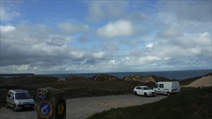
Gallery Images related to A Wales Coast Path Tag 2016
View All 17 Gallery Images
Tracking History (105820.4mi) View Map
|
cumplice took it to EN2 006 GeoArt - Vila de Rei
|
Castelo Branco, Portugal
- 5.37 miles
|
Visit Log
|
|
|
|
cumplice took it to EN2 154 GeoArt - Vila de Rei
|
Castelo Branco, Portugal
- 3.72 miles
|
Visit Log
|
|
|
|
cumplice took it to EN2 159 GeoArt - Vila de Rei
|
Castelo Branco, Portugal
- 2.09 miles
|
Visit Log
|
|
|
|
cumplice took it to Vilarregense Futebol Clube
|
Castelo Branco, Portugal
- 1.02 miles
|
Visit Log
|
|
|
|
cumplice took it to EN2 Km 366.200
|
Castelo Branco, Portugal
- .96 miles
|
Visit Log
|
|
|
|
cumplice took it to EN2 046 GeoArt - Vila de Rei
|
Castelo Branco, Portugal
- .69 miles
|
Visit Log
|
|
|
|
cumplice took it to EN2 047 GeoArt - Vila de Rei
|
Castelo Branco, Portugal
- 1.62 miles
|
Visit Log
|
|
|
|
cumplice took it to EN2 Km 366.400
|
Castelo Branco, Portugal
- .24 miles
|
Visit Log
|
|
|
|
cumplice took it to EN2 Km 367.000
|
Castelo Branco, Portugal
- 1.26 miles
|
Visit Log
|
|
|
|
cumplice took it to EN2 049 GeoArt - Vila de Rei
|
Castelo Branco, Portugal
- .24 miles
|
Visit Log
|
|
|
|
data on this page is cached for 3 mins
|