
 Sink Hole –
N34 38.942 W111 45.180
N34 38.928 W111 45.110
N34 38.921 W111 45.117
About 12 million years ago (the Tertiary) this area was covered by a shallow lake. Plants that grew in the lake caused dissolved calcium carbonate to precipitate out of the lake to form a soft limestone at the bottom of the lake. This limestone is now known as the Verde Formation.
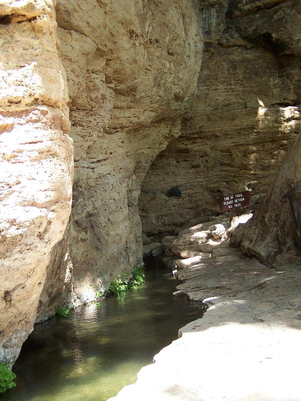
About 2 million years ago the climate changed enough so that the lake dried up. Then infiltrating precipitation and ground water, which are slightly acidic, began dissolving the limestone to form a cavern. At some point, the cavern grew so large that it could no longer support the weight of the rocks above it and collapsed forming the sinkhole. The water continued to dissolve the limestone forming the side cave that drains the lake, called the Montezuma Well.
The water entering the well is loaded with dissolved calcium carbonate from its travels through the limestone beneath the surface. When the water reaches the atmosphere, the dissolved calcium carbonate precipitates back into limestone and releases carbon dioxide. As a result the water in the well is extremely high in carbon dioxide.
 Swallet
N34 38.921 W111 45.117
N34 38.835 W111 45.102
Water has dissolved cracks in the limestone that drain the well. These cracks go from the side of the sink about 150 feet to the side of the cliffs. It takes about 7 minutes for water to go through the cracks to its outlet by the creek. The Native Americans took advantage of this outlet and built a canal to irrigate their crops.
Logging requirements:
Send me a note with :
- The text "GCZ5F8 Montezuma Well" on the first line
- The number of people in your group.
- What makes the lining of the canal almost waterproof?
- The volume of water that flows through the well each day.
The above information was compiled from the following sources:
- Konieczik, A.D. and Leake, S.A. 1997, Hydrogeology and Water Chemistry of Montezuma Well in Montezuma Castle National Monument and Surround Area, Arizona, U.S. Geologic Survey, Water-Resources Investigations Report 97-4156
- -NPS Signage
Placement approved by the
Montezuma Castle National Monument