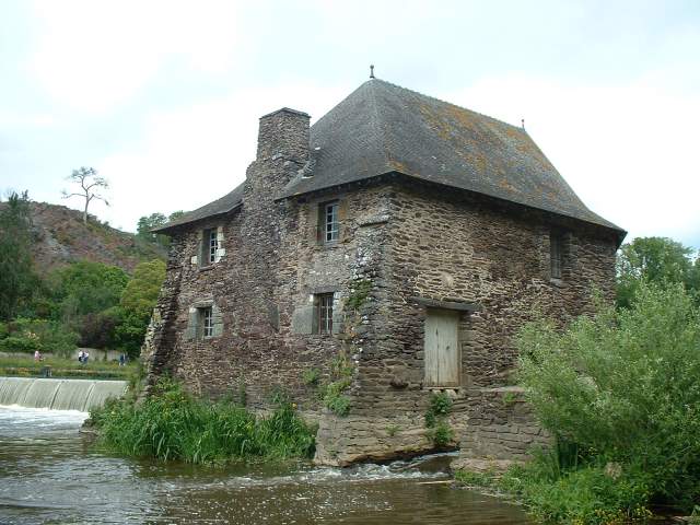
Returning from the watermill Multi-cache
Returning from the watermill
-
Difficulty:
-

-
Terrain:
-

Size:  (small)
Please note Use of geocaching.com services is subject to the terms and conditions
in our disclaimer.

A walk along the Vilaine river and the cliffs it created a very long time ago.
- The coordinates correspond to the parking area. First og to the Boël watermill following the river (N47 59.567 W1 45.243) and count the number A of "vannes".
- Then go to an abandonned quarry (N47 59.562 W1 45.209) that was transformed in a climbing site. Let B be the number of climbing equipments on the cliff.
- The next stop is on top of the cliffs (N47 59.702 W1 45.032) to enjoy the panorama (the location of cache GC16G38 is right on the other side of the river) and count the number C of pairs of round holes drilled in the rock platform. One path to get there begins at point N47 59.545 W1 45.240. Let X=2*A-B-C and Y=B-1=A+1.
- Finally go to the waypoint N 47 59.Y80 W1 4A.X49, it's the initial location of the cache but prone to muggling. Enjoy the view then find the cache 15 meters to the east-south-east (azimuth 120 degrees).
Warning: be careful if geocaching with children as some locations are near the edge of the cliffs.
Une petite promenade le long de la Vilaine et du défilé qu'elle a creusé il y a fort longtemps.
- Les coordonnées initiales correspondent à une aire de parking. Tout d'abord, en suivant la rivière, aller jusqu'au moulin du Boël (N47 59.567 W1 45.243) et compter le nombre A de vannes de la passerelle d'accès.
- Ensuite aller dans une carrière abandonnée transformée en site d'escalade (N47 59.562 W1 45.209) et compter le nombre B de prises artificielles.
- L'étape suivante est en haut des falaises (N47 59.702 W1 45.032) pour admirer le panorama (dont l'emplacement de la cache GC16G38 situé juste de l'autre coté de la rivière) et compter le nombre C de paires de cupules, des trous circulaires creusés dans la plate-forme rocheuse. Pour y accéder, un sentier part du point N47 59.545 W1 45.240. Soient X=2*A-B-C et Y=B-1=A+1.
- Enfin rejoindre l'emplacement initial de la cache aux coordonnées N 47 59.Y80 W1 4A.X49 pour profiter de la vue et du site. Le contenant a été déplacé d'une quinzaine de mètres vers l'est-sud-est (azimuth 120 degrés) car l'endroit initial était très exposé au vandalisme.
Attention : le parcours passe près du bord de la falaise, prudence s'il y a des enfants dans l'équipe.
|
|

Additional Hints
(Decrypt)
Ar cnf bhoyvre yn cebwrpgvba svanyr : yn pnpur rfg nh cvrq q'har cnebv fpuvfgrhfr q'raiveba 2 zègerf qr unhg.
Qba'g sbetrg gur ynfg cebwrpgvba : gur pnpur vf ng gur obggbz bs n fznyy 2 zrgref uvtu fpuvfg jnyy.