An Earthcache is a special place that people can visit to
learn about a unique geoscience feature or aspect of our Earth.
Earthcaches include a set of educational notes and the details
about where to find the location (latitude and longitude). Visitors
to Earthcaches can see how our planet has been shaped by geological
processes, how we manage the resources and how scientists gather
evidence to learn about the Earth. For more information about
Earthcaches, visit http://www.earthcache.org/.
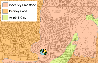
Much of Headington is built around old limestone quarries. Only
one good exposure of the limestones survive, at Rock Edge (formerly
Crossroads Pit), at the junction of Windmill Road and Old Road.
The Wheatley Limestone has been quarried since the twelfth
century and Oxford college records indicate its use as early as the
thirteenth century. At first, the quarries at Wheatley supplied
building stone to many Oxford colleges and to more distant
localities such as Windsor Castle. However, after the end of the
fourteenth century, new quarries at Headington became more
important, and continued to be used into the early nineteenth
century, by which time the poor weathering characteristics of the
stone had been recognised. The earliest buildings were commonly
constructed of 'random rubble' (undressed stone) or only partially
dressed rock, often using Coral Rag. Later, sawn blocks of
freestone from the Wheatley Limestone was used for finishing
exposed surfaces or for entire walls.
The cliff has exposures of Upper Jurassic rock. There are many
fragments of coral and fossils including sea urchins, and this pit
is thought to have been a former boundary between a coral reef and
the surrounding shallow sea. The south end has Coral Rag outcrops,
and there is Wheatley limestone at the north end of the cliff.
Geological materials © NERC. All rights reserved.
Topography © Crown Copyright reserved.
The geological exposures of the Upper Jurassic Coral Rag at this
site enable geologists to reconstruct the environment 145 million
years ago. During this period a warm shallow sea covered
Oxfordshire, similar to that of the present day Bahamas Banks. At
Rock Edge the Coral Rag is rich in fossil remains, derived from
corals reefs that formed in the ancient shelf sea.
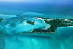
Oxford as it looked 145 million years
ago.
Close examination reveals the presence of two types of
limestone, reflecting the close proximity of the reef margin. One
variety consists primarily of coarse fragments broken off the reef,
whilst the other is finer grained, representing the lime sand that
accumulated on the sea bed a short distance from the reef. Actual
in situ reefs were previously visible in quarries located a few
metres to the south.
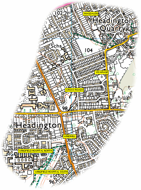
Other nearby quarries (click image for larger version).
Magdalen or Workhouse Quarry
N 51° 45.632 W 001° 12.125
Last quarry to be worked
Vicarage Quarry
N 51° 45.357 W 001º 12.046
Wingfield Hospital North Quarry
N 51° 44.994 W 001° 12.551
Wingfield Hospital South Quarry
N 51° 44.894 W 001° 12.436
Windmill Quarry
N 51° 45.060 W 001º 12.293
Traces can still be found at Slade Close. The flats are built
inside the quarry, the outline of the quarry can be seen to the
east and south of these.
The published coordinates will get you to the nature reserve,
you will then need to explore to find the features. Parking is
restricted for residents immediately adjacent to the reserve but
you can park nearby on The Slade around N 51° 45.110 W 001° 12.327
or N 51° 44.972 W 001° 12.296. Either offer an opportunity to try
and spot the quarry remains at Slade Close.
To log this cache please post a picture of yourself next to the
cliff and a picture of a sign with this cache's name on it.