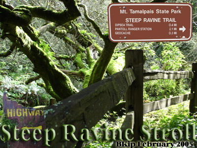
Steep Ravine Stroll is a two
part multi that is along a short trail segment that passes scenic
moss covered trees, monolith rocks, a live redwood bridge, and a
stream with cataract waterfalls.
Part One is a micro with the coordinates to the second and last
part which is a custom camouflaged mint tin. Coordinates
from only 6 satellites at final location.
Continuing on this trail will take you to the scenic vistas of
the Bivouac on Tam’s Mountainside.
Please do not take the paper with the
coordinates from Part One.
Update 24Feb2007- Went to check on cache and discovered that
a tree had fallen, smashing the fence that the cache was attached
to. The area has been cleared and all the remains of the fence
thrown to one side. I spent 30 minutes looking through the debris
without luck. I've replaced the cache with a chrome waterproof
match container and moved it over a short distance. The coordinates
have been updated at the Part 1 trailhead along with new
hints.
These chrome match containers have been known to drive a person
to tears while attempting to open. There are arrows on it showing
proper opening direction. Don't turn tight (opening or closing).
Patience works better than force with these. See container image
below.
Bay Area Hiker - Use these directions for
driving and parking.
