NOTE. The above coordinates are not the location of the cache.
They are the location of the first clue.
Apologies to Roy Orbison for the pun in the name of this
cache.
This is a multi-part cache that reveals some of the history of
the Lawnton area. You will need to visit two locations to gather
the clues, which will lead you to the cache at the third
location.
All locations are within 1 km of each other, but you will find
it much easier if you have a motor vehicle to get around.
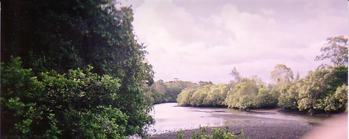
The final location has electric BBQ's, a boat ramp, playing
fields, and is on the banks of the North Pine River, so you can
take the kids swimming as well.
Clue 1.
Go to the picnic shelter at the above co-ordinates. To get
there, you should park your car in Bray Road at S27'16.415
E152'58.224
There is a small park here that most people don't even realize
exists. The park sign is missing from the signpost, so it's very
easy to miss. Walk
through the park, down the hill, towards the river(about 150
meters). You will find a short bush track leading 20 meters to the
river.
There is a picnic table with two bench seats here. Count the
number of horizontal beams of wood that make up the TOP of the
picnic table.
Add to this the number of horizontal beams of wood that make up
the TOP of each bench on either side of the picnic table. Don't
count any beams underneath the table or the benches.
The total number of beams you count is X. Some of locals who know
about this place come swimming at high tide. At low tide it's
possible to cross to the park on the other side.
This park is named after one of the early pioneers in the area.
He owned a farm in this area and operated a blacksmith's shop not
far from here on the site which now contains the local pub.
Clue 2.
Go to the local cemetery at: S27'16.584 E152'58.679
There are plenty of places you can park the car either on the
street to the south of this location, or to the west on the
cemetery driveway.
Many of the early pioneers of the area are buried in this
cemetery. If you've got half an hour, some of the tombstones make
interesting reading.
The early pioneer mentioned in clue 1 is buried here at the
eastern end of the cemetery. The coordinates mark the site of his
grave.
There are several graves in this area. The person you're
interested in migrated from Yorkshire in 1862. Write down the year
(YYYY), month (MM) and day (DD) of the date of his death like this:
YYYYMMDD
Take the last three digits of this date: ABC
Final destination.
The geocache is at these coordinates: S27'16.WWW
E152'58.VVV
WWW = ABC - 414
VVV = WWW + X + 53
To make sure you've got the correct numbers, you might want to
make sure the following checksum adds up: A=B+C+X
Leave your car in the carpark at Leis park. The cache is in a
cylindrical clear plastic screw-top container, wrapped in a black
plastic garbage bag. It is in the
bough of a tree about 1 metre from the ground near the river
bank.
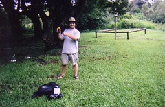
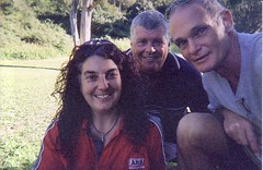
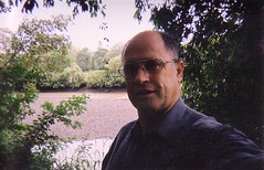
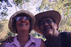
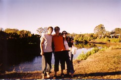
There is a camera in the cache. Please don't remove it, but feel
free to take a picture of yourself. I'll develop the pictures after
the film is used up and publish the photos on the cache's web
site.
The current batch of photos are available at
http://www.flickr.com/photos/magictyger/sets/72157606624375309/
The cache also contains some kids stickers, a compass/whistle
thingy, pencil sharpeners, an animal anti-colision device, and a
bar of soap.