|
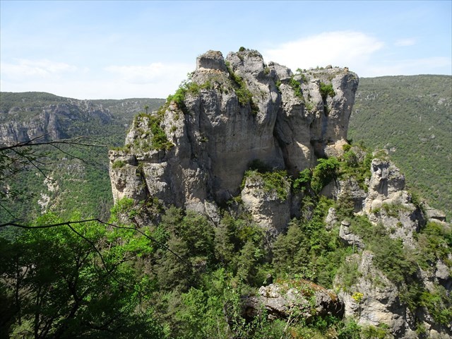
Cinglegros Rock
Cinglegros is a separate promontory of the Causse Méjean (causses are limestone plateau in the south of France) is overlooking the Tarn's Gorges : its location and appearance evoke the ruins
of a formidable medieval fortress, but its formation is of natural origin. It's a fine example of the kind of ruiniform relief to be found
in the surrounding area (above Le Rozier between Tarn and Jonte rivers or at Montpellier-le-Vieux).
A ruiniform relief is composed of rock formations that acquire the appearance of ruins (towers, pinnacles, walls, arches...)
under the action of erosion, mainly of the hydric type. They can take many forms, including chaos, tors, lapiaz or mega-lapiaz,
and appear in many types of rocks, such as granites, basalts or sandstones. But Cinglegros is a very fine example of a
karst landscape in dolomitic limestone.
Sources Géoportail (IGN, BRGM)
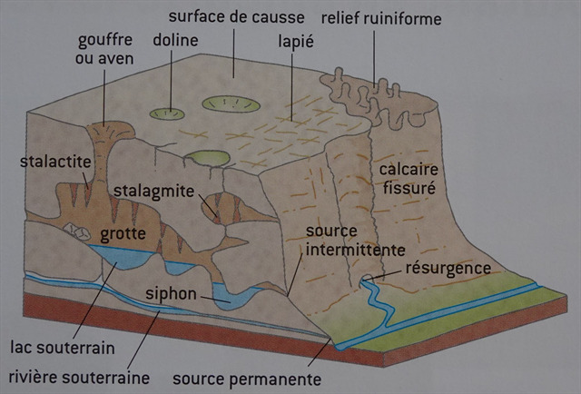
Karst erosion
Named after the Karst plateau in the Balkan Alps, a karst landscape is characterized by the action of water infiltrating soluble rocks.
At Cinglebros, they are carbonate sedimentary rocks based on calcite (CaCO3) or olomite (CaMg(CO3)2).
Naturally, the carbonate ion CO3-- is not very soluble in water, but if water comes into contact with carbon dioxide
(CO2 atmospheric or produced by plants ), carbonic acid H2CO3 is formed, which combines with the carbonate to form
bicarbonate ions HCO3- (also known as hydrogencarbonates), which are soluble in water.
H2O + CO2 + CaCO3 (not very soluble) give Ca++ + 2*HCO3- (soluble)
Slightly acidic water can therefore gradually dissolve rocks, forming cavities and widening faults over time, and transporting debris.
Karst landscapes are thus formed when water infiltration and precipitation dissolve and then mechanically erode the various rocks they cross.
Types of karst formations (source "Roches et paysages" François Michel)
Karst landscapes
The Causse Méjean and the Tarn and Jonte Gorges that border form a typical karst landscape.
Over 150 meters of sedimentary rock were created in the Jurassic period.
The Tarn River began to carve through these rocks 20 million years ago. In the Tertiary period, tectonics led
to the formation of the Alps and Pyrenees, causing the Causses to rise, while rivers formed gorges.
Underground, the action of karstic erosion leads to the formation of vast structures such as caves, which can sometimes hydrogencarbonates lakes,
or avens (Aven Armand), often linked by underground rivers that can lead to springs at the edge of the plateau
or to resurgences (Saint-Chély-du-Tarn, source des Douze)
At the top, the vast arid plateaus may feature dolines (depressions carved out by erosion), lapiaz (very dry limestone surfaces striated by erosion)
or rugged reliefs (particularly on the edge of the Causse).
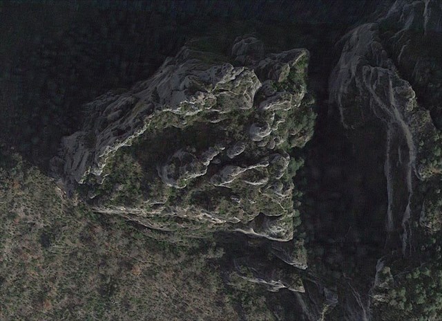
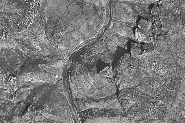
Aerial view of the ruiniform mega-lapiaz (Google)
Ruiniform rocks
Ruiniform rocks appear when karstic erosion takes place in a heterogeneous environment, in this case sedimentary layers where limestone,
dolomitic limestone or dolomite cohabit, depending on the proportion of dolomite.
Like limestone, dolomite is a sedimentary rock. It can either be formed directly during sedimentation under specific conditions
(high temperature, anoxia, presence of bacteria), or, more commonly, by dolomitization, i.e. the replacement of carbon by magnesium
in limestone. A rock containing more than 50% dolimite is called dolomite, otherwise limestone or dolomitic limestone.
Unlike limestones, cold dolomites do not effervesce in contact with chloridic acid.
As magnesium is less soluble than calcium, limestones and dolomites undergo different hydric erosions, resulting in different reliefs.
Rocks containing a higher proportion of dolomites remain when limestones disappear, giving rise to shapes reminiscent of walls,
towers, arches or sculptures.
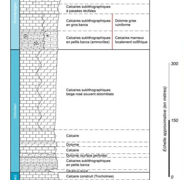
Lithographic log (source Notice BRGM Aveyron)
According to data from BRGM (French national geological office), the Cinglegros rock corresponds to the Rauracian
(Upper Oxfordian) and is therefore in dolomitized layers of pink-gray color, conducive to ruiniformization,
which can be seen on the field.
Validating the earthcache
To validate the cache, you must visit the site and collect the information to be sent via the geocaching profile (you can also publish your visit without waiting for a reply):
Warning: accessing Cinglegros is a substantial hike, involving cliffside paths, metal ladders and steep staircases. It should only be undertaken in good physical condition, without fear of vertigo. In the presence of children, it may be safer to use via ferrata techniques.
This route is not recommended in the event of rain, thunderstorms, high winds, snow or frost.
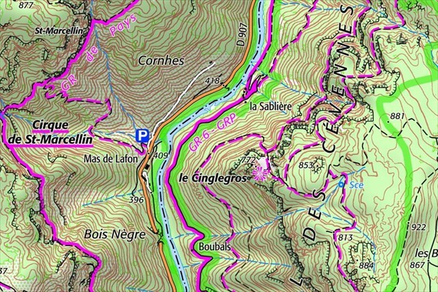
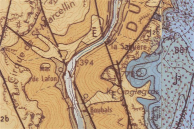
- Question 1 (WP1) : the area corresponds to two faults that appear on the geological map (to the left of hill 778).
Describe what they correspond to on the ground and how they may have formed.
- Question 2 (WP2) : just before the summit, the trail passes through a fault
between two large monolithic blocks. What do you think is the origin of this fault?
- Question 3 (WP2) : describe the appearance of the rock on the walls of this fault (color, appearance, roughness, micro-reliefs) and explain how this corresponds to karst erosion.
- Question 4 (WP3 - Cache WP) : from the panoramic viewpoint, observe the direction of the Tarn upstream and downstream; what conclusion can be drawn
about the relative hardness of the Cinglegros rock?
- Question 5 (WP3 - Cache WP) : take a photo at the summit of Cinglegros showing a team member, a personal object or a geocaching pseudonym.
|