Lac de Kruth-Wildenstein
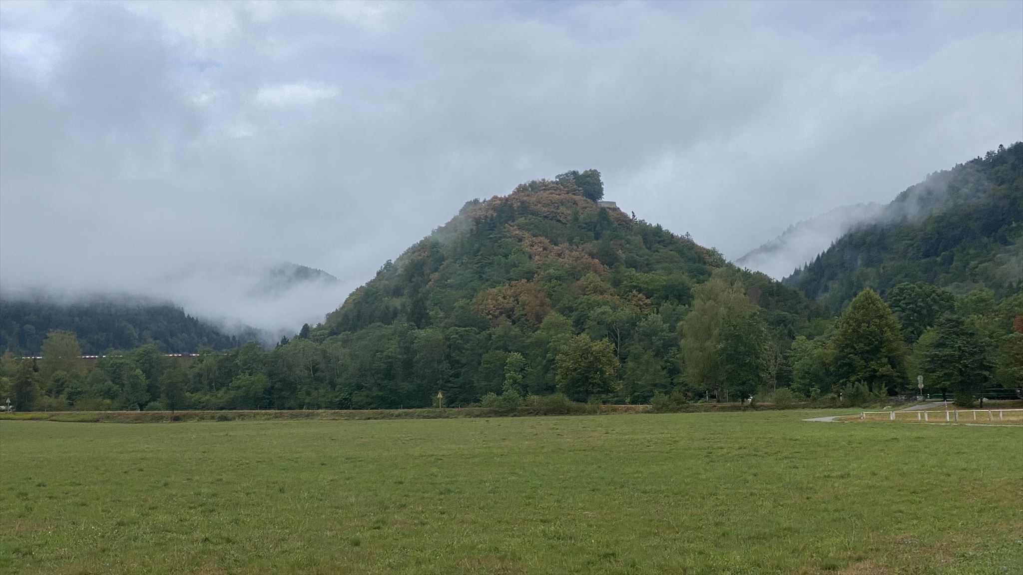 Une ile glaciaire devenue le Schlossberg
La transformation d'un verrou glaciaire en lac artificiel
Cette vallée est la vallée de la Thur celle-ci prend sa source au sud du Hohneck, dans le massif du Rainkopf, vers 1000m d’altitude.
Après avoir suivi cet ancien sillon glaciaire, elle s’élargit progressivement jusqu’à la plaine d’Alsace et se jette dans l’Ill à l’aval de Mulhouse.
A cet endroit la vallée présente une forme géologique particulière en effet, la présence d'un ilot granitique d'environ 670m d'altitude partageait le glacier en deux langues, le côté Nord assez large et celui du Sud beaucoup plus étroit. Celui du Nord est devenu peu à peu le lit de la Thur.
Histoire d'un lac artificiel
Cet imposant ouvrage hydraulique fut construit au début des années 1960, mais l'idée de sa réalisation est beaucoup plus ancienne.
Au 19e siècle, l'industrie textile et métallurgique initié par les industriels mulhousiens trouve dans les vallées de la Thur, de la Doller et de la Lauch, l'énergie (l'eau) et la main-d'œuvre favorables à son développement.
Très tôt, les manufecturiers imaginent la création d'un vaste réservoir d'eau en aval du village de Wildenstein.
En 1861, une première étude est entreprise mais différée pour des raisons d'ordres économique, historique et technique.
Vers les années 1950, le projet est repris par la Département du Haut-Rhin. L'objectif était d'écrêter les crues de la Thur en période de hauts eaux et d'assurer un débit régulier de la rivière (au minimum 3 mètres cube par seconde à Willer-sur-Thur) durant la période sèche.
Ceci répondait aux besoins des industriels (eau de fabrication, dilution des eaux résiduaires), des collectivités locales (réalimentation de la nappe, évacuation des eaux usées) et de l'agriculture (irrigation).
En 1960, le choix s'est porté sur un barrage en terre compactée avec un masque amont étanche.
Les travaux sont effectués de 1960 à 1965 sous la maitrise d'ouvrage du Département du Haut-Rhin, avec le concourt technique et financier du Ministère de l'agriculture, la participation des usages industriels et des communes.
Le plan d'eau couvre une surface de 81 hectares et peut retenir 12 millions de mètres cube d'eau pour une profondeur maximale de 36 mètres.
Questions :
- Nature de la roche en dessous du barrage ?
- Il y a combien d'années que les glaces occupaient cette vallée ?
- Il y a combien d'années qu'un lac excitait avant de disparaitre du fait de l'érosion fluviale ?
- Quelles constructions existaient-ils dans la praire en 1940
- Une photo avec votre pseudo visible sur une morceau de papier ou autres, ou de vous en N47° 57.021' E 006° 57.334' avec la digue en arrière-plan doit être jointe au log.
- Près de cet endroit, expliquer ce que vous voyez sur les roches qui affleurent.
Comment loguer :
Loguez cette cache "Found it" et envoyez-moi vos propositions de réponses soit via mon profil, soit via la messagerie geocaching.com (Message Center), et je vous contacterai en cas de problème.
Lake Kruth-Wildenstein
The transformation of a glacial lock into an artificial lake.
This valley is the valley of the Thur, which takes its source south of the Hohneck, in the Rainkopf massif, at an altitude of about 1000m.
After having followed this ancient glacial furrow, it widens progressively to the plain of Alsace and flows into the Ill downstream of Mulhouse.
At this place the valley has a particular geological shape, indeed, the presence of a granitic island of about 670m of altitude divided the glacier into two tongues, the North side quite wide and the South one much narrower. The North side became little by little the bed of the Thur.
History of an artificial lake
This imposing hydraulic structure was built at the beginning of the 1960s, but the idea of its realization is much older.
In the 19th century, the textile and metal industry initiated by the industrialists of Mulhouse found in the valleys of the Thur, Doller and Lauch, the energy (water) and the workforce favorable to its development.
Very early on, the manufacturers imagined the creation of a vast water reservoir downstream from the village of Wildenstein.
In 1861, a first study was undertaken but postponed for economic, historical and technical reasons.
Around the 1950s, the project was taken up again by the Department of the Upper Rhine. The objective was to reduce the flooding of the Thur during high water periods and to ensure a regular flow of the river (at least 3 cubic meters per second at Willer-sur-Thur) during the dry period.
This met the needs of industry (manufacturing water, dilution of wastewater), local communities (groundwater replenishment, wastewater evacuation) and agriculture (irrigation).
In 1960, the choice was made to build a compacted earth dam with a watertight upstream mask.
The work was carried out from 1960 to 1965 under the supervision of the Haut-Rhin Department, with the technical and financial support of the Ministry of Agriculture and the participation of industrial users and municipalities.
The water plan covers an area of 81 hectares and can retain 12 million cubic meters of water for a maximum depth of 36 meters.
Questions :
1. What is the nature of the rock below the dam?
2. How many years ago did the ice occupy this valley?
3. How many years ago did a lake excite before disappearing due to river erosion?
4. What buildings existed on the prairie in 1940?
5. A photo with your nickname visible on a piece of paper or other, or of you in N47° 57.021' E 006° 57.334' with the dike in the background must be attached to the log.
6. Near this location, explain what you see on the outcropping rocks.
How to log in :
Log in to this "Found it" cache and send me your suggestions for answers either via my profile or via the geocaching.com messaging system (Message Center), and I will contact you in case of problems