
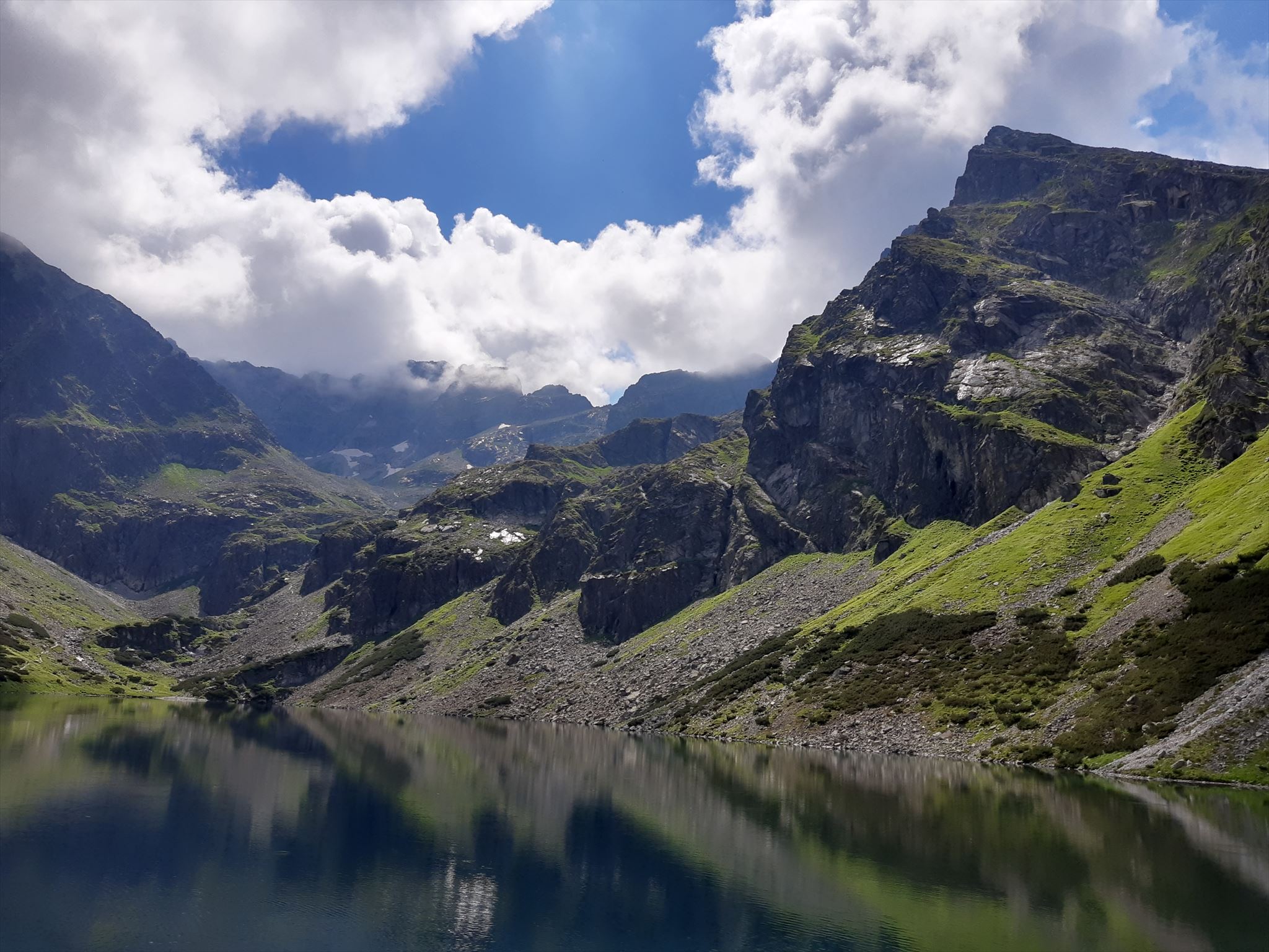
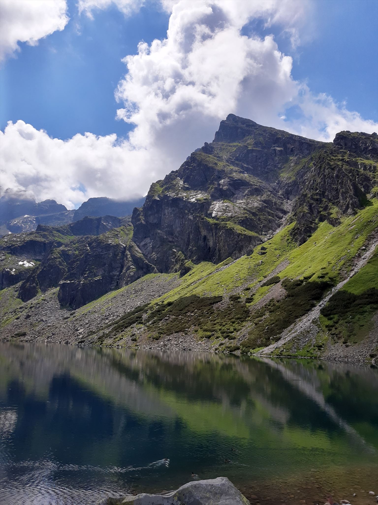
[PL] Kościelec - szczyt Tatr Wysokich położony na wysokości 2155 m n.p.m. w Dolinie Gąsienicowej. Jeden z najpiękniejszych i najbardziej rozpoznawalnych szczytów polskich Tatr. Jego nazwa pochodzi najprawdopodobniej od kształtu przypominającego dach kościoła.
Gdy pierwszy raz go ujrzysz, usłyszysz cichy szept zapraszający Cię na sam szczyt. Owy szept wejdzie głęboko w twoje myśli i prędzej czy później skłoni Cię do zdobycia szczytu. Lęk, który wzbudza jego widok przekujesz w fascynację, dzięki której będziesz podziwiać Dolinę Gąsienicową i najwyższe szczyty polskich Tatr z "polskiego Matterhornu". Tak było z nami, tak było z wieloma przed nami i wieloma po nas.
Znajdują się tutaj trzy szczyty tworzące Grań Kościelców:
- Kościelec - 2155 m n.p.m.
- Zadni Kościelec - 2162 m n.p.m.
- Mały Kościelec - 1866 m n.p.m.
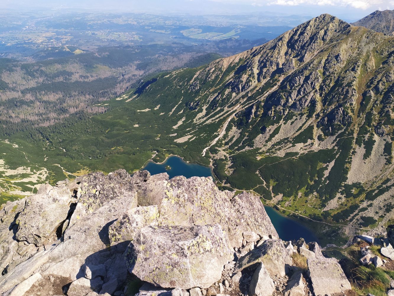
Znakowanym szlakiem turystycznym można zdobyć wyłącznie Kościelec. Pozostałe dwa szczyty są dostępne wyłącznie dla taterników. Grań Kościelców oddziela Czarny Staw Gąsienicowy od Doliny Zielonej Gąsienicowej i tylko ze szczytu Kościelca można podziwiać dolinę w pełni jej okazałości. Droga na wierzchołek wiedzie przez przełęcz Karb, którą można zdobyć podchodząc z dwóch stron: od strony Czarnego Stawu Gąsienicowego lub od strony Zielonego Stawu Gąsienicowego. Zalecanym rozwiązaniem jest wejście na przełęcz Karb jedną drogą, a zejście drugą, by móc podziwiać w pełni całą dolinę.

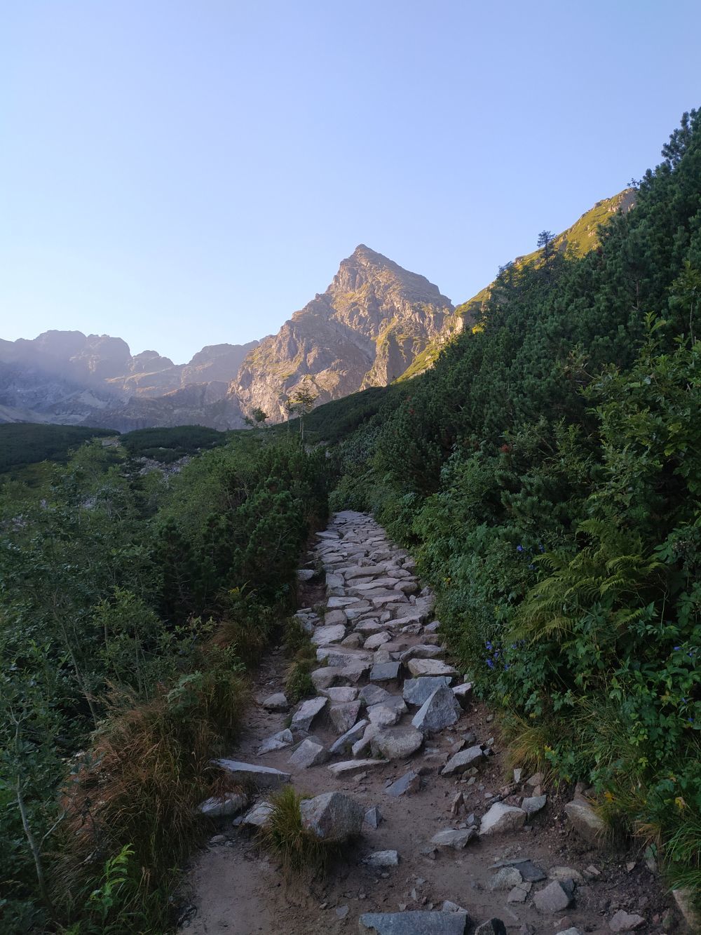
 Trasa ze schroniska Murowaniec od strony Czarnego Stawu Gąsienicowego - jest to trasa cięższa, wiedzie niebieskim szlakiem prosto do Czarnego Stawu Gąsienicowego, od którego zaczynamy wspinaczkę na przełęcz Karb czarnym szlakiem. Można zatracić się tutaj w pięknych widokach i cały czas podziwiać szczyt naszego celu, który z każdym krokiem zbliża się do nas. Jeśli wybierzesz ten szlak do wejścia, twoje kolana będą Ci wdzięczne.


 Trasa ze schroniska Murowaniec od strony Zielonego Stawu Gąsienicowego - jest to lżejszy wariant podejścia na szczyt. Wiedzie okrężną drogą, której przebycie zapewni widoki zapadające głęboko w pamięć. Idąc wzdłuż brzegów szlak stopniowo zacznie piąć się w górę, aż doprowadzi Cię do przełęczy Karb.
TWOJE ZADANIE
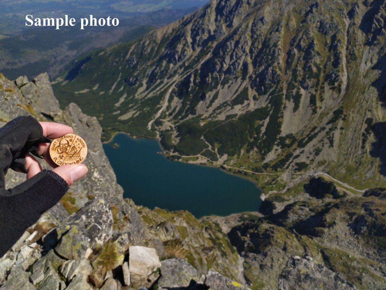
Aby móc zalogować znalezienie, musisz wykonać zdjęcie ze szczytu Kościelca, na którym będzie widniał twój login (podpis/pieczątka/drewniak/inne) a w tle będzie Czarny Staw Gąsienicowy.

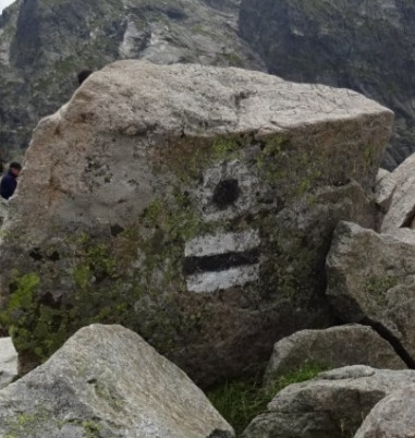
Jeśli pogoda nie dopisze, to nic straconego! Możesz wtedy zalogować kesza robiąc zdjęcie z kamieniem oznaczającym koniec szlaku na Kościelec. Najważniejszy jest fakt zdobycia szczytu góry!

Pamiętaj!
1. Znajdujesz się na terenie Parku Narodowego! Zapoznaj się z jego regulaminem i przestrzegaj wszystkich wymienionych w nim zasad! Nie strasz zwierząt, śmieci zabierz ze sobą, nie zbaczaj z wytyczonego szlaku i ciesz się pięknem przyrody!
2. Szlak jest trudny i wymagający. Zaleca się posiadanie kasku (ochrona przed spadającymi kamieniami) oraz rękawiczki, które mogą być pomocne w kontakcie ze skałą.
3. W okresie zalegania pokrywy śnieżnej może występować zagrożenie lawinowe. Przed wyruszeniem na szlak koniecznie sprawdź komunikat lawinowy TOPR oraz komunikat turystyczny TPN.
4. Link do regulaminu TPN: https://tpn.pl/zwiedzaj/turystyka/turystyka-piesza
Skrytka została stworzona za zgodą Dyrekcji TPN.
Dziękujemy za wasze logi i zdjęcia!

[EN] Kościelec - the peak of the High Tatras located at an altitude of 2155 m above sea level in the Gąsienicowa Valley. One of the most beautiful and recognizable peaks of the Polish Tatra Mountains. Its name probably comes from the shape resembling the roof of a church.
When you see Kościelec first time, you will hear a quiet whisper inviting you to the very top. This whisper will go deep into your thoughts and sooner or later will make you reach the peak. You will turn the fear that arouses the sight of it into fascination, thanks to which you will admire the Gąsienicowa Valley and the highest peaks of the Polish Tatra Mountains from the "Polish Matterhorn". So it was with us, so it was with many before us and many after us.

There are three peaks forming Grań Kościelców:
- Kościelec - 2155 m a.s.l.
- Zadni Kościelec - 2162 m a.s.l.
- Mały Kościelec - 1866 m a.s.l.
The marked tourist trails leads only to the top of Kościelec. The other two peaks are accessible only to mountainers. Grań Kościelców separates Czarny Staw Gąsienicowy from Zielony Staw Gąsienicowy, and only from the top of Kościelec you can admire the valley in its full glory. The road to the top leads through the Karb Pass, which can be reached by approaching from two sides: from the side of Czarny Staw Gąsienicowy or from the side of Zielony Staw Gąsienicowy. The recommended solution is to climb the Karb Pass one way and go down the other, to be able to fully admire the entire valley.
The route from Murowaniec schelter from the Czarny Staw Gąsienicowy side - this is a heavier route, it leads along the blue trail straight to Czarny Staw Gąsienicowy, from which we start climbing the Karb Pass along the black trail. You can lose yourself in the beautiful views here and admire the peak of our goal, which is approaching us with every step. If you choose this trail to climb, your knees will thank you.

 The route from Murowaniec schelter from the Zielony Staw Gąsienicowy side - this is a lighter variant of the approach to the top. It leads along a circuitous road, the journey of which will provide views that are deeply remembered. Walking along the banks, the trail will gradually climb up until it leads you to the Karb Pass.

YOUR TASK
In order to be able to log the find, you must take a photo from the top of Kościelec, which will show your login (signature/stamp/wooden coin/other) and the Czarny Staw Gąsienicowy in the background.
If the weather is not good, nothing is lost! You can log in the cache by taking a photo with the stone marking the end of the trail to Kościelec. The most important thing is the fact of reaching the top of the mountain!
Remember!
1. You are in a National Park! Familiarize yourself with its regulations and follow all the rules in it! Do not scare the animals, take the garbage with you, do not deviate from the marked trail and enjoy the beautiful sights!
2. The trail is difficult and demanding. It is recommended to have a helmet (protection against falling stones) and gloves that can be helpful in contact with the rock.
3. There may be an avalanche risk during the snow cover period. Before setting out on the trail, be sure to check the TOPR avalanche report and the TPN tourist report.
4. Link to the regulations of the TPN: https://tpn.pl/zwiedzaj/turystyka/turystyka-piesza
The cache was created with the consent of the TPN Management.
Thanks for your logs and photos!
Virtual Rewards 3.0 - 2022-2023
This Virtual Cache is part of a limited release of Virtuals created between March 1, 2022 and March 1, 2023. Only 4,000 cache owners were given the opportunity to hide a Virtual Cache. Learn more about Virtual Rewards 3.0 on the Geocaching Blog.