Lions Gate Bridge Virtual Cache
This virtual cache is about the Lions Gate Bridge. You will need to go to the marker and find a plaque to gather information to answer questions posed in the logging requirements. To encourage a variety of photos to be submitted with found logs, photos can be taken from land (walking, bicycle or vehicle), sea (small boat, sea bus or cruise ship) or air (sea plane or helicopter) within 5 kilometres of the bridge.
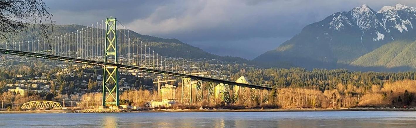
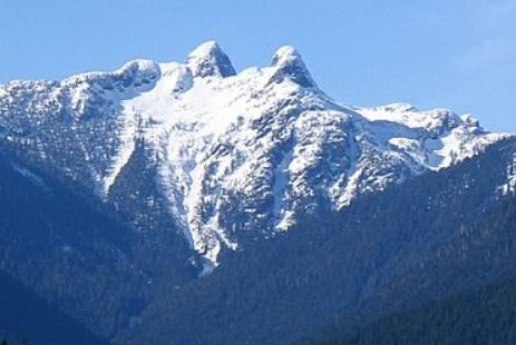
The Lions Gate Bridge is one of the most iconic and recognizable structures in the Province of British Columbia. It connects the City of Vancouver to the North Shore across the First Narrows. The name "Lions Gate" refers to the Lions, a pair of mountain peaks north of Vancouver. Northbound traffic on the bridge heads in their general direction.
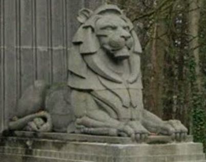
A pair of cast concrete lions, designed by sculptor Charles Marega, were placed on either side of the south approach to the bridge in January 1939.
The Lions Gate Bridge is a suspension bridge in which the weight of the deck is supported by vertical cables suspended from larger cables that run between towers and are anchored in abutments at each end. The total length of the bridge including the north viaduct is 1,823 metres (5,981 ft). The length including approach spans is 1,517.3 metres (4,978 ft), the main span alone is 473 metres (1,552 ft), the tower height is 111 metres (364 ft), and it has a ship's clearance of 61 metres (200 ft). The clearance for ships has now become an issue with some very large cruise ships. They either have to enter and leave the harbour only at times of a very low tide (with only 2 m of clearance) or not able to pass under the bridge at all.

Construction began on March 31, 1937. After one and a half years and a cost of $5,873,837 (CA), the bridge opened to traffic on November 14, 1938. On May 29, 1939, King George VI and Queen Elizabeth presided over the official opening during a royal visit to Canada. A toll of 25 cents was charged for each car or horse and carriage; five cents was charged for pedestrians or bicycles. The toll remained on the bridge until they were removed on April 1, 1963. The bridge now features three lanes for traffic with the centre lane changing directions to accommodate rush hour traffic with lane control lights. Here is a link to a 2 minute YouTube video which gives a quick history of the bridge.
In 1986, the year of Expo 86, the Guinness family, as a gift to Vancouver, purchased decorative lights that make the bridge a distinctive nighttime landmark. In 2009 the bridge's lighting system was updated with new LED lights to replace its system of 100-watt mercury vapour bulbs. The switch to LEDs was expected to reduce power consumption on the bridge by 90 per cent and save the provincial government about $30,000 a year in energy and maintenance costs.

The Lions Gate Bridge was designated a National Historic Site of Canada in 2004 because: it is an outstanding landmark and has a significant symbolic value to Canadians; it is distinctive by its elegant design which complements a spectacular setting; it is an outstanding engineering achievement for its time in its advanced technical features; and, it had an undeniable and significant influence on the development of Vancouver.
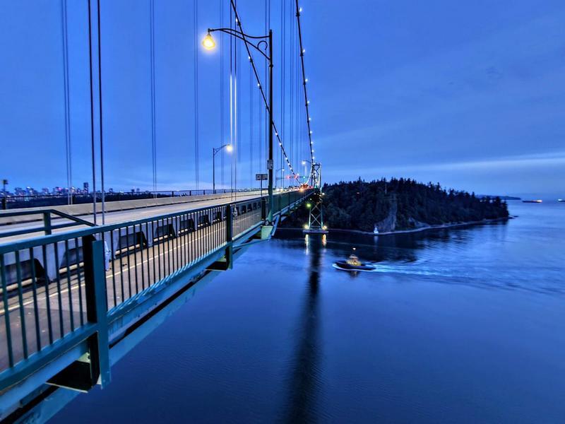
Remember you can walk or cycle across the Lions Gate Bridge and enjoy some great views.
Below you will see a photo taken from the viewing alcove on the west side of the north tower of the bridge looking south towards Prospect Point.
Enjoy one the the great sights of the Vancouver area!
Logging requirements:
You will need to go to the posted coordinates and find a plaque located on the west face of the west abutment of the south end of the bridge. This plaque is not visible from Stanley Park Drive but rather from the bike/pedestrian path. Make sure you find the correct plaque (there are four other plaques for the bridge close by but only one in the location mentioned above).
There are a variety of ways to get to the marker but if you are traveling by vehicle note the waypoint for pay parking. The trailhead coordinates take you to the beginning of a paved path that leads you down to the marker.
At the marker you will find the plaque you need to view to gather information needed to answer the following questions:
-
What does CSCE stand for?
-
In the 8th line of the tribute section on the left side of the plaque what year is mentioned?
-
What happened that year which is mentioned as being a “World’s First”?
Send your answers in a message to the cache owner before you log your find, and do not post them in your log.
In addition, you will need to take a picture of the bridge (within 5 km of the bridge) or from the bridge and post it with your “Found Log” (selfie ok but not required but it must be your photo or one taken by someone with you). In your log indicate the date when and description of where the picture was taken. You are encouraged to submit photos of a variety of different views of the bridge.
Virtual Rewards 3.0 - 2022-2023
This Virtual Cache is part of a limited release of Virtuals created between March 1, 2022 and March 1, 2023. Only 4,000 cache owners were given the opportunity to hide a Virtual Cache. Learn more about Virtual Rewards 3.0 on the Geocaching Blog.