The geocache is NOT at the posted coordinates. All of the information you will need to calculate the coordinates for the final are in the description.
Landsat 9, the successor to the Landsat 8 satellite, will continue the mission of unrivaled space-based Earth observation and carry on the Landsat programs half-century history of Earth imagery provided to users worldwide at no charge. Together, both satellites can image the entire planet every 8 days acquiring around 1,500 high-quality images each day.
Launching from Vandenberg Space Force Base on an Atlas V 401 rocket, Landsat 9 will reach an orbital altitude of 705 kilometers (438 miles) traveling 26,972 kph (16,760 mph). Each orbit will take 99 minutes making about 14 orbits around the planet collecting over 700 images each day.
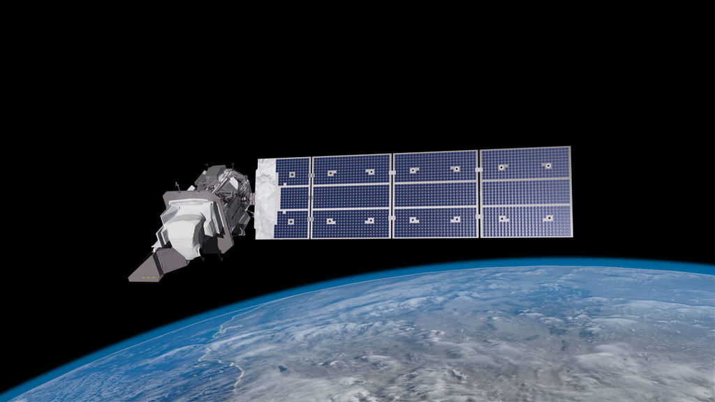
The Landsat 9 spacecraft is 4.6 meters (15 feet) tall, 3 meters (10 feet) deep, and 3 meters (10 feet) long and has a mass (with fuel) of 3,263 kilograms (7,194 pounds). Once in orbit, a deployable 9.8-meter (32-foot) solar panel and 1.2-meter (4-foot) Earth shield will add to its length.
Data from the two instruments onboard Landsat 9—the Operational Land Imager 2 (OLI-2) and the Thermal Infrared Sensor 2 (TIRS-2)—will advance research applications, including our ability to map global surface temperature and continuously track and characterize changes in land cover, use, and condition. They will collect data across 11 spectral bands: OLI-2 measures four visible, one near-infrared, three shortwave-infrared, and one panchromatic band. TIRS-2 measures two thermal bands.
Landsat 9 will continue the long-term data record that, as of 2021, has more than 9 million scenes in USGS archives. Each scene covers 185 km x 180 km (114 mi x 112 mi) with each pixel 30 meters (98 feet) square, about the size of a baseball infield. This spatial resolution is coarse enough for global coverage, yet detailed enough to characterize human-scale processes such as urban growth.
The final coordinates are N 34° 38.A' W 120° 28.B'
A = (Orbital altitude in kilometers) MINUS (orbital altitude in miles) PLUS (2 times the number of orbits each day)
B = (The width of the image scene in miles) PLUS (the height of the image scene in miles) PLUS (how tall the spacecraft is in feet)