The wine industry is a major part of the Santa Ynez Valley's economy, attracting tourists worldwide. Water is an essential part of this business and local agriculture, especially in regions that experience drought. Landsat data help farmers monitor water use and be able to fertilize their crops wisely, thus reducing the amount of nutrients released into the watersheds like the Santa Ynez Valley.
But how exactly does Landsat help?
As farmers and backyard gardeners know, plants grow best when watered just right—not too little or too much. In places around the world, Landsat data helps farmers water just right.
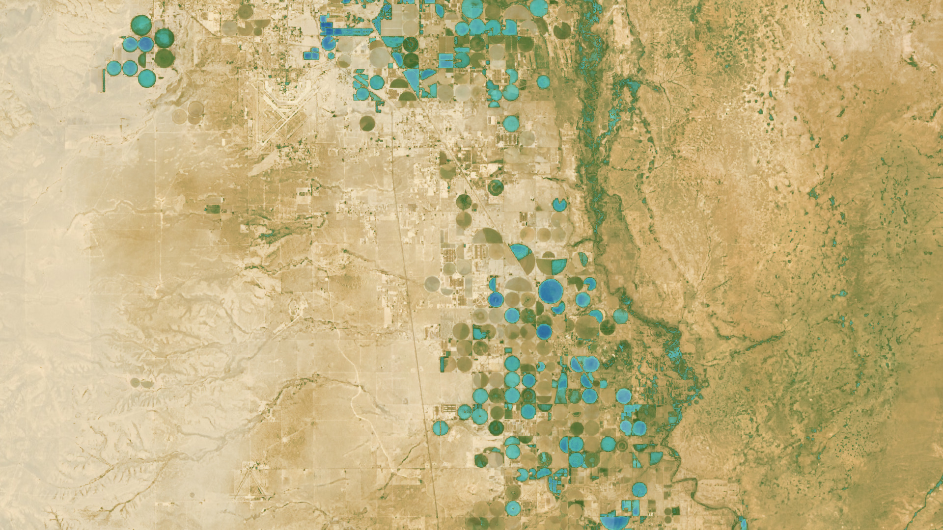
Thermal data provided by the TIRS instrument on Landsat 8 can be used to calculate how much water evaporates from the soil and that transpires or “sweats out” from a plant’s leaves. This process—called evapotranspiration—cools the plant and soil down, so irrigated fields appear cooler in satellite images. Landsat data helps irrigation managers and farmers determine how much of a valuable resource – water – is being used on crop fields. This is especially valuable in arid regions like New Mexico, where this Landsat-derived map of water use (below) shows irrigated fields in the desert.
Grape growers like E. & J. Gallo are pioneering using Landsat data for efficient water-management practices in viticulture. This is a top priority - especially in California's Central Valley, an area that often experiences drought. The Grape Remote-sensing Atmospheric Profile and Evapotranspiration Experiment (GRAPEX) project started in 2013 and aims to develop a multiscale remote-sensing vineyard management toolkit. It is the result of a private-public collaboration between NASA, the U.S. Department of Agriculture (USDA), Utah State University, and Gallo.
Landsat thermal data is used to track soil and vine moisture levels in order better to understand vine water use and plan grapevine irrigation. They’ve created an evapotranspiration toolkit for mapping vineyard water use and water stress to improve irrigation scheduling and management on approximately 20,000 acres of Gallo-owned vineyards from Southern California to Mendocino County.
“The work with GRAPEX has dramatically improved our ability to accurately schedule irrigation. Once we implement the findings of GRAPEX across our entire vineyard acreage, we will reduce the amount of water we apply for irrigation by up to 25%, and that’s a very, very big number.” - Nick Dokoozlian, vice president of viticulture, chemistry and enology at Gallo.
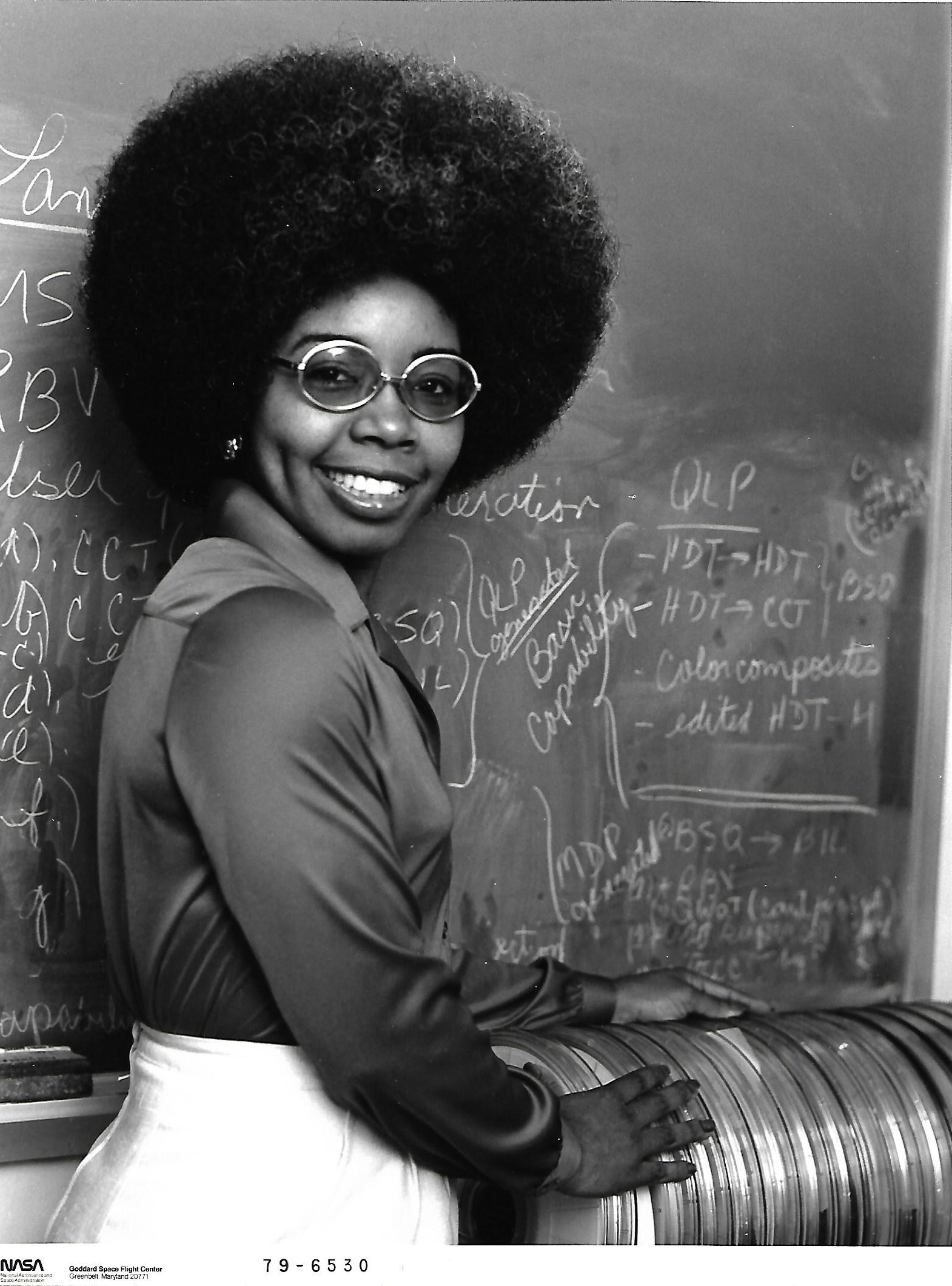
Valerie Thomas in 1979, stood with a stack of early Landsat Computer Compatible Tapes (CCTs). Thomas was responsible for the development of early Landsat digital media formatting.
Today, satellite data is also routinely used as part of global food supply monitoring, Satellites help make sure nations have estimates of what crop yields will look like from year to year and season to season. That all started with Landsat. In the 1970s, a massive experiment named the Large Area Crop Inventory Experiment, or LACIE, was designed so that scientists could figure out if satellites had a role to play in helping to keep food prices steady for consumers worldwide. Answer: they did."
Landsat 9 and the TIRS-2 will continue to provide a global view of agriculture to help ensure the world’s food supply is successfully forecast and managed.
The geocache, a LARGE container with a REGULAR container locked inside, should be VERY EASY to find. The combination is the numerical equivalent of "Geocaching-Montemar-Ghetto" or "GMG".
The Wine Tasting room is open Friday-Sunday. Be sure to say "Hi" to the cat, who loves to snuggle with everyone.