Introduction
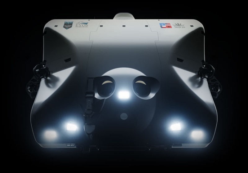
On March 1st, and March 3rd 2021, Richard Garriott and Michael Dubno as part of the Caladan Oceanic Challenger Deep Expedition 2021, dove 10,925m below the surface in the submarine Limiting Factor. They left the deepest geocache to date, and likely the deepest geocache possible during their dives. While this depth has been rarely visited, new technology such as the submarine Limiting Factor, can now make repeated dives to this depth, and plans to revisit in future expeditions as well.
This EarthCache is marked with a titanium plate, which contains the geocache number, and a secret message that future visitors must provide as proof that they have "found" the cache.
The plaque will be tethered with Kevlar rope, to a float made of carved syntactic foam. Markers with floats and weights are the STANDARD deep water method for marking sites to find again on a future visit.


Richard and Michael’s dive was part of a scientific expedition that conducted detailed mapping, recorded video footage, and collected biological samples from the ocean’s greatest depths. New species have been identified at Challenger Deep in the past, and it is expected that new ones may yet be discovered. Extremophiles, or organisms that live in extreme environments, are of special interest to Richard, who has studied them in numerous locations across the globe. The expedition also assessed and documented the environmental impact and pollution at Challenger Deep. In addition to making new contributions to science, the expedition will also provide inspiration to students through the Venture to the Deep initiative, which features fun STEAM (science, technology, engineering, art, and mathematics) activities. This EarthCache is an additional effort to educate the public about some of the fascinating scientific concepts on display at Challenger Deep.
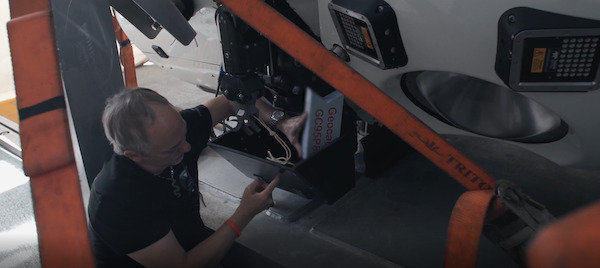
The Challenger Deep EarthCache marker being attached to the Limiting Factor submarine by Richard Garriott.
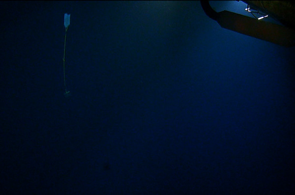
The Challenger Deep EarthCache, released at the deepest point of the ocean.
Location
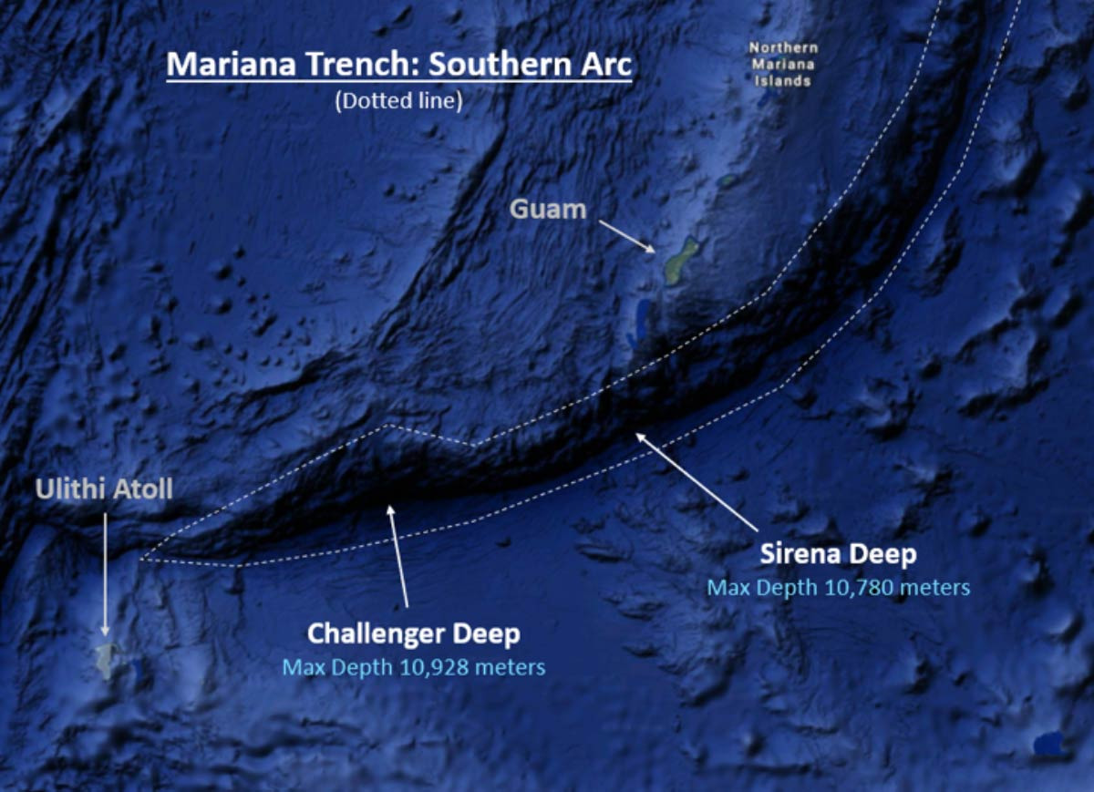
At a depth of approximately 10,925 meters (6.79 miles), Challenger Deep is the deepest part of Earth’s ocean floor. It is located in the western Pacific Ocean, near the southern end of the Marianas Trench. The Marianas Trench is 2,550 km (1,580 mi) long — more than 5 times the length of the Grand Canyon (Arizona, USA) — and it spans 69 km (43 mi) in width.
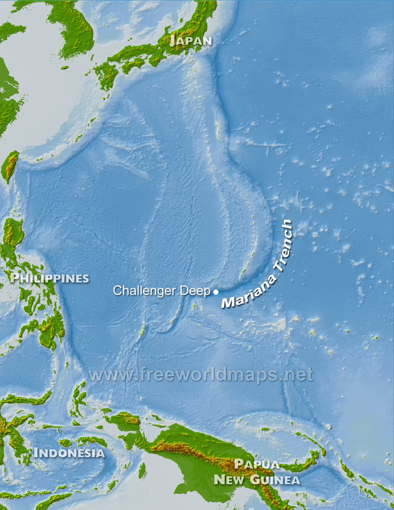
(Map courtesy freeworldmaps.net)
(Image courtesy The Five Deeps Expedition)
Geology
Challenger Deep is a prime demonstration of the power of plate tectonics--the unifying theory of geology. Plate tectonic theory describes Earth’s surface as being composed of rigid plates of lithosphere that float and drift on a more viscous layer known as the asthenosphere. Challenger Deep, and the Mariana Trench, are part of a subduction zone, which is a place where two lithospheric plates converge, or move toward each other, with one plate plunging beneath the other. The Mariana Trench marks the boundary where the denser Pacific Plate plunges beneath the less dense Philippine Sea Plate. Plate boundaries such as this are geologically active regions; they are often associated with volcanoes, earthquakes, tsunamis, and landslides. Plate boundaries, and sites like Challenger Deep, are important to geologists because they offer many clues about the forces that shape our planet.
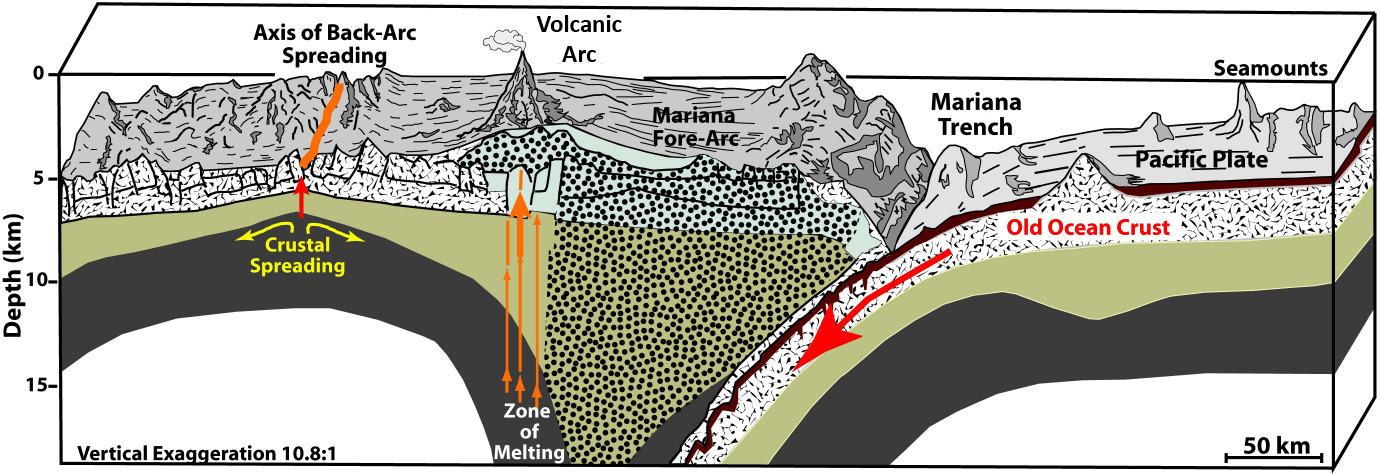
(Image courtesy NOAA)
Biology
The geologic forces that created Challenger Deep have also resulted in a habitat that is among the most unique on earth. The immense pressure, near-freezing temperatures, and lack of sunlight create an environment that is hostile to all but the most specialized forms of life. The organisms that live in deep ocean trenches have bodies that are adapted to survive in these harsh conditions. Due to the absence of sunlight, photosynthesis cannot take place, so organisms must get their nutrients through other means. One nutrient source is chemosynthesis, a process by which microbes produce organic compounds using energy derived from reactions involving inorganic chemicals. These chemicals may include sulfides, methane, carbon dioxide, and other compounds that derive from geological processes. Hence, the biology and geology at Challenger Deep are closely intertwined.
Planetary Science
Organisms that live in extreme conditions, such as those found at Challenger Deep, are called extremophiles. Extremophiles are of great interest to scientists in a variety of fields, including geology, paleontology, medicine, astrobiology, and planetary science. By studying extremophiles, geologists and biologists can learn about early life on earth and the conditions that gave rise to it. Astrobiologists study extremophiles to understand how and where life might exist elsewhere in our solar system, such as on other planets and their moons. Some astrobiologists believe that extremophiles in the unique environment of Challenger Deep may serve as a model for how life might survive in the ice-covered ocean of Europa, one of Jupiter’s largest moons.
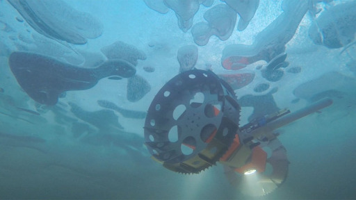
(An underwater rover developed by NASA-JPL for potential exploration of Europa’s ocean; courtesy NASA-JPL)
Geographical/Geophysical Stats:
- Depth: 10,925 m, 10.93 km, 35,843.18 ft, 6.79 mi
- Pressure: 1,086 bars (15,750 psi), over 1,000 times the air pressure at sea level
- Temperature: 1 to 4 °C (34 to 39 °F), just above the freezing point of water
- Natural Light: None
Common Depth Comparisons:
- Challenger Deep: 10,925 m, 10.93 km, 35,843.18 ft, 6.79 mi
- Cruising altitude for a commercial flight: 10,668 m, 10.67 km, 35,000 ft, 6.63 mi
- Mt. Everest: 8,848.86 m, 8.85 km, 29,032 ft, 5.50 mi
- Average depth of Earth’s ocean: 3,682 m, 3.68 km, 12,080 ft, 2.29 mi
- Infographic: Tallest Mountain to Deepest Ocean Trench
Jurisdiction:
Much of the Mariana Trench is contained within the Mariana Trench Marine National Monument, which is jointly managed by Secretary of Commerce (NOAA), the Secretary of the Interior (U.S. Fish and Wildlife Service) and the Commonwealth of the Northern Mariana Islands (CNMI) Government, in cooperation with the Department of Defense and the Department of State.
Logging Requirements:
To prevent abuse, this EarthCache has been locked and will be unlocked for verified finders. For those who have found it, please email the code word printed on the plaque, along with an authentic photo from your dive to the following email address for verification: GC95P88@geocaching.com.
Please note that random codeword guesses, or guesses without an authentic photo will not receive a reply.
Once verified, you will be required to submit answers to the following questions.
Questions:
Visitors to Challenger Deep are likely to be part of a scientific mission. As part of the logging requirements, please share some basic scientific observations made:
- What is the greatest depth measured? (Various depth measurements have been made over the years, using various methods, and each new measurement helps to determine the true depth.)
- What is the lowest temperature measured? (This provides useful information about the environmental conditions experienced by the special organisms that live in Challenger Deep.)
- What is the greatest pressure measured? (This also provides useful information about the habitat.)
- Describe the geological “landscape” at the deepest point of your voyage. Based on your understanding of plate tectonics, the unifying theory of geology, why do you think the landscape looks like this? (Answers may vary depending on the precise route taken or the angle of approach.)
- Please share a photo from your voyage, either of yourself, your submersible, a personal item you brought, or the scenery at Challenger Deep.
- Please share a link to any webpages or other publications that have resulted from data collected on your voyage. Alternatively, provide a brief description of the types of data and/or samples collected.
Additional Media:
Special thanks to the Geological Society of America for their assistance with this EarthCache.