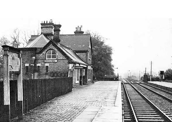
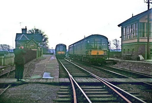
Blunham was a railway station on the Varsity Line between Oxford and Cambridge. Opened in 1862, the station was located in a rural area and saw little passenger traffic; it closed together with the line in 1968. Blunham station was built in the architectural style of the Bedford & Cambridge Railway, a style which included strong gables in yellow gault brick together with red brick dressings and string courses.The main station buildings were situated on the down side and a wooden shelter served for passengers on the up platform. The station had a substantial goods shed which contained a 25cwt crane and sidings controlled by a 20-lever frame signal box.] A longer private siding led southwards to Beeson's Mill which produced linseed oil on the banks of the River Ivel. The station, like many others on the line, saw much traffic in vegetables - notably potatoes, leading to special trains being laid on to arrange for the collection of goods for carriage to Bletchley and onward transport to London. The station served a relatively rural community - there were 598 residents in 1901 - and this, coupled with its remote location to the south of Blunham village, left it susceptible to competition from the motor car. The station eventually closed together with the Bedford & Cambridge-built section of the Varsity Line in 1968.
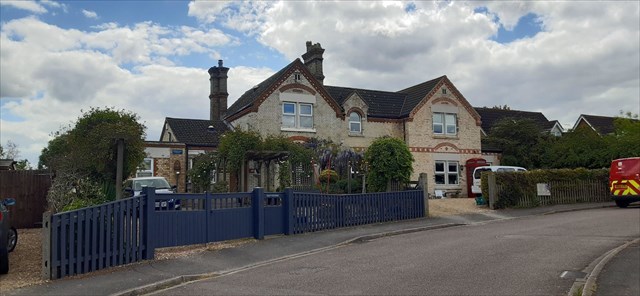
The main station building has been restored and converted into two semi-detached private residences respectively named "Stationmaster's Cottage" & "Station House". The building can be viewed from the published coordinates. The approach road to the station has been redeveloped as a new housing development called "Old Station Court" which continues westwards across the former railway alignment. To the east, the trackbed is intact including bridge no. 15 over the River Ivel which now forms part of National Cycle Route 51.
To locate the cache:
Opened: ab/cd/1862
Closed to goods: ef/gh/1964
Closed to passengers:ij/kl/1968
The cache is located at N52 08.(a+c+d)(h+e+j)(d+e+f+g) W000 19.(i+j+k+l)(b+e-f)(e+h)