
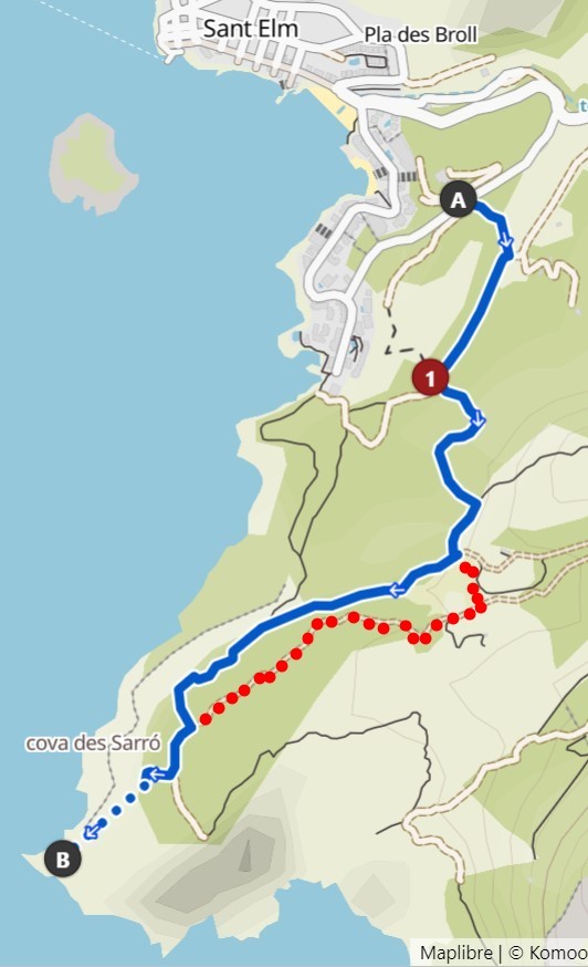
This is a little hike on the plateau to the most western landmark of Mallorca! Plan for about 2 hours incl. photo stops.
Use the red dotted way to get back and cross the field at the fence.
Komoot-Track: https://www.komoot.de/tour/779900148
For the way back, I recomment to do the little detour over Es Puig Blanc (112m) at S2. (See the view in that picture above)
Stage1 (Parking): A = First digit (Erste Ziffer der vierstelligen Zahl)

Stage 2: B= Color of Sant Elm sign (Welche Farbe links und rechts?)
White/Red: B=7
White/Green: B=4
White/Yellow: B=3 (this is the right solution, the tree has been cut off in the meanwhile)

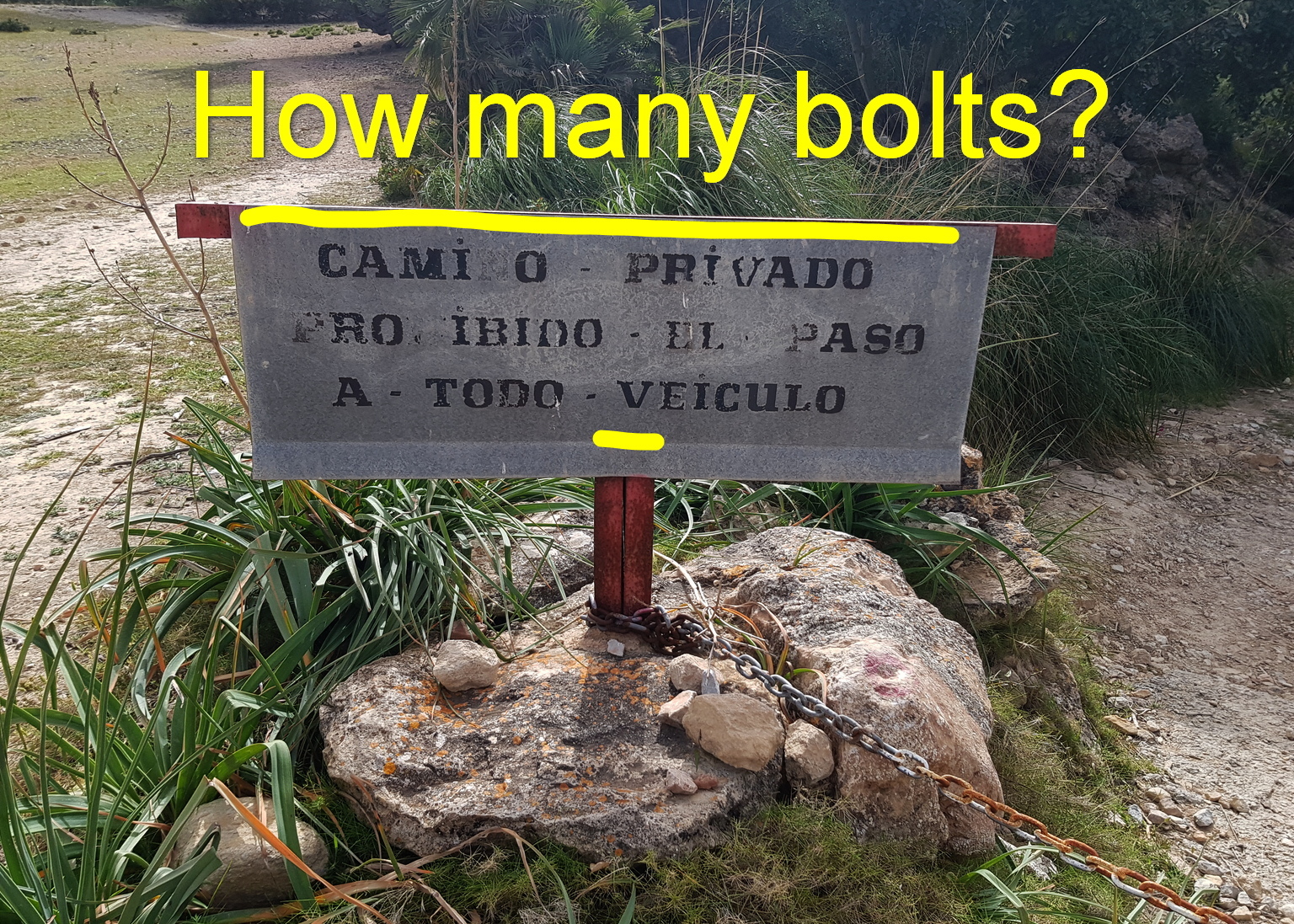
Stage 3: C = Number of bolts holding the sign? (Wieviele Nieten?)
Stage 4: D = Letter value in alphabet of THIRD letter in name? (Buchstabenwert des DRITTEN Buchstabens im Namen?)

---> Calculate Final: N 39° 34.(DCB+21)' E 2° 21.B(DB-A)A'
Put the digits, example: A=1, B=2, C=3, D=4 --> N 39° 34.(432+21)', E 2° 21.B(DB-A)A'