(Note: This event is meant to be accessible only from the Delaware River, using appropriate river craft. Do not attempt to approach it from land as that will likely be all of these: foolhardy, unsafe, and trespassing. It is being held here by permission of the landowner.)
The Tri-State area is filled with far more than its share of remarkable, natural sites and geographical oddities. However, you can't say you've seen it all without a trip down the river that carves out the unique shape that gives us the Tri-State Point.
The suggested Delaware River adventure should take about four hours (rough estimate) of kayaking from the Westfall landing to Milford Beach, but this geocaching event begins at 10:30am and ends at 11:00am and is held at the posted coordinates. You can bring your own watercraft (not just kayak) or rent one from a nearby location just about a quarter-mile upstream from the starting parking coordinates given in the description. Whatever way you find to go down the river, you'll enjoy a spectacular trip that is certain to show you wildlife (eagles are likely, herons are very likely, and a host of other water-dwellers are nearly certain) and special locations (passing under two important, local bridges and approaching a third, and floating right through the Tri-State Point itself - which is actually not on land but in the middle of the water. And it's there, in the middle of the river at N41º21' 25.8" W74º41'43.4" where we will shoot the group photo that will be one of the highlights of this event. Expect to see beautiful scenery and learn more about this area.
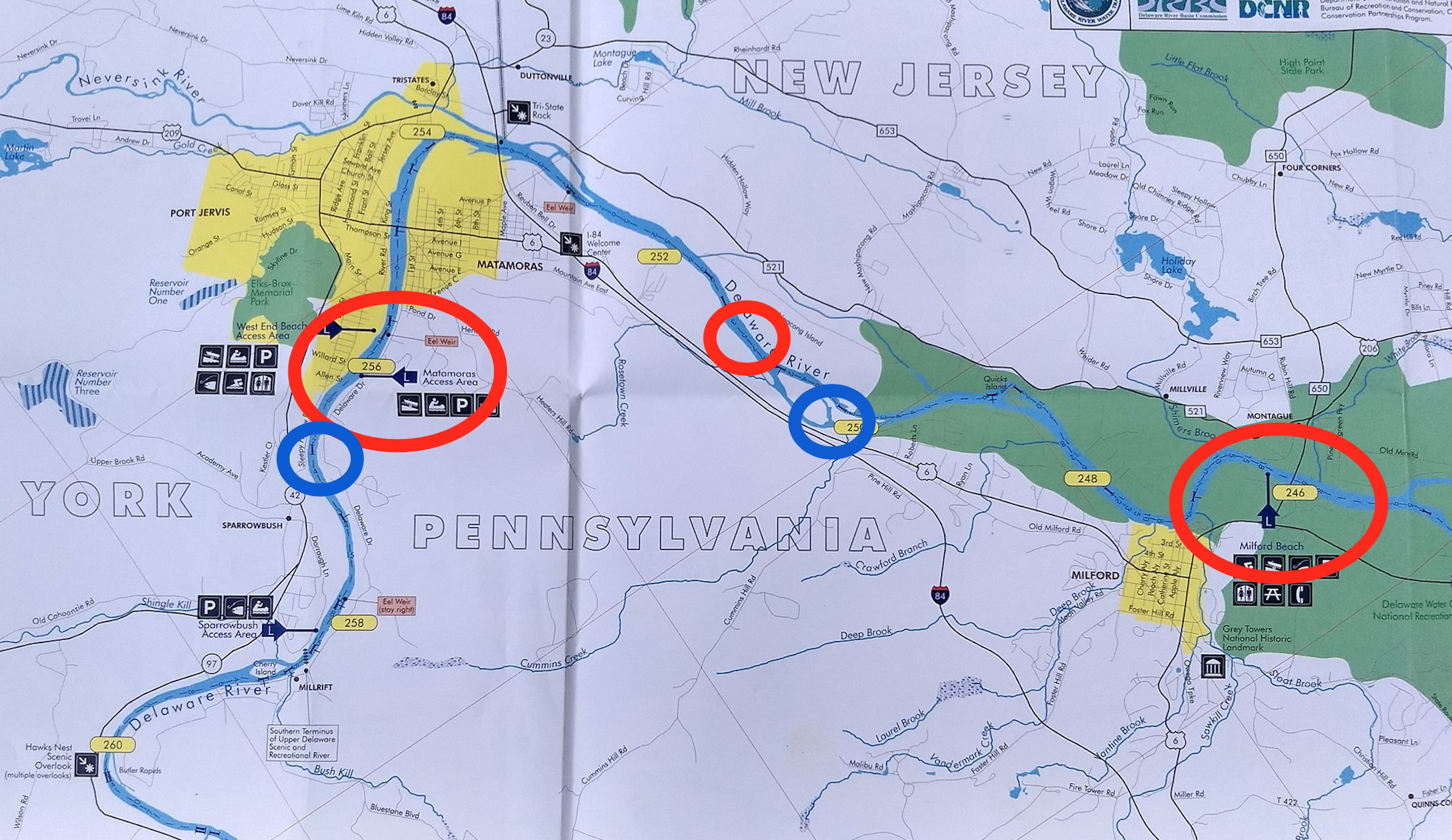
Large RED ovals show starting and ending points for those bringing their own boats.
Small BLUE ovals show the course followed by rentals.
Small RED oval shows where those bringing their own boats would end the trip if weather conditions call for a shortened trip; in that event, our shuttling would pick up from here instead to bring you back to Matamoras Boat Launch.
Click on the map to enlarge.