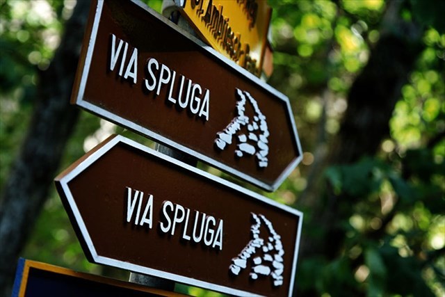


Willkommen auf der Via Spluga
Die ViaSpluga ist ein kulturhistorischer Wanderweg, der die Geschichte des Gebiets um den Splügenpass erschliesst. Seit dem Mittelalter verbinden sich hier, auf der direkten Route von Süddeutschland in die Lombardei, die Schicksale der Rätoromanen, Walser und Lombarden.
Die ViaSpluga führt über rund 65 km auf der einst wichtigen Handelsroute von Thusis im bündnerischen Domleschg über den Splügenpass ins italienische Chiavenna. Es werden 4 Tagesetappen an je 14-19km empfohlen.
Gleich eingangs überwindet sie die dramatische Viamala, die berühmteste Schlucht an der Splügenroute. Weiter führt die Route durch Zillis, Andeer und an den Dörfern des Schamserbergs vorbei, bis sich das einladende Tal zur unwegsamen Roflaschlucht verengt. Durch den sonnigen Talboden des Rheinwalds erreicht sie das Passdorf Splügen (1475 m). Von hier an steigt der Weg gegen Süden hinauf zur 2115 m hoch liegenden Splügen-Passhöhe, um dann durch die Schlucht im Val Cardinello und das waldreiche Val San Giacomo abzusteigen nach Chiavenna.
Die Route folgt historischen Saumpfaden und umfasst deren spektakulärste Abschnitte in der Viamala, in der Rofla und im Val Cardinello. Trotz ihrer Hindernisse war sie seit der Antike beliebt und bereits in den Fernstrassenverzeichnissen des römischen Reiches verzeichnet, da sie eine fast schnurgerade Verbindung zwischen dem süddeutschen Raum und der Lombardei bildet.
Weg- und Strassenbau, Transportdienste und Handelsverkehr, geistiger Austausch und künstlerische Gestaltungskraft haben das Bild der Landschaften und Siedlungen mitgeprägt und die Lebensgrundlagen und den Erfahrungshorizont der einheimischen Bauern erweitert. Die Kirche Zillis mit ihren weltberühmten romanischen Deckenmalereien bildet den künstlerischen Höhepunkt des Weges, der drei alpine Sprach- und Kulturregionen verbindet.
(Quelle: https://www.schweizmobil.ch/de/wanderland/routen/route-050.html)
Wichtige Hinweise
- Die Splügenpass Buslinie (Splügen - Monte Spluga - Chiavenna) verkehrt NUR in den Sommermonaten! Detailierte Infos entnehmt ihr bitte den Webseiten der Busbetriebe (siehe "Weitere Informationen")
- bitte prüft vor Beginn der Tour den Wegzustand. Es kommt vor, dass Teile der Route gesperrt sind. Sollte dies so sein begeht ihr den Weg in Eigenverantwortung. Die Betatester haben den Weg während einer Sperrung begangen. Es ist also durchaus möglich. Die Terrain-Wertung erhöht sich dadurch jedoch allenfalls.
- Der Weg ist nur in den Sommermonaten machbar, also ca. Juni-Oktober (siehe Wegzustand). Selbst im Sommer sind auf hoch gelegenen Abschnitten Schneefelder möglich
- Ich als Owner trage weder Verantwortung für Links in diesem Listing, noch für die Sicherheit der Wanderer während der beschriebenen Tour
- Der Weg darf und kann grösstenteils ausschliesslich zu Fuss begangen werden
-
Multi Anleitung
- Der Multi führt über 40 Stationen
- Lade die Fotos (PDF Datei) auf dein Handy oder drucke es aus. Beim Ausdrucken empfehle ich dringend einen Farbdruck, damit es ein bisschen einfacher ist
- Auf jedem Foto findet ihr eine 2-stellige Zahl zwischen 10 und 59. Ordnet diese der Station zu. Also z. B. A1=53. Ihr braucht diese Zahlen, um am Ende das Finale berechnen zu können
- Sämtliche Fotos sind vom Weg aus sichtbar an der Stelle wo die Stages gesetzt sind.
Berechnung Final
Kontrollsumme A1 bis J1 = 348
Kontrollsumme K1 bis T1 = 341
Kontrollsumme U1 bis D2 = 342
Kontrollsumme E2 bis N2 = 343
(((A1 * B1 * C1 * D1) + (E1 * F1 * G1 * H1) + (I1 * J1 * K1 * L1) - (M1 * N1 * O1 * P1) - (Q1 * R1 * S1 * T1)) - 6`975) / 12 = XX.XXX
(((U1 * V1 * W1 * X1) + (Y1 * Z1 * A2 * B2) + (C2 * D2 * E2 * F2) - (G2 * H2 * I2 * J2) - (K2 * L2 * M2 * N2)) – 6`528) / 6 = YY.YYY
= N 46° XX.XXX E 009° YY.YYY
Weitere Informationen
- Broschüre Kultur- und Weitwanderweg Via Spluga: https://www.viamala.ch/sites/viamala/files/2022-04/web_viaspluga_broschuere_2022.pdf
- zur Route (Bus- und Zugverbindungen & Haltestellen (CH), Etappen, Höhenprofil, usw.): https://www.schweizmobil.ch/de/wanderland/routen/route-050.html
- aktueller Wegzustand: https://www.viamala.ch/de/viaspluga
- vielfältige Informationen (Route, Wegzustand, Gepäcktransport/-depot, Broschüre, Hotels, Parkieren) : https://www.viamala.ch/de/viaspluga
- übersichtlicher Wanderbeschrieb, Tourmerkmale, öffentliche Verkehrsmittel, ... https://wegwandern.ch/listing/via-spluga-thusis-chiavenna-wanderung-wandern/
- weiterführende, detailierte Informationen (Anreise, Route, Unterkünfte, ...): http://www.wandersite.ch/spluga.html
- Busverbindung Splügen - Monte Spluga - Chiavenna -STPS: http://www.stps.it -Postauto: https://www.postauto.ch/de/ausflugstipps/spluegenpass-linie
-


Benvenuti sulla Via Spluga
La ViaSpluga è un sentiero escursionistico culturale che ripercorre la storia della regione dello Passo della Spluga. Dal Medioevo, su questa via che collega il sud della Germania con la Lombardia, si incrociano i destini retoromani, walser e lombardi.
La ViaSpluga ripercorre un'importante via di transito del passato: un percorso lungo circa 65 km conduce da Thusis, nel Domleschg grigionese, a Chiavenna, in Italia. Si consigliano 4 tappe giornaliere di 14-19 km ciascuna.
Inizia con il superamento dell'imponente Viamala, la gola più famosa della strada dello Splügen. Passa quindi da Zillis, Andeer e dai villaggi del Schamserberg, finché l'ampia valle si restringe verso un'altra gola, la Roflaschlucht. Sul fondovalle soleggiato del Rheinwald si giunge a Splügen (1475 m). Da qui il sentiero volge verso sud e sale ai 2115 m dello Splügenpass, per poi riscendere attraverso la gola del Cardinello e la boscosa Val San Giacomo fino a Chiavenna.
L'itinerario si snoda su antiche mulattiere e comprende tutti i punti più spettacolari dell'antica via di transito. Malgrado gli ostacoli, questo collegamento diretto fra le regioni germaniche meridionali e la Lombardia era già percorso nell'antichità e figurava nel registro delle vie a lunga percorrenza dell'Impero romano.
La costruzione di sentieri e strade, i servizi di trasporto, gli interscambi culturali e l'espressività creativa hanno segnato in modo indelebile i paesaggi e gli insediamenti ed esteso l'orizzonte degli abitanti della regione. L'apice artistico di questo itinerario che collega tre regioni linguistiche e culturali alpine è la chiesa di Zillis, con i suoi celebri affreschi romanici sul soffitto.
(Fonte: https://www.schweizmobil.ch/de/wanderland/routen/route-050.html)
Avvertenze Importanti
- La linea autobus Splügenpass (Splügen - Monte Spluga - Chiavenna) è disponibile SOLO nei mesi estivi! Informazioni dettagliate sono disponibili sui siti web delle compagnie di autobus (vedi "Ulteriori informazioni").
- si prega di controllare le condizioni della strada prima di iniziare il percorso. Può succedere che alcune parti della via siano bloccate. I beta tester si sono fatti strada durante uno sbarramento simile. È quindi possibile percorrerlo, ma a propria responsabilità. In questo caso la classificazione del terreno potrebbe aumentare.
- Il percorso è possibile solo nei mesi estivi, cioè circa giugno - ottobre (vedi condizioni del percorso). Anche d'estate si possono trovare distese di neve sui tratti alti.
- Come owner non sono responsabile per i link presenti in questo elenco, né per la sicurezza durante il tour descritto.
- Parte del percorso può venir percorso unicamente a piedi.
Instuzioni Multi Cache
Calcolo Finale
Nummero di controllo da A1 a J1 = 348
Nummero di controllo da K1 a T1 = 341
Nummero di controllo da U1 a D2 = 342
Nummero di controllo da E2 a N2 = 343
(((A1 * B1 * C1 * D1) + (E1 * F1 * G1 * H1) + (I1 * J1 * K1 * L1) - (M1 * N1 * O1 * P1) - (Q1 * R1 * S1 * T1)) - 6`975) / 12 = XX.XXX
(((U1 * V1 * W1 * X1) + (Y1 * Z1 * A2 * B2) + (C2 * D2 * E2 * F2) - (G2 * H2 * I2 * J2) - (K2 * L2 * M2 * N2)) – 6`528) / 6 = YY.YYY
= N 46° XX.XXX E 009° YY.YYY
Ulteroni Informationi


Welcome on the Via Spluga
The ViaSpluga is a cultural-historical hiking trail, which reveals the history of the area around the Splügenpass. Since the Middle Ages here on the direct route from southern Germany to Lombardy the fortunes of the Rhaeto-Romans Walser and Lombards have connected.
The ViaSpluga leads over approximately 65 km on the once important trade route of Thusis in Switzerland across the Splügen Pass into the Italian town of Chiavenna. 4 days of hiking between 14-19km each are recommended.
Right at the beginning it overcomes the dramatic Viamala which is the most famous gorge on the Splügen route. The route continues through Zillis, Andeer and the villages of the Schamserberg, until the wide valley narrows to the rough Rofla-Gorge. Through the sunny valley floor of the Rhineforest you reach the pass village Splügen (1475 m). From here, the path ascends south to the 2115 m high Splügen Pass, then descend through the gorge of Val Cardinello and the wooded Val San Giacomo to Chiavenna.
The route follows historic mule tracks and includes its most spectacular sections in the Viamala, Rofla and Val Cardinello. Despite its obstacles, it has been popular since antiquity and already listed in the long-distance directories of the Roman Empire, as it forms an almost dead straight line between southern Germany and Lombardy.
Road and road construction, transport services and trade, intellectual exchange and artistic creativity have influenced the image of landscapes and settlements and expanded the livelihoods and experience of local farmers. The Zillis church, with its world-famous Romanesque ceiling paintings, is the artistic highlight of the path connecting three Alpine language and cultural regions.
(Quelle: https://www.schweizmobil.ch/de/wanderland/routen/route-050.html)
Important Hints
- The Splügenpass bus line (Splügen - Monte Spluga - Chiavenna) operates ONLY in the summer months! Detailed information can be found on the websites of the bus companies (see "Further Information")
- Please check the trail condition before starting the tour. It happens that parts of the route are blocked. If this is the case, you will take the path on your own responsibility. But the beta testers have made their way during a blockage. So it is quite possible. However, the terrain rating might increase.
- The path is feasible only in the summer months, so about June-October (see trail condition). Even in summer snowfields are possible on high-altitude sections
- As owner, I am not responsible for any links in this listing, nor for the safety of the hikers during the described tour
- The path is a foothpath only for most of the way
Multi Instructions
- The multi cache lead over 40 stages
- Download the photos (PDF File) onto your smartphone or bring them as a printed version. When printing a colored print is highly recommended as it makes it a bit easier to solve the puzzle
- On every photo is a 2-digit number between 10 and 60. Add them to the right stages. For example: A1=53. You need this to calculate the final at the end.
- All the photos are visible at the stages mentioned in the waypoints. No need to go off trail
Calculation Final
Checksum A1 bis J1 = 348
Checksum K1 bis T1 = 341
Checksum U1 bis D2 = 342
Checksum E2 bis N2 = 343
(((A1 * B1 * C1 * D1) + (E1 * F1 * G1 * H1) + (I1 * J1 * K1 * L1) - (M1 * N1 * O1 * P1) - (Q1 * R1 * S1 * T1)) - 6`975) / 12 = XX.XXX
(((U1 * V1 * W1 * X1) + (Y1 * Z1 * A2 * B2) + (C2 * D2 * E2 * F2) - (G2 * H2 * I2 * J2) - (K2 * L2 * M2 * N2)) – 6`528) / 6 = YY.YYY
= N 46° XX.XXX E 009° YY.YYY
Further Information

Banner
(D) Fühl dich frei diesen Banner in dein Profil einzufügen. Dafür muss du folgendes tun: 1. Den Link unterhalb des Banners kopieren, 2. In deinem GC-Profil auf das Sympol für Einstellungen klicken, 3. Den Link im Feld "Über" einfügen, fertig.
(GB) Feel free to add this banner to your profile. Therefore you need to do the following: 1. copy the link below the banner, 2. go to your GC-profile and click onto the sympol for settings, 3. paste the link in the section "About", done
(I) Sentiti libero di aggiungere questo banner al tuo profilo. Pertanto, puoi leggere quanto segue: 1. copia il link sotto il banner, 2. vai al tuo profilo GC e fai clic sul sympol per le impostazioni, 3. incolla il link nella sezione "Informazioni", fatto 
<a href="https://coord.info/GC89A0B" target="_blank"><img src="https://s3.amazonaws.com/gs-geo-images/388bed03-4c35-405e-9a75-70fa04c79840_l.jpg" alt="Via Spluga” width=”248” height="auto"></a>