Na základe doterajších archeologicky skúmaných častí kastelu Gerulata možno v kontexte zaužívanej schémy stavby rímskych kastelov na Dunaji rekonštruovať jeho štyri stavebné etapy, polohu pohrebísk a taktiež polohu civilných osád – vicusov.
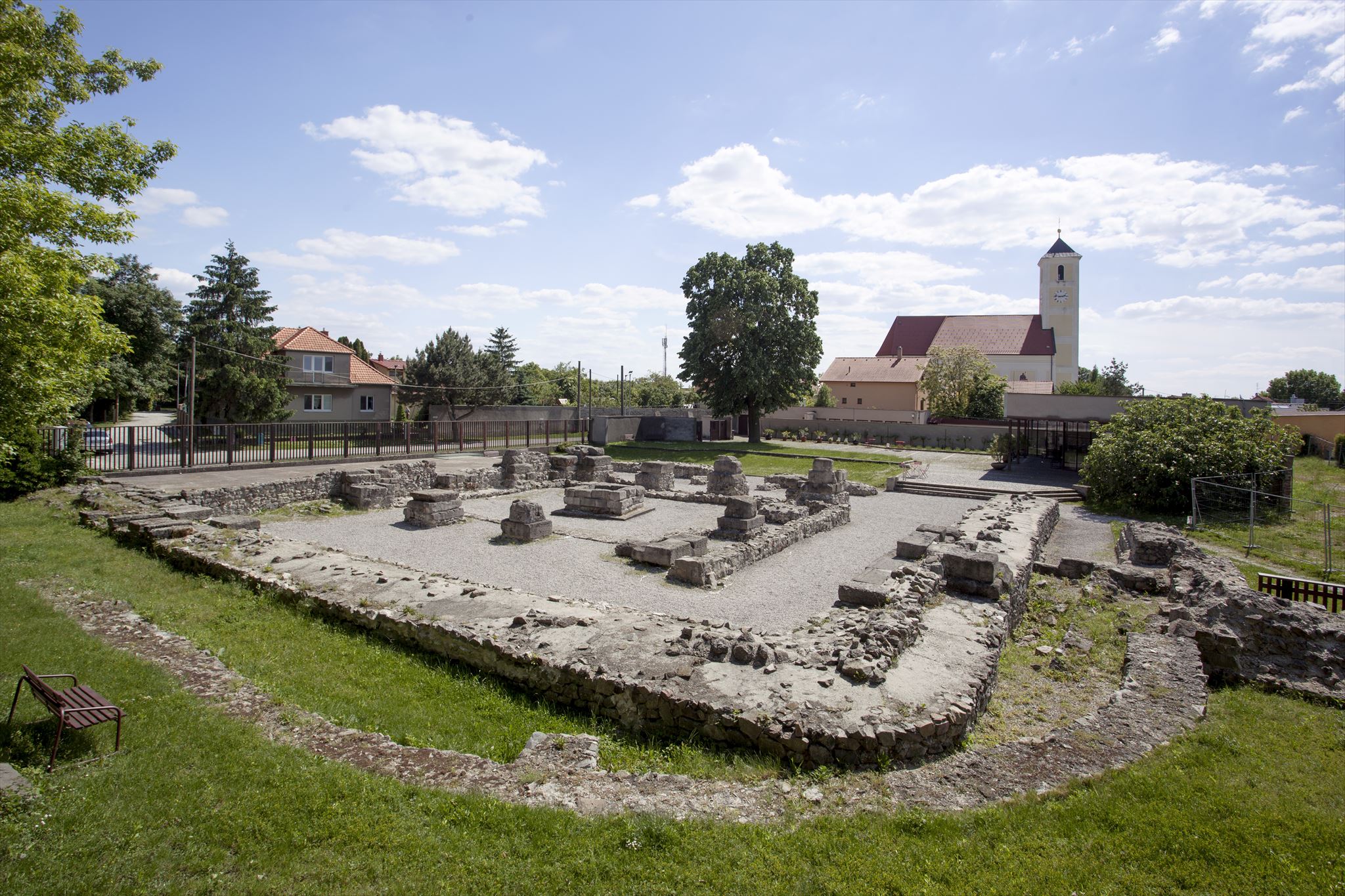
Prvá stavebná etapa Gerulaty bola vybudovaná v druhej polovici 1. storočia za vlády Fláviovcov. Základy Gerulaty vznikli v období vlády cisára Domiciána (69 – 96), keď na územie dnešných Rusoviec prišli vojaci piatej kohorty Lucensium a vybudovali tu drevozemný kastel. Neskôr bol rozšírený a počas štyroch stavebných etáp prebudovaný na kamenný kastel. Kamenné základy kastelu Gerulata našli archeológovia v lokalite pod kopcom Bergl. Najlepšie sa zachovala neskoroantická pevnosť štvrtej stavebnej etapy vybudovaná v rohu staršieho kastelu.
Medzníkom prvej a druhej stavebnej etapy boli markomanské vojny. Z tohto obdobia máme doložené dva dočasné tábory. O tábore druhej stavebnej etapy máme najmenej poznatkov. Archeologické výskumy ukázali, že koncom 3. a v 4. storočí došlo v Gerulate k mimoriadnej stavebnej aktivite, ktorej výsledkom bola tretia stavebná fáza kastela. Do obdobia tretej stavebnej etapy (270 – 375) patrí aj Dom s hypocaustom, ďalšia významná pamiatka, ktorá spolu s Gerulatou a Irkutskou ulicou tvorí spoločné pamiatkovo chránené územie. V zázemí kastelu Gerulata boli preskúmané poľnohospodárske usadlosti, ktoré ho zásobovali agrárnymi produktami.
Rímske vojenské tábory boli stavané podľa jednotného plánu. Vznikali na pravouhlom pôdoryse, obohnanom hradbami a priekopami, a na každej strane mali brány, cez ktoré viedli cesty. Hlavná brána (porta praetoria) smerovala vždy na východ alebo smerom k nepriateľovi, v prípade pochodu bola umiestnená v smere ďalšieho ťaženia. V blízkosti vojenských táborov prirodzene vznikali civilné osady, čím sa vytvárali rozsiahlejšie a bohatšie osídlenia. Tábor bol usporiadaný v pravouhlej mriežke, jeho cesty boli vybavené kanalizáciou. Nachádzali sa tu budovy veliteľstva, ktoré zahŕňali svätyňu, zbrojnicu, pokladnicu, obydlie veliteľa a dôstojníkov a nemocnicu. Okrem toho sa v tábore nachádzala sýpka, sklady, dielne a kúpele.
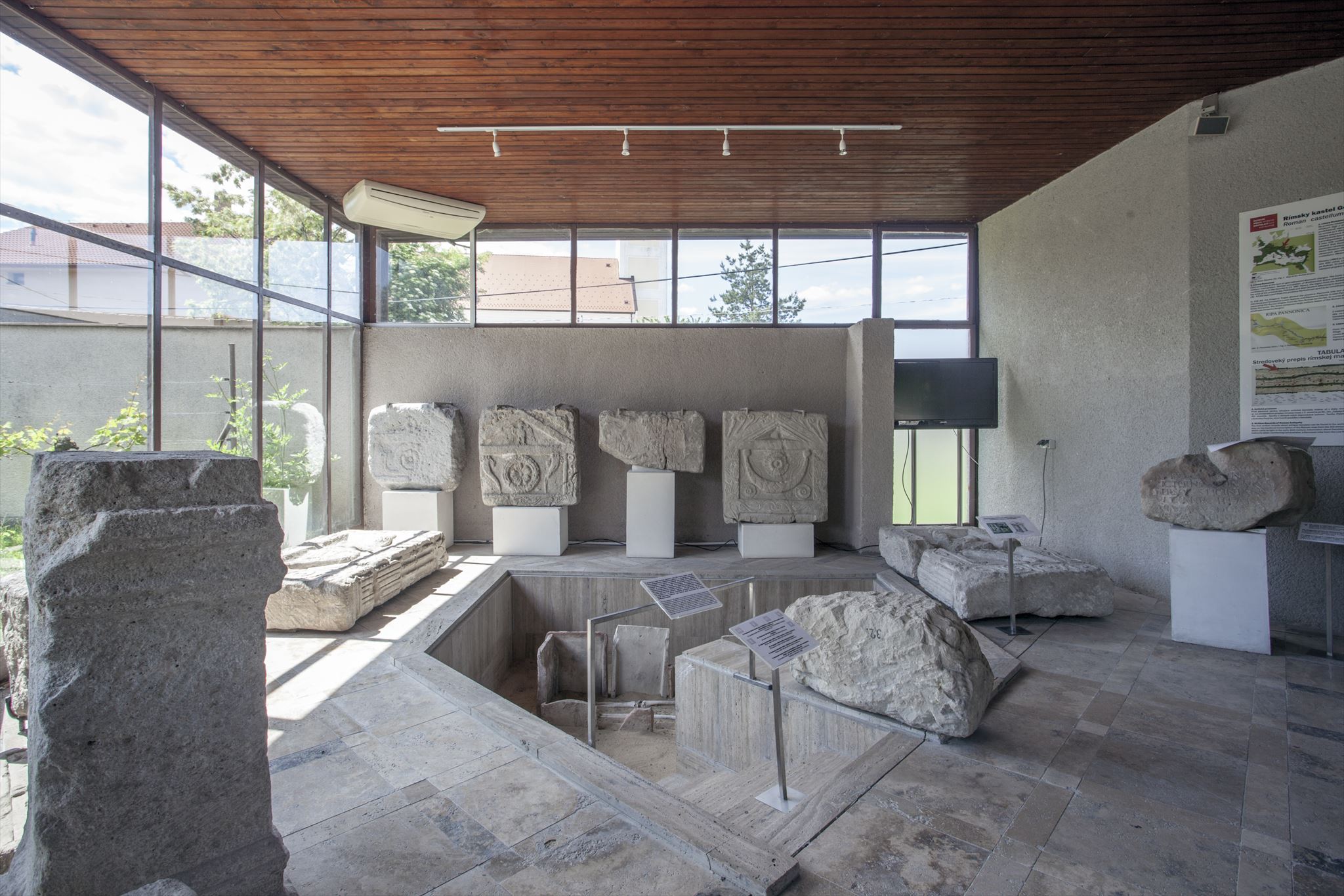
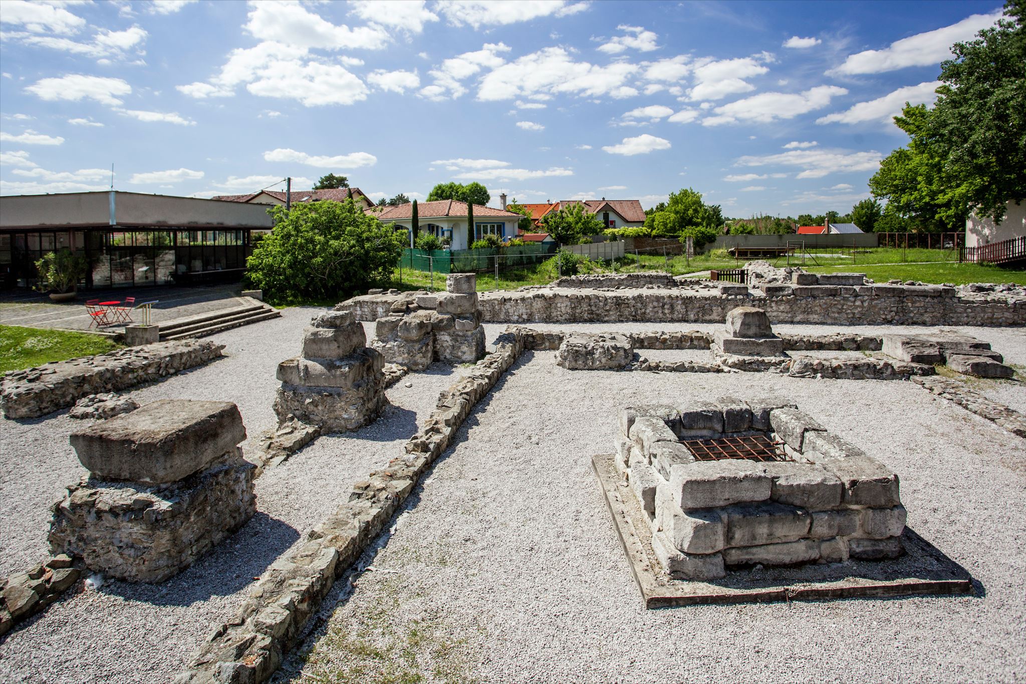
Hlavnú stavebnú aktivitu štvrtej etapy predstavovala výstavba neskoro antickej vežovitej pevnosti, ktorá vznikla zabudovaním do rohu staršej architektonickej konštrukcie. Táto veža mala 12 mohutných pilierov a uprostred nádvoria, ktoré vytvárali, bola asymetricky umiestnená studňa. Statické posudky dokonca uvažujú až o trojposchodovej stavbe. V pilieroch i obvodových múroch mladšieho kastelu sa našli zamurované staršie kamenné výtvarné diela, ktoré sú vystavené v lapidáriu múzea.
Vežovitá stavba má paralely s podobnými limitnými pevnosťami na dunajskom limese z konca 4. storočia. Je datovaná do obdobia po roku 380 aj vďaka nálezu trojvrstvového hrebeňa, ktorý nájdete v expozícii múzea.
V juhovýchodnej časti pevnosti sa zachovala jednoduchá štrkovo-vápenná dlážka s tehlovou drvinou.
Stavba sa zachovala vďaka stredovekému hrádku, ktorý bol postavený v 11. storočí na kamenných základoch rímskej pevnosti. Hrádok pôvodne vznikol ako drevo zemná stavba, ktorá bola v polovici 13. storočia modernizovaná stavbou obytnej kamennej veže s tehlovou plentou.
Otváracie hodiny:
Sezónne 1. marec – 15 november
Utorok – Nedeľa 10.00 – 17.00, posledný vstup o 16.30
Vstupné:
Základné vstupné 2,50 €
Zľavnené vstupné 1,50 €
(deti do 14 r., študenti, dôchodcovia)
Rodinné vstupné 5,00 €
(2 dospelí a deti vo veku 14 r.)
Neplatiaci 0,00 €
(deti do 6 rokov, ŤZP, ŤZP/S, novinári,
pedagogický dozor na 10 žiakov jedna osoba,
turistický sprievodca)
Vstup do areálu múzea 0,00 €
Podmienky logovania
1, Ako sa volali civilné osady, ktoré vznikali v okolí rímskych táborov?
2, Koľko brán mal tábor Gerulata?
3, Sprav foto seba, alebo svojho GPS pred vchodom do tábora.
Upozornenia
- Správne odpovede mi pošli do správy.
- Logy, nespĺňajúce vyššie uvedené podmienky, budú vymazané bez varovania. Ak potrebuješ zalogovať svoj nález, hoci plánuješ uploadovať obrázky neskôr, zaloguj poznámkou (Write Note).
- Logy spred dátumu publikácie kešky nie sú povolené a budú zmazané.

Foto Eva Benková

Ancient Gerulata Museum
The Roman Empire covered the largest area during the reign of Emperor Trajan (98 – 117). The territory of the empire was defended by a fortified system called Limes Romanus. Gerulata was part of this system, which stretched for more than 5,000 km over the territories of Europe, Asia, and Africa.
Come and visit Gerulata, the first castellum in the line Carnuntum – Ad Flexum, which is part of the UNESCO World Heritage List.
National Heritage Site Roman castellum Gerulata

The Ancient Gerulata Museum in Rusovce are located on the site of the former Roman military castellum on the border of the fortification system. Geographically, the area of present-day Rusovce lay in the province of Pannonia on the northern edge of the Roman Empire.
Gerulata lay about 40 km from Carnuntum and was the first fort in the carnuntum – Ad Felsum line. This military camp played a very important strategic role – it protected the eastern wing of legions located in Carnuntum, the capital city of the province of Upper Pannonia.
The name Gerulata was probably adopted from the original Celtic population. Besides th fort, gerulata consisted of civilian settlements, cemeteries, a harbour, watchtowers, signal towers, as well as farmsteads and villa rustica settlements. There may have been a ford near the camp, but neither the ford nor the harbour have been archeologically attested. Thanks to previously analysed parts of the castellum, it was possible to outline its four construction phases, the location of burial grounds and civil settlements – vici, as well as agricultural settlements and a villa rustica.
Topography of the Gerulata Fort

In the context of the usual structure of Roman forts on the Danube, the archaeologically examined parts of the Gerulata fort allow us to reconstruct the fort’s four building phases and the location of cemeteries and civilian settlements – vici.
The first building phase of Gerulata was built in the second half of the 1st century during the Flavian rule. The foundations of Gerulata were laid during the reign of Emperor Domitian (69 – 96), when the soldiers of the fifth cohort Lucensium arrived at the area of present-day Rusovce and built an earth-and-timber fort there. It had dimensions of approximately 240 x 145 m. The fort was later rebuilt into a stone fort during four building phases. Archaeologists discovered the foundations of the Gerulata fort below the Bergl hill. The best-preserved part is the late ancient fortlet of the fourth building phase raised in the corner of the earlier fort.
The Marcomannic wars were an important milestone between the first and the second building phases. Two temporary forts are attested from this period, but knowledge about the fort of the second building phase is scarce. Archeological excavations revealed an unusual building activity at Gerulata towards the end of the 3rd and throughout the 4th century, which constituted the third building phase of the fort. The third building phase (270 – 375) is associated with the House with a hypocaust, a significant monument that forms part of a protected area along with Gerulata and Irkutská Street. Agricultural settlements supplying agricultural products to the Gerulata fort have been investigated in the fort’s hinterland.

Roman military camps were built according to a uniform system. They had a rectangular ground plan enclosed by walls and ditches, and on each side were gateways, through which passed roads. The main gateway (porta praetoria) always faced eastward or toward the enemy; in the case of a march, it was placed in the direction of further campaign. Civilian settlements were established close to the military camps, thus forming larger and richer settlement areas. The camp was arranged in a rectangular grid and its roads had a sewerage system. There were buildings of the command staff, which included a shrine, armory, treasury, the commander’s and officers’ houses and a hospital. The camp also had a granary, storehouses, workshops, and baths.
The main construction of Garapata’s fourth building phase is a late ancient tower-like fort, which was built into the corner of an earlier architectural structure. The fort had 12 massive pillars which formed a courtyard. In the middle was an asymmetrically placed well. Earlier stone artwork that had been bricked up in the pillars and outer walls of the later fort are now exhibited in the museum lapidarium.
The main construction activity of the fourth building phase was the construction of the late ancient tower-like fortlet in the corner of an earlier structure. The tower had 12 massive pillars that formed a yard, in the middle of which was an asymetrically placed well. Structural assessments even assume that the tower may have been a three-storey building. In the pillars and perimeter walls of the later fort were bricked up earlier stone artworks, which are now exhibited in the museum’s lapidarium. The tower-like building has parallels with similar late fourth century forts on the Danubian Limes. Dating of the tower to the period after AD 380 is partly based on the find of a composite comb, which is exhibited in the museum.
A simple gravel and lime floor with brick rubble has been preserved in the south-eastern part of the fort. The more costly floors in Roman buildings were made by pressing mosaic stones, stone boards, bricks, or tiles into a thin lime layer.
The structure has survived thanks to the medieval castle, which was built on the stone foundations of the Roman fort in the 11th century. The castle was originally an earth-and-timber structure of the motte type (a lowland castle raised on an artificial hill) and was modernized in the mid-13th century by a residential stone tower with a brick wall.
Access to the Museum
Opening hours
Seasonal operation from 1 March until 15 November
Tuesday – Sunday 10.00 – 17.00, last entry at 16.30
Admission
Basic ticket price 2,50 €
Reduced ticket 1,50 €
(Children under 14 years of age, students, seniors)
Family ticket 5,00 €
(Two adults and children under 14 years of age)
Free entry 0,00 €
(Children under 6 years of age, disabled person
card's holders and their guide, journalists,
teacher accompanying 10 pupils of students,
tourist guide)
Access to the museum area 0,00 €
Logging conditions
1, What were the names of the civilian settlements that developed around the Roman camps?
2, How many gates did the fortress of Gerulata have?
3, Take a photo of yourself or your GPS in front of the camp entrance.
Warnings
- Send me the correct answers in the message.
- Logs that do not meet the above mentioned conditions will be deleted without notice. If you still need to log your find intending to upload the pictures later, please, use Write Note.
- Logs prior to the cache publication date are not allowed and will be deleted.

Photo by Eva Benková
Please leave the following text at the bottom of the page, so cache finders understand the Virtual Rewards 2.0 project.
Virtual Rewards 2.0 - 2019/2020
This Virtual Cache is part of a limited release of Virtuals created between June 4, 2019 and June 4, 2020. Only 4,000 cache owners were given the opportunity to hide a Virtual Cache. Learn more about Virtual Rewards 2.0 on the Geocaching Blog.