
The Hartbeespoort Aerial Cableway was constructed in 1973. Sadly, by 2005, the cableway had fallen into a state of disrepair and was closed.
In 2010, a private company bought the old cableway and in collaboration with a Swiss company the cableway was renovated. New galvanised cabling, touch-screen technology, and auto cabin spacing, and conveyor programming technology was installed. The 14 new cable cars, each able to carry six passengers, can transport 300 people an hour, round trip.
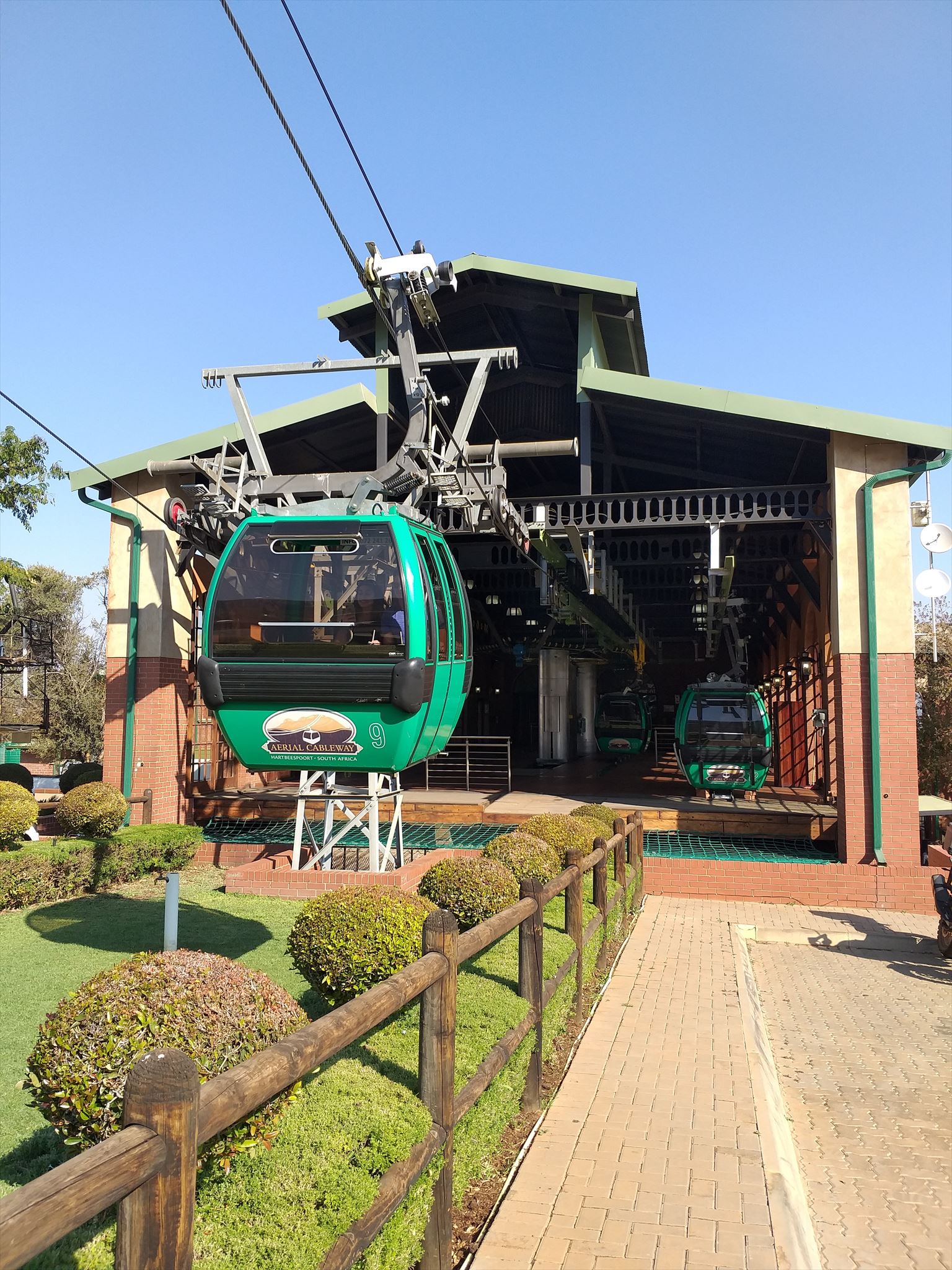
The building housing the massive gears and mechanisms of the cableway is designed like an old-fashioned train station, with tall, arched windows, face-brick walls and a multi-tiered roof. In the base station the mechanisms that run the cableway, huge wheels and gears, and thick shining cable, are astounding.

There is a vulture sanctuary next to the cableway, and if you’re lucky, the vultures fly over the cableway looking for a meal.
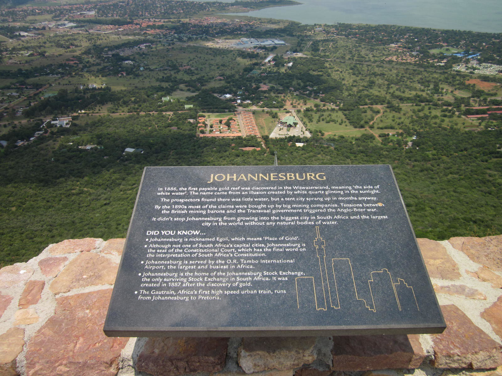
On a clear day you can see the Dome in North Riding, Johannesburg, the town of Brits and some of Pretoria from the top of the mountain.
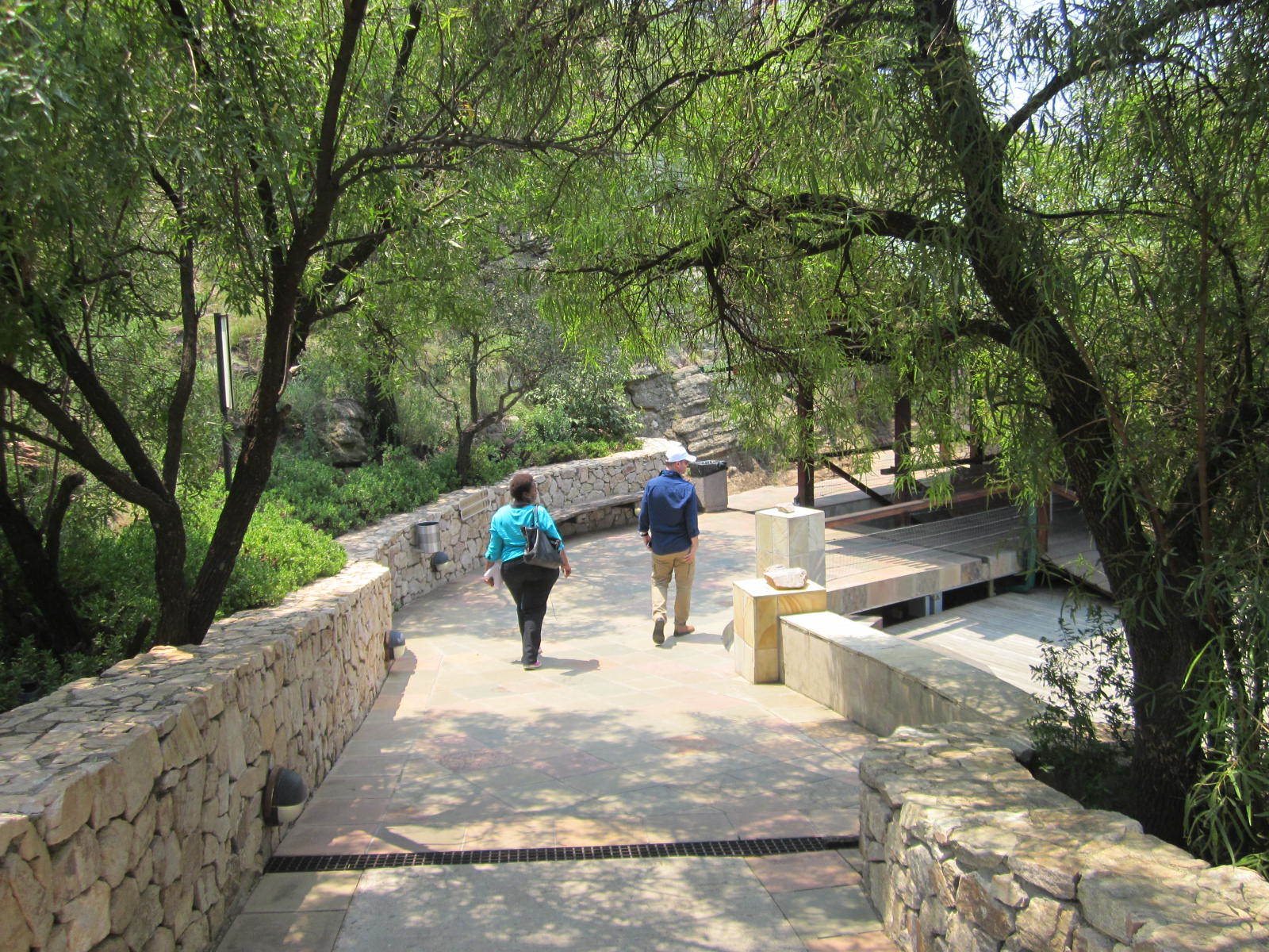
The Dassie Loop, a paved pathway wraps around the mountain, where informative signs along the walkway explained points of interest visible.
Standing at the top of the Harties Cableway, one can survey the immediate area and beyond. Firstly, you overlook several battlegrounds that were significant during the South African War, which lasted from 1899 to 1902. This complicated war chiefly involved British and Boer troops.
In the distance, you will make out Johannesburg and Pretoria, two of the country’s major cities. While the latter has its roots in the history of the Boers and the mass migration known as the Great Trek, Johannesburg was founded on the discovery of gold in 1886. The wealth offered by the area has translated into modern-day times – Johannesburg generates more economic activity than any other city in Africa.
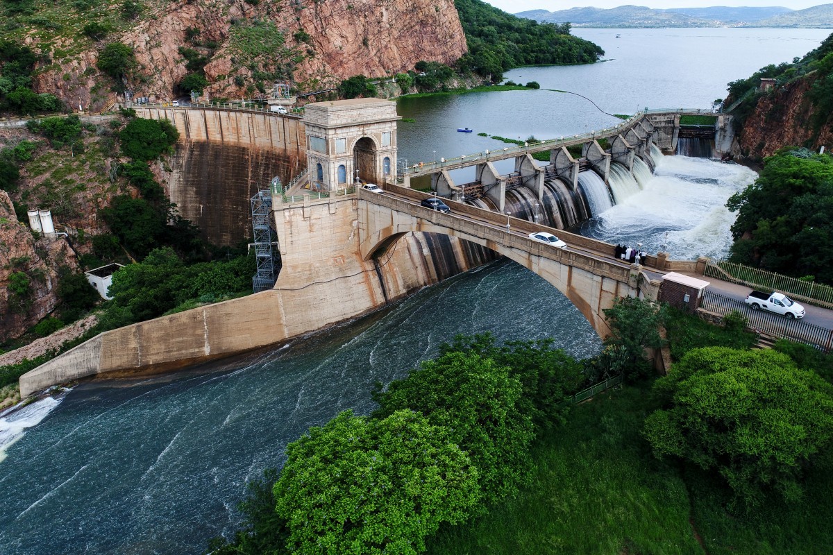
One of the more prominent sights is, of course, Hartbeespoort Dam, which dominates 2,062ha of the valley. It was through great vision and perseverance that construction of the dam was finally completed in the 1920s. Construction began in 1896 at an inlet of the Crocodile River, close to where the railway bridge in Meerhof lies today.
It was a project first envisioned by a Boer War general and original owner of farm Hartbeespoort, Hendrik Schoeman. He believed a dam would serve as a focal point for industrial, agricultural and residential development in the area – so much so that he invested £10 000 in its development, a considerable fortune in those days. It was originally called Sophia Dam in honour of Schoeman’s wife and was the largest in the southern hemisphere at the time. The outbreak of war soon after halted all plans to upgrade the dam, and in 1902 the general died.
In 1905, Swedish engineer August Karlson was hired by the government to start construction on the dam wall as we know it today in the Schoemansville area, and preliminary investigations began. Plans were postponed again when the South African Union was formed in 1910, but with increasing public interest, the Hartbeespoort Irrigation Scheme Act of 1914 permitted construction to continue in 1915. Again war intervened, with World War One halting construction until 1918. In that year, farms were bought and divided up for residential areas, and the farm school in the area was demolished to make way for the dam basin. Work also started on two cofferdams, which were used to dam up the river so builders could pour the wall foundations. But these were washed away by serious flooding and torrential rains in May 1921. This resulted in the frustrated engineer leaving.

The government hired a new engineer, and finally, in September 1923, the road was laid across the Hartbeespoort bridge – which was then the new main road between Pretoria and Rustenburg. The design of the bridge was taken from Roman architecture and built in an odd shape known as a “Triomfboog”, renowned for its strength in retaining water. The arch built on the wall symbolises a gateway and is a stark copy of the Arc de Triomphe in Paris. Over 250 000 bags of cement were used in construction of the wall, which was raised by 2,4m in 1970. This, along with the sluice gates that were installed, allows the dam to collect 205-million cubic metres of water.
When it comes to history, the Magaliesberg mountain range, outdoes anything else you can see from the top of the Harties Cableway. Its history stretches back at least 2-billion years, when the geological structural elements moved into place.
Logging Requirements:
1) Post a photo of yourself (no face required) with any of the interesting features mentioned in the cache description. Please include, in any way possible, your cache name and the date in your photo, ie. written on a piece of paper/or your tablet or in any other creative way you can think of. This photo can be added to your log. Please message or email to us.
2) (Location question) Look around the bottom cable station and find the signs which tell you something about time. One sign indicates more, or longer. What other very interesting bit of information is mentioned on this board? Please send your answer to us via a message or an email. Please don’t mention this answer in your log.
Virtual Rewards 2.0 - 2019/2020
This Virtual Cache is part of a limited release of Virtuals created between June 4, 2019 and June 4, 2020. Only 4,000 cache owners were given the opportunity to hide a Virtual Cache.
Learn more about Virtual Rewards 2.0 on the Geocaching Blog.