Halnaker Windmill
Halnaker Windmill (pronounced 'Hannecker Windmill', by the locals) is a Grade II listed building standing at the top of Halnaker Hill, itself a Scheduled Ancient Monument.

A mill on the site was first recorded in 1540 but the mill that survives today was built in 1740 and was in operation until it was badly damaged by lightning in 1905. It was subsequently restored in 1934 by Sir William Bird, as a memorial to his wife. The most recent renovations by West Sussex County Council have taken place since 2013 with major improvements such as the tiling of the exterior being completed in 2017 and the sails being replaced in 2018.
Halnaker Hill
The top of Halnaker Hill itself is a Scheduled Ancient Monument as it is the location of a Neolithic earthwork structure known as a 'causewayed enclosure'.
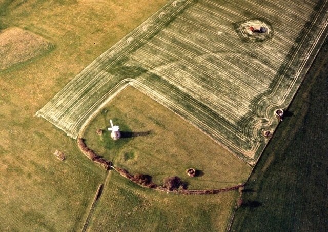
Only 50 to 70 of these enclosures are recorded nationally and due to their rarity, their wide diversity of plan, and their considerable age, they are considered to be nationally important.
The strategic importance of the hill into the 20th century is represented by the remains of World War II defences on the site - although there is some dispute over the exact nature of the function they served.
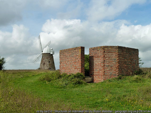
Historic England describe them as searchlight emplacements but others say that they are the remains of HFDF (High Frequency Direction Finding) stations, built to assist pilots flying to and from the nearby RAF stations at Goodwood, Tangmere and Merston. Whatever their true function, the partly ruined emplacements are a powerful reminder of a crucial episode in the defence of the Channel coast. From the top of the hill there is a far-reaching view across the South Coast including Chichester, Portsmouth and Bognor Regis. If visibility is good, see if you can spot any local landmarks including Chichester Cathedral (bearing 232 degrees) and The Trundle Communication Mast (bearing 290 degrees).
The Walk
The site cannot be accessed by bicycle as there are strident prohibition notices, a kissing gate and two stiles. Unfortunately this also means that the site is inaccessible to wheelchairs and pushchairs.
The public footpath initially follows the line of the ancient Roman road of Stane Street (which originally linked London with the Roman town of Noviomagus Reginorum - later renamed Chichester), before turning northwards to the hilltop. If you approach the hill from the southwest, you should be rewarded by a stroll through a pretty tunnel of trees that overhangs the sunken holloway, worn down by centuries of foot traffic and water erosion.
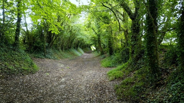
You'll climb about 275 feet, over a distance of about 3/4 mile. The first 0.4 mile is a fairly gentle stroll, before increasing in gradient as you leave Stane Street and climb up Halnaker Hill proper. Brisk and fit walkers will be able to get up in about 20 minutes, the rest of us take a little longer!
The Task
- During your visit, take a photo of either yourself, your GPSr or a sign with your caching name on it, with a view of at least part of the windmill itself in the background. If you use a sign, please make sure it is readable in the picture so check your photo before leaving.
- Within 7 days of logging on-line, attach your photo to your log.
- For those who visit in a group, please do not just refer to another photo of you on a different log, without uploading a photo to your log too. All on-line logs must have a photo as described.
- 7TH JUNE 2021: ADDITIONAL NOTE for clarification. Please only log this virtual cache if you are playing within the spirit of the game. The first three words of the task instructions "During your visit" mean that you must actually visit the site of the windmill itself rather than just view it from a distant footpath.
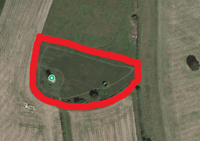
- To prove your visit to this location, your photo must be taken from a place within Halnaker Hilltop boundary fence i.e. from a distance not greater than 400ft. The boundary fence described is NOT the one which circles only the windmill itself, but is the one which circumnavigates the hill-top (including the accessible WWII structure) and which is accessed by the walker or geocacher through the wooden gate at N50 52.722 W0 41.611 (see image below).
Parking
A small lay-by offers space for approximately 8-10 vehicles, beside the A285 at the entrance to Warehead Farm. Follow Mill Lane uphill from here. If there is no space available (and if you don't mind a slightly longer and more challenging walk) another lay-by offers parking for a further half-dozen vehicles, one mile from the mill, by the A285 next to the entrance to Seabeach House. However, the footpath that leads southwest along Stane Street Roman road is much more overgrown, narrow and uneven.
Virtual Rewards 2.0 - 2019/2020
This Virtual Cache is part of a limited release of Virtuals created between June 4, 2019 and June 4, 2020. Only 4,000 cache owners were given the opportunity to hide a Virtual Cache. Learn more about Virtual Rewards 2.0 on the Geocaching Blog.