Le Menez Hom est le sommet le plus occidental des montagnes Noires, qui se prolongent toutefois dans la presqu'île de Crozon jusqu'au-delà de Toul-ar-groas via le Menez Luz situé près de Telgruc, par une longue bande de quartzites dévoniens. Il se situe dans le domaine centre du massif armoricain.
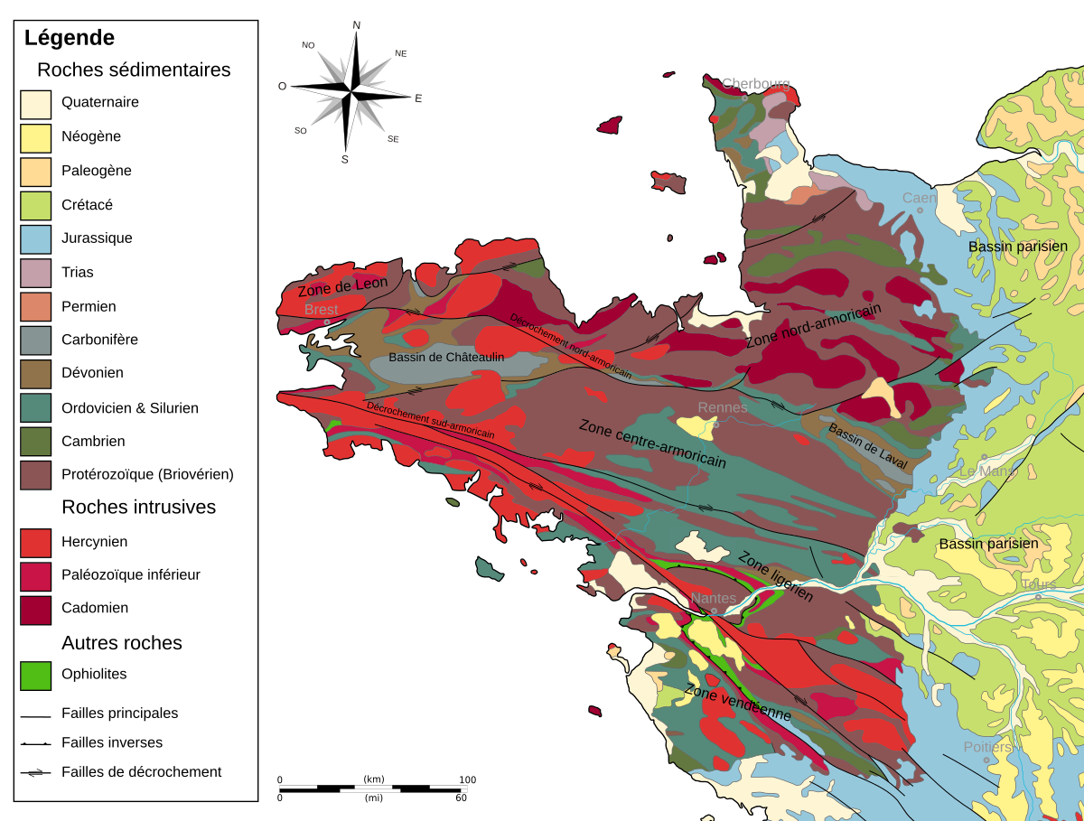
Le Massif Armoricain présente une structuration polyphasée qui s’est faite lors d’épisodes géologiques successifs. Depuis le Protérozoïque supérieur (650 Ma), le Massif Armoricain a été soumis, au moins par deux fois, à des phénomènes tectoniques ayant engendré la formation de chaînes de montagne (orogenèses « cadomienne » et « hercynienne »).
Ce massif est divisé en grands domaines (Les domaines Nord-Centre-Sud Armoricains), séparés les uns des autres par deux zones de cisaillement majeures que sont : le Cisaillement Nord Armoricain (CNA) et le Cisaillement Sud Armoricain (CSA). Dans la partie Nord du Massif Armoricain, peut être isolé un « sous domaine » qu’est le domaine du Léon. Le Finistère se situe dans la partie occidentale du Massif Armoricain.
The Menez Hom is the westernmost summit of the Black Mountains, which however extend into the peninsula of Crozon as far as Toul-ar-groas via Menez Luz near Telgruc, by a long strip of quartzites Devonian. It is located in the center of the Armorican massif
The Armorican Massif presents a polyphase structuring which occurred during successive geological episodes. Since the Upper Proterozoic (650 Ma), the Armorican Massif has been subjected, at least twice, to tectonic phenomena that have led to the formation of mountain chains ("Cadomian" and "Hercynian" orogenes).
This massif is divided into large estates (the North-South-Armorican domains), separated from each other by two major shear zones: North Armorican Shear (CNA) and Southern Armorican Shear (CSA). In the northern part of the Armorican Massif, it is possible to isolate a "sub domain" that is the domain of Leon. The Finistère is located in the western part of the Massif Armoricain.
Bien que la vue - à 360° - au niveau des coordonnées de cette earthcache soit géniale c'est au sous-sol, donc à vos pieds, que je vous demande de prêter attention !
Although the view - 360 ° - at the coordinates of this earthcache is great is in the basement, so at your feet, I ask you to pay attention!
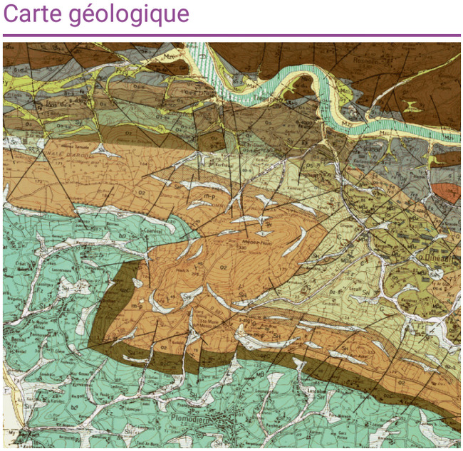
La carte géologique du secteur du Menez Hom (ci-dessus) permet de découvrir les différentes composantes géologiques du secteur. Vous pouvez donc y voir que le Menez Hom est constitué de Grès (une roche sédimentaire), de Quartzite (roche métamorphique) et de Schiste (roche métamorphique). Allons donc observer le sol aux différents waypoints indiqués !
The geological map of the Menez Hom sector (above) reveals the different geological components of the area. You can see that the Hom Menez consists of Sandstone (a sedimentary rock), Quartzite (metamorphic rock) and Schist (metamorphic rock). Let's observe the ground at the different waypoints indicated!
- Question 1 - Au waypoint de la earthcache : N 48° 13.185' W 4° 14.110' - Au sol, autour de l'emplacement de l'ancien tumulus vous allez pouvoir découvrir 2 de ces 3 roches. Pouvez-vous me les citer ?
- Question 2 - Au waypoint 2 : N 48° 13.201' W 4° 14.042' - Vous êtes à proximité de l'observatoire astronomique du Menez Hom, que pouvez-vous découvrir au sol ? Précisez de quel type de roches il s'agit ...
- Question 3 - Au waypoint n°3 : N 48° 13.210' W 4° 14.118' - Vous allez trouver une roche seule et bien visible. Quel est le type de cette roche parmi les 3 cités ci-dessus ?
- Question 1 - To the waypoint of the earthcache: N 48 ° 13.185 'W 4 ° 14.110' - On the ground, around the site of the old tumulus you will be able to discover 2 of these 3 rocks. Can you quote them to me?
- Question 2 - Waypoint 2: N 48 ° 13.201 'W 4 ° 14.042' - You are near the astronomical observatory of Menez Hom, what can you discover on the ground? Specify what kind of rocks it is ...
- Question 3 - To waypoint n ° 3: N 48 ° 13.210 'W 4 ° 14.118' - You will find a rock alone and clearly visible. What is the type of this rock among the 3 mentioned above?
Validez votre découverte / Validate your discovery
Loguez cette cache "Found it" et envoyez-moi vos réponses soit via mon profil, soit via la messagerie geocaching.com (Message Center), et je vous contacterai en cas de problème.
Log in this "Found it" cache and send me your answers either via my profile or via the geocaching.com (Message Center) mail, and I will contact you in case of a problem.
Pour rappel : il n'y a pas de boîte à trouver pour valider une earthcache ! Vous pouvez loguer votre découverte mais devez aussi m'envoyer vos réponses au plus vite.
To remind: there is no box to find to validate an earthcache! You can log your discovery but also send me your answers as soon as possible.