Background
The boulders and rocks you see littering the hill up here have long been believed to be the remnants of a mighty battle between two Saddleworth giants called Alphin and Alder. The giants lived across from each other on the two hills that mark the entrance to the Upper Tame Valley – Alderman's Hill and Alphin Pike. Sadly their friendship dissolved over their rivalry for the love of a beautiful water nymph called Rimon who lived in Chew Brook down in the valley below. Rimon took a fancy to Alphin, and as is the way with giant/water nymph love triangles – a fierce fight ensued that saw the two giants casting enormous boulders at each other across the valley from their respective hillside homes. Alphin lost, (he is buried near Giants Rock on Greenfield Moor), and Rimon, distraught, threw herself to her death from the top of the hill.
The Oven Stones are supposedly the remnants of that battle - but geologists are quick to point out more natural explanations. This EarthCache brings truth rather than legends so you can leave understanding the real reason these rocks look as they do today. This is an observational EarthCache - this means to answer the questions you only need to observe what you see here and use the information included in the listing to form your answers. No other research or previous knowledge is required so please do give this EarthCache a try!
Background to Gritstone
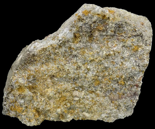
Firstly, we need to understand the basic formation of the rock you see here today. The northern Peak District is bounded on east and west sides by sandstone scarps. They are made of a rock often called "Millstone Grit". This is in fact a catchall for a variety of coarse sandstones, referred to here as "grits". The name "Millstone Grit" came about because certain varieties of Gritstone were commonly used to make millstones. Gritstone is actually a variation of sandstone and is made from sand, grit and rounded pebbles of quartz and some feldspar. The name ‘grit’ is used for many local sandstones and indicates the coarseness of the quartz grains in the rock, although the size of the particles in the sandstone is variable. Most of the sandstones of the Millstone Grit are coarse, with grains larger than 0.5mm and there are white quartz pebbles up to 10mm, especially in the Kinderscout Grit.
Gritstones were laid down in the delta of an immense river which flowed from a mountainous area. The land was below the sea, and every tide, every flood, dumped sand onto the sea floor. Generally the layers were thin and/or disturbed by currents. Occasionally some event would occur which laid down layers many metres thick in a very short time. All this happened around 300 million years ago, long before the dinosaurs. Eventually the grits were buried by muds, coal, and limestones. The layers of sand, under pressure and subject to chemical change, became rock. Eventually what is now England was pushed up out of the sea and erosion began creating all the gritstone formations you see up here today.
Gritstone Edges and Tors
At the most basic level, because grit is strong, it tends to form the highest ground. Gritstone is a sedimentary rock which means it was formed in layers over a period of time and those layers would have been flat/horizontal when they were originally formed due to the force of gravity. Because it is has highly variable layers, it often forms cliffs or edges. The erosion of weak layers undermines stronger material above and the resultant overhang breaks off. A variation on this occurs where shale layers interleave grit or similar sandstones. Shales, though weak, tend to be a barrier to ground water and channel water to spring lines.
Landslips can also occur when blocks of grit slip on the weak and wet grit-shale boundary and therefore the gritstone would slide down the hill. When sedimentary rock is originally formed the layers are flat/horizontal to the ground due to the way the material is deposited (gravity). There are various ways in which sedimentary rock can become tilted at different angles but up here the most likely explanation would be for the rock previously supporting them to have eroded away causing the gritstone to move and slip. Some of the gritstone up here is now surrounded by soft peat so this may also contribute to slippage with the weight of the rocks gradually causing movement, possibly in conjunction with the erosion of the peat . Therefore angled layers here would be good evidence of slippage.
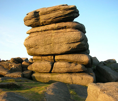
Where gritstones has been eroded in plateau areas, tors develop. The exact origin of tors, is not clear, but seems likely to be due to the rotting of thick layers in a warm wet climate. Occasionally, particularly hard cores remained unaffected. Wind and rain have since removed all the loose, rotted material, and left the tors behind. Wind erosion, probably particularly severe in the intensely cold, dry conditions which prevailed over the Peak District during the last Ice Age, have them picked out weak layers and scoured out the sculptured features we see today,
Questions to Answer (Logging Requirements)
Please visit the listed coordinates. Please look at the entire Oven Stones formation to answer the questions. The questions all relate directly to the information provided in the listing so you should be able to answer everything from GZ with no extra reading required. Please ensure you send in the answers at the time or soon after you log your find, as logs may be deleted if no attempt at the answers are made.
1) Observe the main rocks here. Describe the quality of the gritstone making up the Oven Stones. Can you see any weaker shale layers in this formation? How thick are the layers? Does this rock look strong and resistant to erosion? Have any weaknesses already gone or are they still here?
2) Having read the description above, would you describe the Oven Stones formation here as a Gritstone Tor or are they simply gritstone rocks that have been exposed like many other formations up here?
3) Now look the angles of all the rock you can see in the immediate area. Are they still flat/horizontal layers as they would have been when they were formed or are some at different angles? What would you estimate the angle to be?
4) Looking at the position of the rock, do you think slippage has occurred here or do you think it is some other geological event that is responsible?
5) Do you think the rocks will stay in the position they are in now? What might have happened in another thousand (or so) years?
Please note. Non spoiler photos are always welcomed. At the time of publication if you are in an area where there is no signal and you write your answers into the message center it will not queue the message to be sent later as it does with logs - instead it will be deleted immediately by the app if it fails to send. Please be aware of this as I need to receive your answers. If you don't get a pop up saying 'message sent' then it hasn't!
Thank you for visiting the Oven Stones EarthCache