Another event in an unusual or difficult-to-access location, previous ones being on Mickle Fell and Hestan Island.
The Place: Cramond Island, Edinburgh
The Date: 7 April 2019
The time: 10.30 – 11.00
Because access to the island requires a walk of around ¾ mile on a causeway which is above water for roughly 2 hours either side of low tide (which is expected to be at 10.18 on that date), it will not be possible to set off for the island before about 08.15 and it is essential to leave the island by 12 noon at the latest.
There is a notice board near the start of the causeway which provides up-to-date and more precise information about safe crossing times. You are responsible for your own safety when crossing to the island and you should follow the advice on the board.
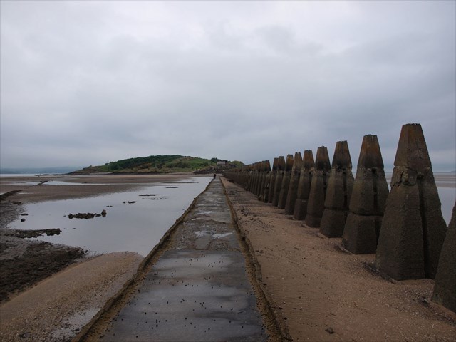
Cramond Island is situated in the Firth of Forth just NW of Edinburgh. The island measures roughly 1/3 mile long and slightly less in width. It contains a ruined farm building and a variety of wartime defence structures. There are magnificent views over the Forth estuary including towards the old Forth railway bridge. An unusual feature is the line of pylons running alongside the causeway, reputed to be defences against enemy vessels getting through at high tide.
There’s a handful of caches on and around the island and the event will take place at the high point of the island (at the dizzy height of some 68ft). All are welcome for the usual geochat and TB exchanges. I will supply the baking, bring your own beverage.