To celebrate the landing on Mars of NASAs Perseverece rover, Geocaching HQ & GSA encourage the geocaching and geoscience communities to develop and visit EarthCaches that highlight planetary geology and Mars analogs found here on Earth.

INTRODUCTioN
Dún Chaoin , or Dunquin which means "Caon's stronghold" in Irish is a Gaeltacht village at the western end of the Dingle peninsula in Co Kerry. The pier down in the little sheltered harbour served as the point where Currachs landed while serving the people on Blasket for centuries while the island was inhabited. Today it is still used for fishing and tourism.
This Earthcache will introduce you to some fine examples of fossilised mud cracks in order for you to answer a few questions. I'm sure you are all familiar with dried out puddles and their little mud cracks.
LOCAL GEOLoGY
As you look down at the pier the rocks on your left or southern side of the harbour are from the Lower Devonian period. These rocks are made up of steeply uplifted colourful layers of fine sandstones, Siltstones and Mudstones. They vary from purples through to greens
During the Devonian Period, which lasted from 415 - 359 million years ago, What is now Ireland was situated on the southeastern margin of a large ‘Old Red Sandstone’ landmass that had formed from the final closure of the Iapetus Ocean during the Silurian period. This landmass on the Laurussian Plate covered most of what is now northern Europe and North America.
From the mid-Devonian onwards, Ireland, as part of this landmass, was gradually moving from its position 35° south of the equator steadily northwards. The climate was semi-arid, with seasonal rainfall, Ireland being on the windward side of the continent, similar to the position of Zimbabwe today. Erosion of the Caledonian Mountains in the northwest supplied sediment via large rivers to the extensive deserts of the alluvial plains where it was deposited. In this example, a fine layer of muddy sediment was laid down which then dried out with the resulting cracks and subsequently a layer of coarser sand was deposited on top of it. Over time it all turned to rock. Eventually, the layer of sandstone was eroded away leaving only the material you can see today between the cracks
NOT SO LOCAL GEoLOGY
The following image I got permission to use courtesy of The Geological Society of America. It is a picture of a slab of rock called "Old Soaker" and was discovered on Mars after images from the Curiosity rover helped prove that there was a lot of water there in the past.
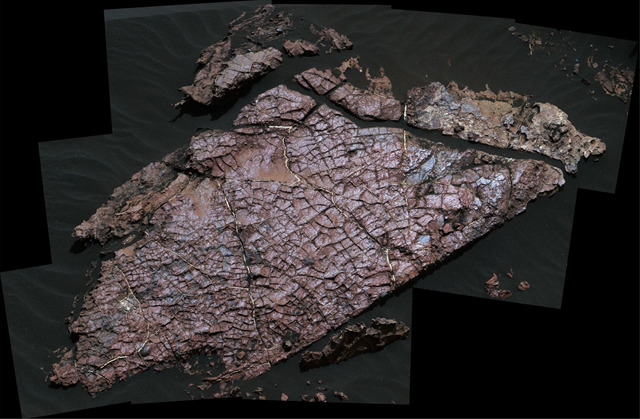
'OLD SOAKER'
‘Old Soaker’ is the name given to a coffee table sized slab of rock in the Gale Crater on Mars by scientists and geologists studying images and information sent back by the Curiosity rover in 2017.
They believe that 3.5 billion years ago the crater contained lakes and concluded that the polygon like features on the surface of the slab were indeed mud cracks, desiccation cracks infilled with sediment and were identical in appearance to desiccation features here on Earth. These can only be formed when wet sediment is exposed to the air suggesting that the lake levels rose and fell. Lead author Nathaniel Stein, a geologist at the California Institute of Technology in Pasadena explained that the mud cracks show that the lakes in Gale Crater had undergone similar cycles that can be seen on Earth.
Gale crater was chosen as the landing site because the main scientific goals of the mission were to study the climate and geology of Mars, to see whether Mars could have ever supported life and what role water might have had there in the past.
DESICCATION CRACKS
Desiccation (from Latin de- "thoroughly" + siccare "to dry"). Desiccation or Mud cracks form when a shallow body of water, into which muddy sediments have been deposited, dries up and cracks.
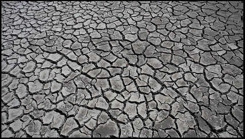
These cracks only form in clay rich sediments. Moisture loss due to evaporation by solar heating causes mud to contract creating stress fractures, these get wider and longer eventually joining up to form irregular polygon shaped sections. Each crack has a V-shaped cross-section being wide at the surface and a narrowing to a point, which makes them great indicators of which way was up. The cracks are wider at the top because evaporation is greatest at the surface which receives the most heat. These cracks are only preserved if they are infilled by another sediment of a different colour in this case fine to medium grained sand.
FOSSILISATION
Fossils are very useful in helping geologists to date rocks or how they were formed. Be they the fossilised remains of creatures, the traces they left behind or fossilised traces of other occurrences such as the event being examined here.
Fossils are extremely important for understanding sedimentary rocks, they tell us a great deal about the depositional environment of the sediments and the climate at the time. They can help geologists to differentiate between marine, aquatic, and terrestrial environments, detect the existence of currents, estimate water depths, and get an accurate idea of average temperature and rainfall levels.
Important
You will need a measuring tape and possibly a protractor.
Obviously care should be taken making your way down to the pier and you do so at your own risk and I would advise against it during a storm.
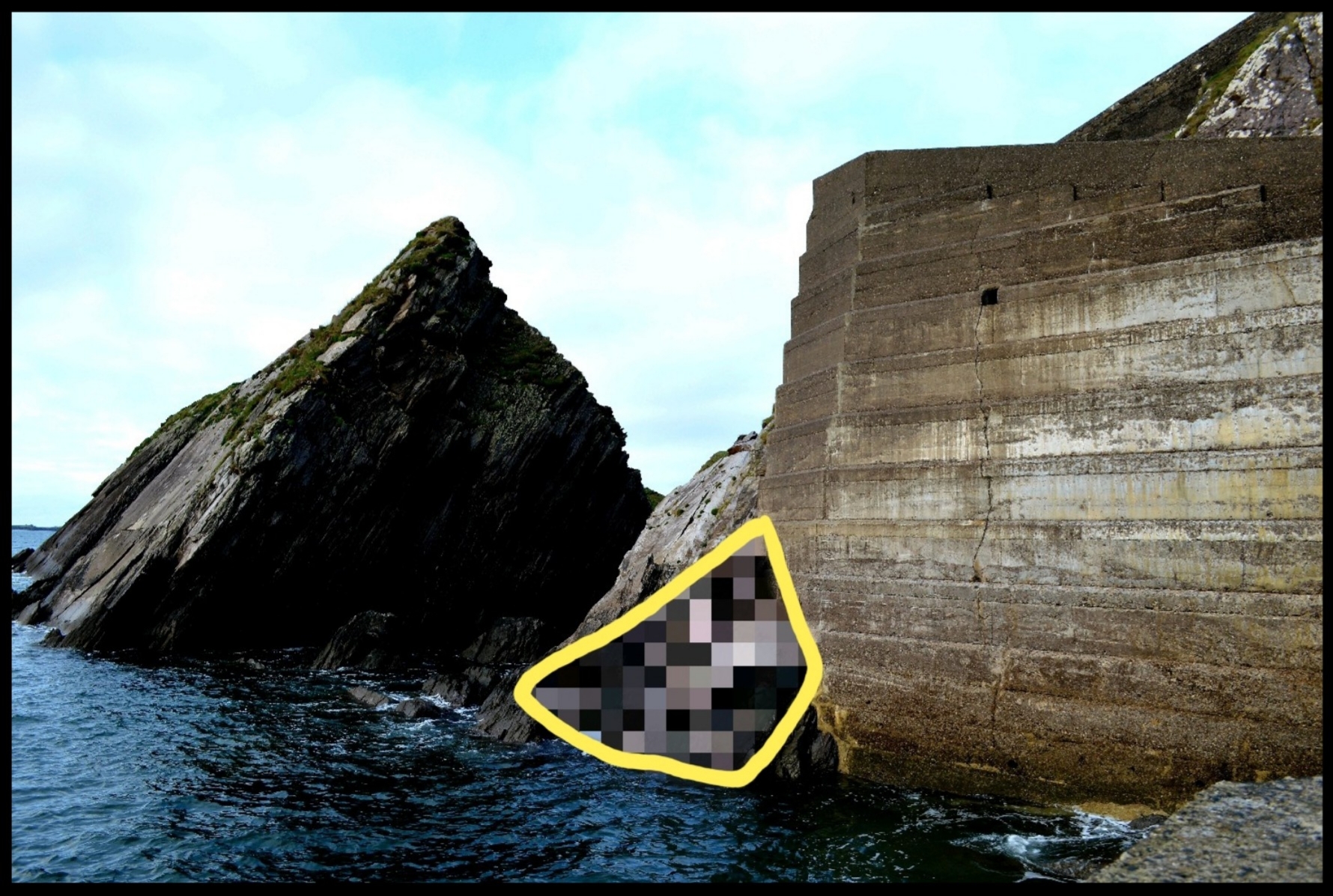
From the parking area walk all the way down the zizagging path to the bottom where you find yourself on the pier and can see where this next picture was taken and be able to clearly see the pixilated Mudstone bedding plane shown Q1. The info for Q2 is also down here. On the way down or back up you will pass the location for Q3
 Subject of Earthcache, What you need to locate
5 QUESTIONS.
Q1. Looking at the mudstone bedding plane in question can you tell me what colour the rock is and also is the material filling the cracks darker or lighter than the host rock?
Q2. What year did Tomas Keane's name first appear here? Check the small print.
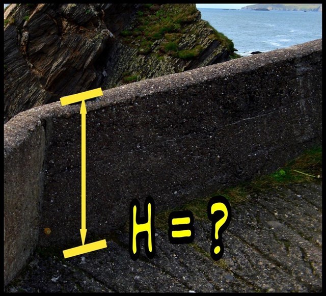
Q3. How high is the wall here where you are standing? Hint <1m?
Q4. As mentioned above these sedimentary bedding planes have been uplifted, Roughly what angle they are tilted at today?
Q5. How did the Devonian period get its name?
Please send the answers using the message center and not by email because I may miss them there. Also pictures are welcome but not of the desiccation cracks or the graffiti on the pier(Q2)so as not to give the answers away.
Special thanks to The Geological Society of America for allowing me to use the image from the Mars Curiosity rover.
I'd also like to thank Geological Survey Ireland for the use of some site specific information from online and elsewhere

| I have earned GSA's highest level: |
 |