Bagnoles-de-l'Orne - Les Pierres plates

Français
Le site
Au point de coordonnées Sur la droite en montant l’avenue des pierres plates, se trouve une curieuse pierre blanchâtre. Cette plaque de Grès armoricain, a été récemment dégagée sur une longueur d’une dizaine de mètres. Sa surface est présente un pendage de 25° vers le Nord-Est. Elle est inclinée vers la chaussée de l’avenue et attire ici notre attention.
Sur cette plaque de grès armoricain sont visibles des empreintes fossiles. Près d’un panneau d’information, des traces ressemblant à des « pas de bœufs » se dessinent nettement à la surface ainsi que des de traces comme taillées au burin, ce sont des marques fossiles de terriers de Lingules . Plus haut, des marques circulaires sont nommées « seau du diable » elles se remarquent aussi facilement.
Un retour de 470 milions d’années
Datant de la formation du Grès armoricain - Arénigien (Ordovicien inférieur) voici environ 470 000 000 d’années. ces traces constituent un véritable patrimoine géologique.
Ces traces ont été laissées sur les fonds sableux par les animaux lors de leurs déplacements ou pendant leurs périodes de repos sur les fonds marins. Ces sables se sont ensuite cimentés pour former le grès.
Le site des Pierres Plates est un affleurement particulièrement remarquable du Grès armoricain caractérisé par la présence de pistes bilobées et de terriers de Lingules; l’ensemble de traces fossiles montrent ici d’un approfondissement du milieu de sédimentation.
Le site est protégé dans le cadre du Parc naturel régional Normandie-Maine.
Près du point de coordonnées N 48°33.555 W 00°25.393 Un panneau explicatif a été mis en place par la municipalité de Bagnoles-de-l’Orne. Ce panneau d’information évoque la présence de lingules (brachiopodes) et de trilobites (arthropodes) sur le fond marin où s’est déposé le sable qui s’est ensuite transformé en grès.
«pas de bœuf »
Des traces remarquables, dont une succession de «pas de bœuf», se situent juste à proximité du panneau.

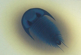
Nommées «pas de bœuf » dans le langage populaire, ces traces bilobées, courtes et concaves, appartiennent à l’ichnogenre Rusophycus. L’animal responsable de ces traces, probablement un trilobite, s’est enfoncé dans le sable soit pour se reposer, soit pour se nourrir.
Terriers de lingules
Ces terriers ont été creusés par des Lingules, brachiopodes inarticulés, fouisseurs, à coquille chitineuse allongée et à long pédoncule enfoncé dans le sable. Les terriers présentent une ouverture de forme lancéolée caractéristique.


A proximité on peut aussi observer des empreintes circulaires, non identifiée. Elles sont nommées communément «sceau du diable» ! , légende locale qui alimente la création de ces traces, avec leurs 470 millions d’années.

Pour enregistrer votre Earth-cache, observer le site et trouvez les réponses aux questions
- Sur la roche, identifiez les traces de trilobites, Expliquez comment ces traces se sont formées et indiquez comment elles sont disposées sur la pente de la roche, combien en comptez-vous?
- identifiez les traces de terriers de Lingules. Quelle forme ont ces marques expliquez cette forme. Combien en estimez-vous présentes sur ce rocher à 20% près
- identifiez les traces de « sceau du diable » Quelle forme ont ces marques? Combien en identifiez-vous ?
- indiquez l’ordre où vous trouvez ces trois types de traces de votre gauche à votre droite
- Merci de bien vouloir joindre une ou plusieurs photos montrant votre passage sur le site.
Loguez cette cache par un "Found it" et envoyez-moi vos propositions de réponses soit via mon profil, soit via la messagerie. Je vous confirmerez alors par retour, la validation de votre « found-it » ", si problème je vous contacterai.
Rappel concernant les « Earthcaches »: Il n'y a pas de conteneur à rechercher ni de logbook à compléter. Il suffit de se rendre sur les lieux, de répondre aux questions ci-dessus et de nous renvoyer les réponses
English
The site
At the point of coordinates On the right up l’avenue des pierres plates, is a curious whitish stone. This plate of Armorican sandstone, was recently released over a length of ten meters. Its surface is 25 ° dipping to the northeast. It is inclined towards the pavement of the avenue and attracts our attention here.
On this plate of Armorican sandstone are visible fossil footprints. Near an information panel, traces resembling "Footprints of beef”, are clearly visible on the surface as well as traces as cut with the burin, they are fossil marks of burrows of Lingules. Higher up, circular marks are called "devil's bucket" they are also noticeable.
A return of 470 million years
Dating from the formation of the Armorican Sandstone - Arenigian (Lower Ordovician) about 470 million years ago. these marks constitute a true geological heritage.
These marks were left on the sandy bottom by the animals during their movements or during their rest periods on the seabed. These sands then cemented to form sandstone.
The site of the “Pierres Plates” is a particularly remarkable outcrop of Armorican sandstone characterized by the presence of bilobed tracks and burrows of Lingules; the set of fossil marks here show a deepening of the sedimentation environment.
The site is protected as part of the “Parc naturel régional Normandie-Maine”.
Near the point of coordinates N 48 ° 33.555 W 00 ° 25.393 An explanatory panel has been set up by the municipality of Bagnoles-de-l'Orne. This information panel evokes the presence of lingules (brachiopods) and trilobites (arthropods) on the seabed where the sand was deposited, which was then transformed into sandstone.
" Footprints of beef "
Remarkable marks, including a succession of " Footprints of beef ", are just near the panel.
Named " Footprints of beef " in popular language, these bilobed, short and concave traces belong to the ichnogenous Rusophycus. The animal responsible for these tracks, probably a trilobite, has sunk into the sand either to rest or to feed.
burrows of Lingula
These burrows were dug by Lingules, inarticulate brachiopods, burrows, with an elongated chitinous shell and a long peduncle embedded in the sand. The burrows have a characteristic lanceolate opening.
Nearby you can also see circular footprints, unidentified. They are commonly called "seal of the devil"! , local legend that feeds the creation of these traces, with their 470 million years.
To log your Earth-cache, look at the site and find the answers to the questions
1) On the rock, identify the traces of trilobites, Explain how these marks were formed and indicate how they are arranged on the slope of the rock, how much do you count?
2) identify the marks of burrows of Lingules. What form do these brands have? How much do you estimate on this rock at 20%?
3) Identify the marks of "seal of the devil" What shape do these marks have? How many do you identify?
4) indicate the order where you find these three types of marks from your left to your right
5) Thanks to join one or more photos showing your presence on the site .
Log this cache by a "Found it" and send me your proposed answers either through my profile or via email. I will then confirm by return, the validation of your "found-it", if problem I will contact you.
Earthcache reminder: There is no container to search for or a logbook to complete. Just go to the site, answer the questions above and send us the answers