Cette zone des falaises est une aire de nidification du faucon pèlerin, elle est donc protégée.
NE VOUS APPROCHEZ PAS TROP DE LA FALAISE
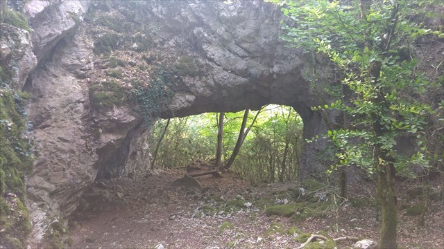
Découvert lors d’une randonnée, un peu en dehors des sentiers battus et sans aucune signalisation, se trouve sur la crête qui domine le Doubs une magnifique arche : la Roche trouée de Martelin.
Mais comment c’est elle formée ?
En géomorphologie, l’érosion est le processus de dégradation et de transformation du relief, et donc des roches, qui est causé par tout agent externe (donc autre que la tectonique).
Les facteurs d'érosion sont :
- le climat ;
- le relief ;
- la physique (dureté) et la chimie (solubilité par ex.) de la roche ;
- l'absence ou non de couverture végétale et la nature des végétaux ;
- l’histoire tectonique (fracturation par exemple) ;
- l'action de l'homme (pratiques agricoles, urbanisation).
L'érosion agit à différents rythmes et peut, sur plusieurs dizaines de millions d'années, araser des montagnes, creuser des vallées, faire reculer des falaises.
L'érosion liée à la température fait également intervenir l'eau comme agent d'érosion en présence de roches poreuses et/ou de fissures qui éclatent en cas de gel.
La cryoclastie est un exemple d'érosion par thermoclastie : la roche éclate à cause de l'alternance gel-dégel de l'eau qui s’infiltre, lorsque l'eau gèle, elle occupe plus de volume et exerce une force capable de faire exploser une roche.
En passant de la phase liquide à la phase solide, le volume de l’eau augmente d’environ 9 %. La glace contenue dans le réseau poreux des roches peut donc exercer des pressions disruptives importantes au sein de la masse rocheuse (de l’ordre de 15 daN/cm²)
La cryoclastie conduit à la fragmentation de la roche en débris anguleux, souvent de forme lamellaire, mais variable selon la texture de la roche (clivages cristallographiques, plans de schistosité, foliations, microfissures). Les morceaux libérés par le gel sont appelés gélifracts.

Rappel : Sur une Earthcache, il n'y a pas de boites à trouver
Pour valider votre visite sur le site,
Loguez cette cache "Found it" et envoyez-moi les propositions de réponses
en precisant le nom de l'Earthcache
via mon profil soit via la messagerie geoocaching.com
et je vous contacterai en cas de probleme
LES LOGS ENREGISTRES SANS REPONSES SERONT SUPPRIMES

Une photo de vous sur le site est optionnelle mais sympathique
Q1 : la cryoclastie est elle une forme d érosion ?, si oui citez 2 autres d érosion.
Q2 : En passant de la phase liquide à la phase solide, de quel % augmente le volume d eau ? Quelle pression la glace exerce t elle ?
Q3 : Au sol se trouve des débris de roche, comment les nomment t on ? Et d ou viennent ils ?
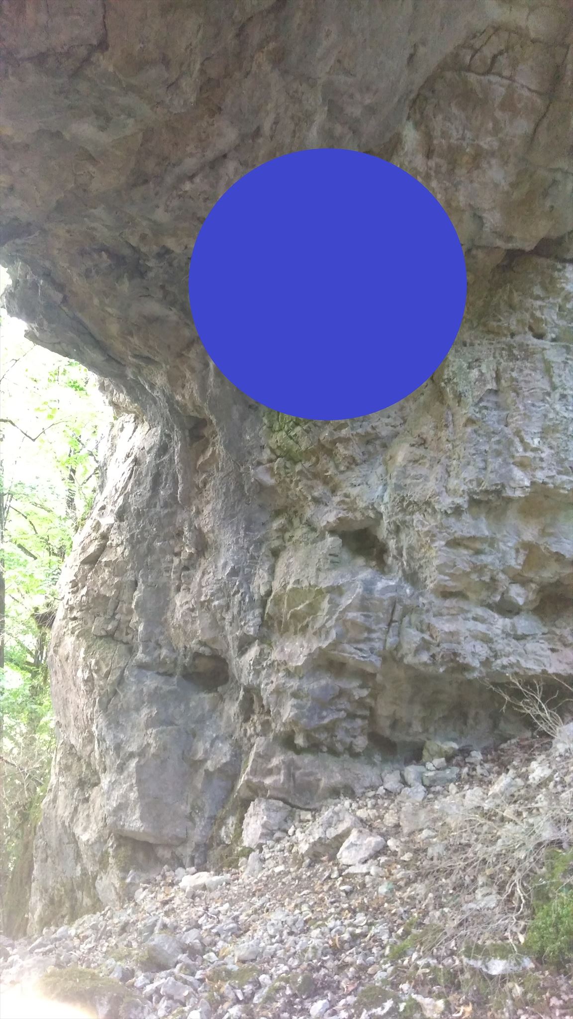
Q4 : En haut a à droite de l arche que voyez vous (sous le rond bleu de la photo) ?

This area of the cliffs is a nesting area of the peregrine falcon, so it is protected.
Discovered during a hike, a little off the beaten track and without any signage, is located on the ridge overlooking the Doubs a magnificent arch: the rock hole of Martelin.
But how is it formed?
In geomorphology, erosion is the process of degradation and transformation of the relief, and therefore of the rocks, which is caused by any external agent (hence other than tectonics).
Erosion factors are:
- the climate ;
- the relief;
- physics (hardness) and chemistry (eg solubility) of the rock;
- the absence or absence of vegetation cover and the nature of the plants;
- the tectonic history (fracturing for example); the action of man (agricultural practices, urbanization).
Erosion acts at different rates and can, over several tens of millions of years, erase mountains, dig valleys, push back cliffs.
Temperature-related erosion also involves water as an erosion agent in the presence of porous rocks and / or cracks that burst in the event of frost.
Cryoclasty is an example of thermoclastic erosion: the rock breaks out because of the alternating freeze-thaw of the water which infiltrates, when the water freezes, it occupies more volume and exerts a force able to make explode a rock.
By moving from the liquid phase to the solid phase, the volume of water increases by about 9%. The ice contained in the porous network of the rocks can therefore exert significant disruptive pressures within the rock mass (of the order of 15 daN / cm²)
Cryoclasty leads to the fragmentation of the rock into angular debris, often of lamellar form, but variable according to the texture of the rock (crystallographic cleavages, schistosity planes, foliations, microcracks). The pieces released by the gel are called gelifracts.

: On Earthcache, no boxes to find
Log this cache "Found it"
And send me your proposals for answers either via my profile,
Either via the messaging geocaching.com (Message Center),
And I will contact you in case of problem.
THE LOGS SAVED WITHOUT ANSWERS WILL BE DELETED
Q1: Is cryoclasty a form of erosion? If yes, give 2 more erosion.
Q2: When moving from the liquid phase to the solid phase, what% increases the volume of water? What pressure does the ice exert?
Q3: On the ground is rock debris, how do you name it? Where do they come from?
Q4: At the top right of the arch that you see (under the blue circle of the photo)?