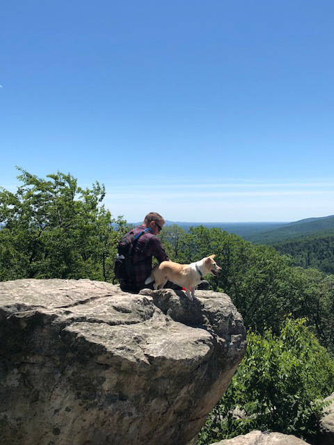
This cache is 2018 MGS Award Winner for Most Scenic Hide of the Year in Western MD!

LestISmiteThee's TB Tattoo Geo-miles:
Traveling the world, one Geocache at a time...
The Journey
You are about to embark on an adventure millions of years in the making!
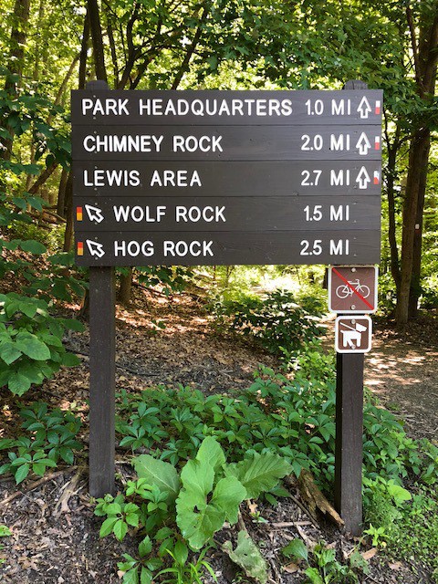
The Catoctin Mountain Geology Tour will take you via waypoints to Chimney Rock, Wolf Rock, Thurmont Vista, Blue Ridge Summit Vista, and Hog Rock. Please note the blaze colors included in each waypoint.
Before you start your expedition, please check NPS.gov and the Visitor Center for the latest updates in Catoctin Mountain Park, including hours, closures, and weather conditions.
Be prepared for a 8.4 mile (13.5 km) round-trip along blazed trails with a few hundred feet of elevation change. This may take around four hours depending on your fitness level.
Whether you plan to complete this EarthCache all at once or during multiple visits, it is highly recommended to print and bring the official NPS Catoctin Mountain Park map.
Due to low cell tower coverage, it is also recommended to save this EarthCache for offline use on your phone or dedicated GPS device.
Please also bring ample water; there is no water available on the trail or at any parking location except the Visitors Center.
Please do not attempt this EarthCache if there is snow and/or ice on the ground. Also note the Thurmont Vista Parking Area and parts of Park Central Road are closed during Winter, but the Thurmont Vista itself along the trail is still open.
The EarthCache
You are standing on rock created 500 million years ago!
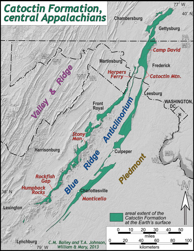
The Catoctin Formation spans the central Appalachians from Pennsylvania to Virginia. It was created from layers of basalt and rhyolite igneous rocks, plus shale, sandstone, graywacke, and congolmerate sedimentary rocks.
If you were standing here when North America collided with Africa around 250 million years ago, you would be as high as the modern Himalayas! The massive amounts of heat and pressure from the collision metamorphosed these rocks.
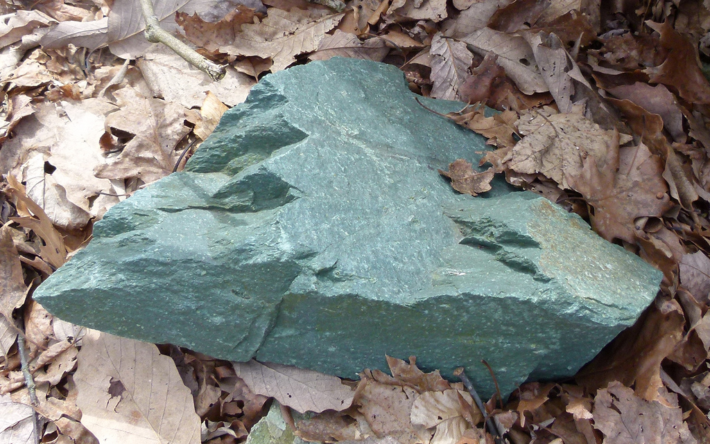
Basalt metamorphosed into metabasalt.
Metabasalt is also known as greenstone due to its blue-green color, which is why the Blue Ridge Mountains were thusly named.
Rhyolite metamorphosed into metarhyolite.
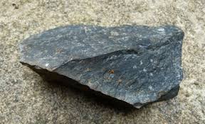
Shale metamorphosed into phyllite.
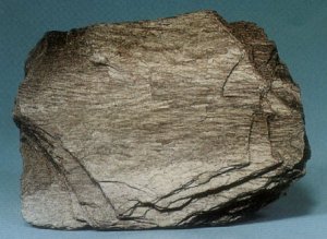
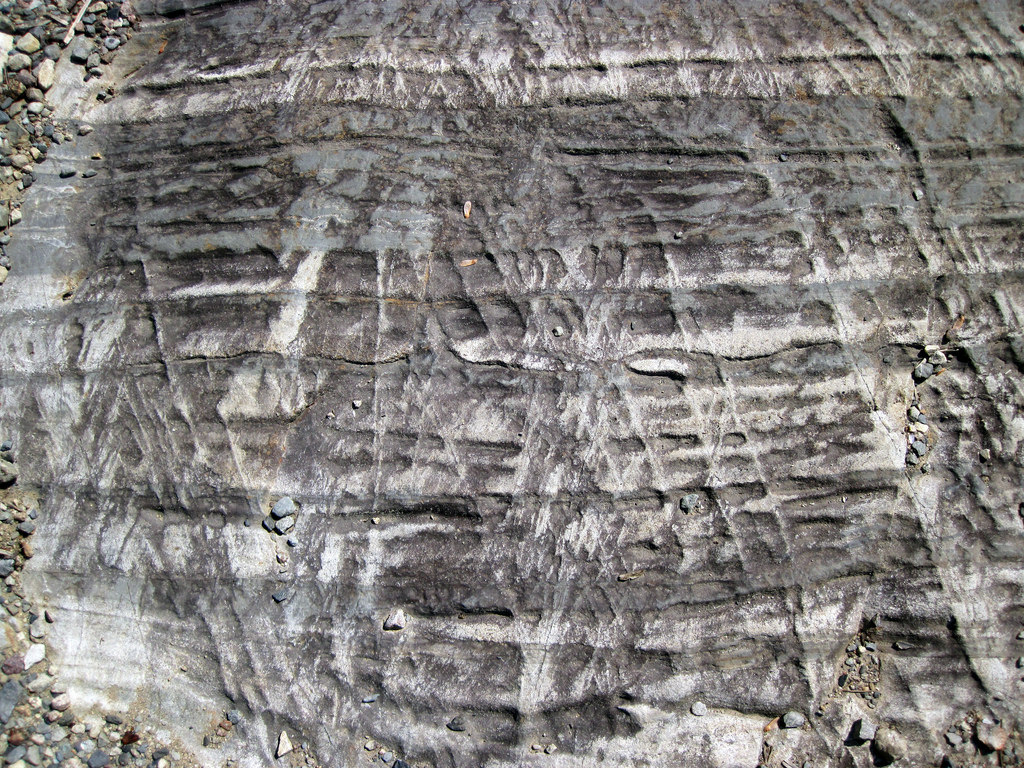
Sandstone metamorphosed into quartzite.
Quartzite is the hardest rock and has eroded more slowly than the surrounding rocks.
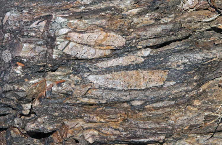
Congolmerate metamorphosed into metaconglomerate.
Graywacke metamorphosed into metagraywacke.
Thanks to millions of years of erosion, you can now see layers of all these rocks around Catoctin Mountain Park!
Arthur Keith noticed these layers exposed on Catoctin Mountain in 1894, thus naming it the Catoctin Formation. The name Catoctin comes from the Native American Algonquian word "Kittockton," possibly meaning “speckled mountain” or “place of many deer.”
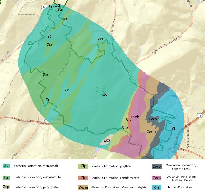
The Loudoun Formation at the Catoctin Mountain Park Visitor Center contains phyllite, metaconglomerate, and metagraywacke.
The Weverton Formation at Chimney Rock, Wolf Rock, and Thurmont Vista, contains quartzite, metaconglomerate, phyllite, and metagraywacke.
The Catoctin Formation at Blue Ridge Summit Overlook, Hog Rock Overlook, and Cunningham Falls contains metabasalt. Hog Rock was named long ago by farmers who would bring their pigs up the mountain to eat their favorite acorns.
There are no physical cache containers at any of the listed coordinates. To officially find this Earthcache, you must send us a message within one week of logging it with the correct answers to the following questions. No guessing required -- all questions can be answered on-site with location observation and info provided in the cache description. Logs containing answers or logs without a corresponding message sent to us within one week will be deleted with or without warning.
Chimney Rock
1) Describe the types of rocks you observed here based on the information above. Are these rocks primarily phyllite, quartzite, metaconglomerate, or metagraywacke? Why do you think it is more prevalent at this location than the other three types of rocks?
2) What specific animal does the sign say to watch out for, and is this animal shown on the sign?
Wolf Rock
1) Describe the types of rocks you observed here based on the information above. Is quartzite visible among the other rocks, and if so, why is it visible?
2) NPS Sign 1 - How long is Wolf Rock in feet?
3) NPS Sign 1 - What material was compressed here and what did it become?
4) Geology Sign 2 - Where did the material in question 3 come from?
5) Geology Sign 2 - Erosion here exposed sediments and ancient ____.
Thurmont Vista
1) Describe the types of rocks you observed here based on the information above. Is there more or less quartize here than at Chimney Rock and Wolf Rock? Are these rocks smaller or larger than the ones at Wolf Rock, and why?
2) What small structure was built here and what two materials is it made of?
3) What blue thing can be seen below from this vista?
Blue Ridge Summit Overlook
1) BRSO Waypoint 1 - Are the rocks to the right after the sign smooth and round, or split and jagged?
2) BRSO Wapoint 2 - Is the rock here exposed or covered in plants?
3) Is there a difference between these two rocks? What type(s) of rock are they based on the information above?
Waypoint 9 - PLEASE DO NOT POST PHOTOS OF THIS LOCATION
1) What number and words are on this sign?
2) Based on the information above, is the thing at this waypoint more like waypoints 2-5 or waypoints 6-7, and why?
Hog Rock
1) Describe the rock you observed here based on the information above, specifically noting its texture. Is this rock primarily phyllite, quartzite, metaconglomerate, or metagraywacke?
2) What number and words are on the sign to the left (not the larger sign on the right)?
Sources:
National Park Service: Catoctin Mountain
The College of William & Mary Blogs
The College of William & Mary Department of Geology
Hiking Updward
Special thanks to Rick Slade, Jennie Pumphrey, and Lindsey Donaldson of the National Park Service of Catoctin Moutain Park for their support on this EarthCache!
Congrats to flyingmoose for FTF!