
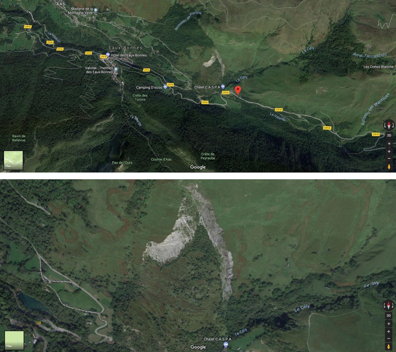
 Au mois d'août 1982, à la station de Gourette, commune des Eaux-Bonnes, des craquements se produisirent dans la montagne, et des blocs de rocher de quelques centaines de kilos dévalèrent la pente et s'arrêtèrent à quelques mètres seulement d'une maison ; la ligne électrique à haute tension alimentant la station fut coupée à la suite de la chute d'un pylône. On se rendit alors rapidement compte qu'il s'agissait d'un important glissement de terrain qui, de toute évidence, menaçait le CD 918 qui permet l'accès à Gourette et au col d'Aubisque.
Fort heureusement, il y avait une possibilité de déviation moyennant quelques aménagements que les autorités locales décidèrent de réaliser rapidement. Dès le début de décembre 1982, c'est-à-dire à l'ouverture de la saison hivernale, cet itinéraire de secours était mis en service. La suite des événements a montré que ces précautions n'avaient pas été inutiles, car le CD 918 était irrémédiablement coupé en mars 1982.
Pour pouvoir logguer cet Earthcache, rendez vous aux coordonnées indiquées pour observer et repondez aux questions suivantes. Loguez cette cache "Found it" et envoyez-nous vos propositions de réponses soit via notre profil, soit via la messagerie geocaching.com (Message Center), et nous vous contacterons en cas de problème
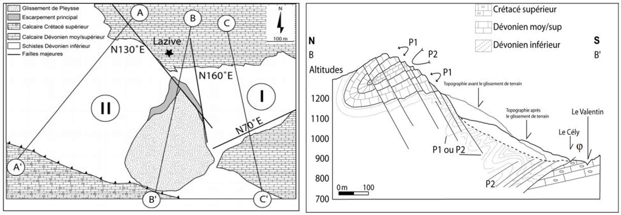
- Quelle est la masse qui a glissé en août 1982: 1, 5 ou 10 millions de m3?
- A quelle vitesse moyenne cette masse a poursuivi son mouvement en 1982: 1, 5 ou 10 m/jour?
- Dans quelle formation géologique s'est produit le glissement?
 In August 1982, at the station of Gourette, common Eaux-Bonnes, cracks occurred in the mountains, and blocks of rock a few hundred pounds down the slope and stopped a few meters from a house ; the high-voltage power line feeding the station was cut off following the fall of a pylon. It was quickly realized that this was a major landslide that obviously threatened in the longer term the CD 918 which allows access to the resort of Gourette and the col d'Aubisque.
Fortunately, there was a possibility of deviation with some adjustments that the local authorities decided to make quickly. From the beginning of December 1982, that is to say at the opening of the winter season, this rescue route was put into service. Subsequent events showed that these precautions were not useless, because the CD 918 was irretrievably cut in March 1982.
To log this Earthcache, go to the coordinates listed and answer the following questions. Log this cache "Found it" and send us your suggestions for answers either via our profile or via the messaging geocaching.com (Message Center), and we will contact you if any issue
- What was the mass that slided in August 1982: 1, 5 or 10 millions m3?
- At what average speed did this mass continue its movement in 1982: 1, 5 or 10 m/day?
- In which geological formation did the landslide occur?
Log this cache "Found it" and send us your suggestions for answers either via our profile or via the messaging geocaching.com (Message Center), and we will contact you in case of problems