This is the third of a series of four multicaches that will each require a visit to some of the small settlements in Ano Meria, the beautiful northern part of Syros that is often overlooked by visitors to the island. Ano Meria, the soul of Syros, rises from the most dramatic and isolated of its beaches up to its highest peaks with breathtaking views of many of the Cycladic islands across the sea. The region is reached by car from the road north out of Ano Syros above Ermoupoli.
To find this cache, you will have to visit Amigdalo (Αμύγδαλο), Ligero (Λυγερό), Chalandriani (Χαλανδριανή), and Platy Vouni (Πλατύ Βουνί) which are close by each other on the road north from Ano Syros.
The given location is not where you'll find the cache, but is a short way along the path up to the small church of Agios Ioannis Fisontas (Άι-Γιάννης ο Φυσώντας / St. John 'who blows') which is built on the base of an Ancient watchtower on the hill of Fisontas above Amigdalo.
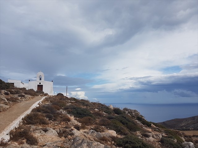
When you reach the church (N37 28.657 E24 55.817), you will be able to enjoy the views across the sea to the East and the West, and also find the following number:
A=The number of steps (including the one at the gate) all the way up to the church door
A little way to the north lies the settlement of Ligero in a green valley below Fisontas (N37 28.927 E24 55.653).
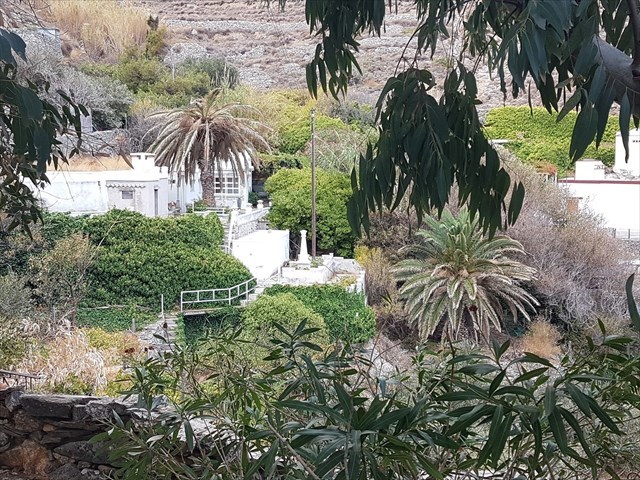
The given coordinates are at the end of the path where you will find a small cave/grotto containing a well.
B=The number of steps down into the cave.
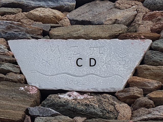
At the end of the 19th Century, the archaeologist Christos Tsountas discovered an ancient cemetery containing more than 600 graves in the village of Chalandriani (N37 29.014 E24 56.000) dating from the Early Cycladic Period (2800-2300 BCE). Inside the graves were a great wealth of artefacts, including a distinct variety of the classical Cycladic figure, many of which can be seen today in the museum in Ermoupoli.

At the given coordinates, you can look to find the two numbers C and D which have been obscured in the following photo
A short distance from Chalandriani lies the agricultural village of Platy Vouni ("wide mountain", N37 28.605 E24 56.302). The given coordinates are the carpark at the top of the village. From here, you can wander eastwards along the main "street".

E=The last digit in the date above the door of the house in the photo above
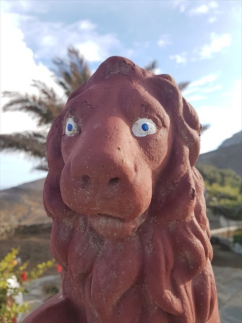
F=The number of these lions guarding their house.
You will find the cache hidden at N37 28.(B-F)(E/C)(D-C) E24 56.(A-B)(E-F)(E/D). The cache you are looking for is yellow and small enough to fit inside a hen's egg.
W (a.k.a. DidianRay)

You can check your location for this multicache on GeoChecker.com.