(This EarthCache is now part of the Cheadle GeoTrail Audio guide. This provides audio commentary on the geology of 4 EarthCache locations in the Cheadle area: 'Millstone Grind' (GC7MEBC), 'Rock of Ages' (GC7DHPN), 'Death in Paradise' (GC7MM93) and 'Memorial Rocks' (GC7NAFQ). This trail can be accessed by downloading the "SITUATE" app to a smart phone from the App Store and searching for 'Cheadle GeoTrail'. (https://situate.io/). This was produced to celebrate GEOweek 2023).
THE GEOLOGICAL BACKGROUND
St Mary’s was built from local Helsby Sandstone, typically sourced from quarries in the Alderley Edge area of the Cheshire basin. From a study of the mineralogy, textures and structures of its building stones a great deal can be learned about the environmental conditions that Cheshire experienced when these rocks were laid down ~250 – 200 million years ago, during a time called the Triassic Period.
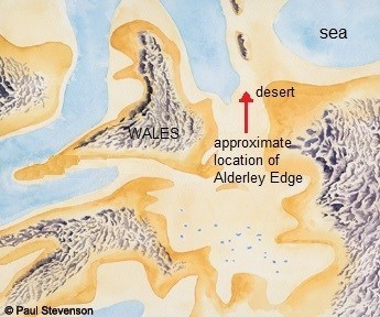
Figure 1
A schematic map of Britain (Figure 1) shows that the area of Cheshire was a semi-desert in the Triassic, similar to the Namibian Desert today, with sand dunes crossed by short-lived streams that quickly dry up in the heat (Figure 2).
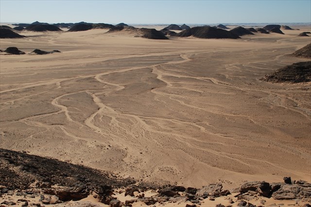
Figure 2
With the high rates of evaporation, salts were deposited on and within the sediment; in particular barium salts which lead to the precipitation of barium sulfate in the form of the mineral barite (or baryte). This forms an effective cement to bind the sand grains together, effectively bullet-proofing the rock from weathering and erosion. The barite typically takes the form of a “desert rose” with the ‘petals’ seen as flattened crystal blades within the rock and occasional showing rosettes (Figure 3).
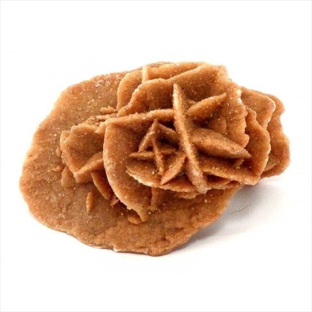
Barite desert rose
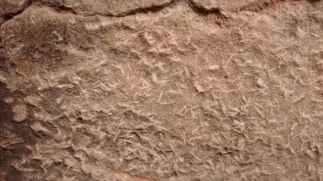
Figure 3
The red colour of the sandstone is another indication of it having been deposited in hot, arid conditions with iron oxides (rust) forming a cement around the quartz sand grains. The sand dunes and the river sediments typically produce cross bedding (see Earthcache: ‘Royal Rocks’ - GC6Z950) indicating the direction of the wind or water current at that point and time. When saturated sediments in the stream channels are subjected to earthquakes they often behave like quicksand as water is shaken from the sediment producing slump (dewatering) structures ( Figure 4).
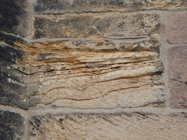
Figure 4
THE GEOLOGY OF ST MARY’S BUILDING STONES
The building stones of St Mary’s are easily accessible from the churchyard (with permission granted by the church authorities), however, due care and respect should be given to the gravestones and flagstones, for what they are and as some can be slippery in wet weather.
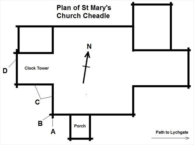
Figure 5
The coordinates (SJ 85625 88608) take you to the wall buttress to the left of the front entrance porch of the church (location A on Figure 5). ). Observation of the buttress near ground level shows two veins of the mineral barite cutting through the sandstone block and, like most of the blocks from which the church is built, the ‘petals’ of barite can also be clearly seen to be randomly orientated within the sandstone.
At location B on the same buttress, one of the sandstone blocks is seen to be in a more weathered state, with the barite less conspicuous in this block compared to most of the others.
On the south-facing wall of the clock/bell tower (location C) the blocks typically show the sandstone to be layered, cross-bedded, and though mainly made of red quartz sand, rounded pebbles are very much in evidence near the benchmark/mason’s mark (a carved arrow with a line above). This is also seen by studying the church walls along the path to the east (right) of the main porch towards the lychgate.
On the west-facing side of the clock/bell tower (location D), to the top left of the door arch near the two security lights, the large block that is cut at an angle and extended into the buttress shows evidence of deformation possibly formed when wet sediment was subjected to an earthquake.
To log this EarthCache please answer the following questions and send by e-mail or through the Message Centre;
- How many clock faces appear around the church bell tower?
- Suggest a geological reason why the red Triassic sandstone with barite was so favoured as a building stone.
- Suggest a typical range of sizes for the pebbles within the sandstone blocks.
- State one piece of evidence that might suggest these Triassic rocks were originally deposited by water rather than wind.
Please feel free to add photos to the gallery.