KING'S HIGHWAY 17 - Virtual Reward Virtual Cache
KING'S HIGHWAY 17 - Virtual Reward
-
Difficulty:
-

-
Terrain:
-

Size:  (virtual)
Please note Use of geocaching.com services is subject to the terms and conditions
in our disclaimer.
KING'S HIGHWAY 17
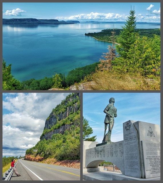
Are you ready for a road trip? In order to log this virtual cache, you must visit the posted coordinates and take a photo of the road below from the bridge. You must also visit at least 20 of the 25 additional waypoints along Ontario Highway 17.
To prove your visit to each waypoint, we ask that you take a photo of yourself OR your GPS OR other personal token or trackable, with the monument, landmark, or scenic view at the coordinates. (Showing your face in the photo is OPTIONAL). Please post one photo per location with your log.
Ontario Highway 17 is almost 2,000km in length, and you will need to cover most of it in order to log a find on this Virtual! However, you will also be treated to some of Ontario's best scenery, and hopefully, a memorable experience.
Congratulations to cavecats on the FTF!
King's Highway 17 is a provincially maintained highway and the primary route of the Trans-Canada Highway through Ontario. It begins at the Manitoba boundary 50 km west of Kenora and the main section ends where Highway 417 begins just west of Arnprior. This makes it Ontario's longest highway. Highway 17 is a very important part of the national highway system in Canada, as it is the sole highway linking the eastern and western regions of the country.
Virtual Reward - 2017/2018
This Virtual Cache is part of a limited release of Virtuals created between August 24, 2017 and August 24, 2018. Only 4,000 cache owners were given the opportunity to hide a Virtual Cache. Learn more about Virtual Rewards on the Geocaching Blog.
Additional Hints
(No hints available.)