
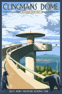
Clingmans Dome is open year-round, but the road leading to it is closed from December 1 through April 1. The peak is accessible after driving Clingman's Dome Road from Newfound Gap, and then walking a steep half-mile trail. A paved trail leads to a 54-foot observation tower. Park in the lot and follow the walkway to the dome. Stay on the paved walkway. BRING BINOCULARS to enhance your views from the top.
National Park Service Policy
"Dogs are allowed in campgrounds, picnic areas, and along roads, but must be kept on a leash at all times. The leash must not exceed 6 feet in length. Dogs are only allowed on two short walking paths—the Gatlinburg Trail and the Oconaluftee River Trail. Pets are not allowed on any other park trails."
EARTHCACHE REQUIREMENTS
Each cacher must send his/her own answers BEFORE logging a find. Enjoy the journey (learning adventure) as well as the destination (smiley earned). Remember to take only pictures and leave only footprints. To get credit for this Earthcache, complete the following tasks:
1. MESSAGE …. OUTCROPS ... Follow the paved path to the posted coordinates. Are you viewing regional deformation -or- quartz embedded within Thunderhead sandstone? Explain your decision.
2. MESSAGE …. CONCRETIONS ... a. Identify the concretion. ... b, Explain how it was formed. ... c. There are several of these concretions within this outcrop. What is their range in size and depth?
3. MESSAGE …. STAINING ... Follow the paved path. Locate (coordinates) and describe a colorful outcrop that indicates various degrees of staining
4. MESSAGE …. AT THE TOP ... a. DIRECTION? What are the main weathering agents that have shaped these mountains so differently? Erosion continues at the rate of an inch every thousand years. ... b. DIRECTION? You will see a passage through the mountains. What is this passage called -and- how does its elevation compare with Clingmans Dome? ... c. EAST! What significant mountain do you see at the Eastern view? What is its significance? ... d. DIRECTION? There is a mountain with the name of the rock described on this cache page. How much lower in elevation is this mountain (name) than the Dome?
LOG …. Post a picture of you or your signature item anywhere along the trail. This picture is your log signature.
OPTIONAL - Please respect the time and effort involved in creating this earthcache by adding A and B to your log.
A. JOURNEY OF THE MIND ... Science explains what we observe. Relate (in your own words) something you found interesting in the reading. This adds to your learning adventure and your log.
B. JOURNEY OF THE HEART ... Art shares our personal experience of what we see. Share something special you found on site, and why it is special to you. This is a memorable addition to your log and will make other hearts smile.
Journeys of Heart and Mind ...
Stories to Touch the Heart and Puzzles to Challenge the Mind / Rainbow Tree Story
THANK YOU Jamie Sanders for permission to share this learning adventure to Tennessee's High Point.
ON THE TRAIL
You will see several outcrops along the way to the top. There are minerals embedded within the rock that characterize Thunderhead Sandstone. Regional deformation is evident within the rocks. In addition, you will view colors that indicate various degrees of staining. Each outcrop gives a window into the rock formations of the Great Smoky Mountains.
REGIONAL DEFORMATION
Stress causes rocks to display various degrees of faulting (breaks) and folding (bends). Here you will view bedding tilted at varying high degrees of dip indicative of regional deformation.
THUNDERHEAD SANDSTONE
-Sandstone is a sedimentary rock formed from sediments cemented together to form rock. Geologic groups are divided into formations based on similarities.
-"The Great Smoky Group is a thick monotonous mass of clastic sedimentary rocks, pebble conglomerate, coarse to fine sandstone, and silty or argillaceous rocks, which can be divided into three intertonguing formations—the relatively fine-grained Elkmont Sandstone below, the coarse-grained Thunderhead Sandstone in the middle, and the dark silty and argillaceous rocks of the Anakeesta Formation above. Both the Elkmont and Thunderhead Sandstones are somber gray and thick bedded and are composed principally of quartz and potassic feldspar grains, with lesser quantities of plagioclase feldspar and here and there a few pebbles of light-colored granite and quartzite. In the Thunderhead Sandstone many of the quartz grains are conspicuously blue tinted."
-Veins of quartz crosscut the rock and embedded quartz pebbles in the conglomerates characterize the Thunderhead.
CONCRETIONS
A concretion is a hard, compact mass of matter formed by the precipitation of mineral cement within the spaces between particles. They are found in clay strata that was originally mud laid down on the sea floor millions of years ago. Concretions vary in size and shape, but most usually spherical.
CALCIUM CARBONATE DISCS - These concretions aka fairy stones consist of small single or multiple discs often with concentric surface grooves. They can appear as shallow bowl-like depressions formed when calcium carbonate minerals in the rock weathered quicker than the non-calcareous parts of the rock. This process is called differential weathering.
CANNONBALL CONCRETIONS - These concretions are large round concretions resembling cannonballs. They were created by early cementation of sand and silt by calcite.
ELONGATE CONCRETIONS - These concretions form parallel to sedimentary strata due to the flow of groundwater.
HIATUS CONCRETIONS - These concretions are characterized by exhumation, exposure and reburial. They are most commonly found during periods in which calcite sea conditions prevailed, such as the Ordovician, Jurassic and Cretaceous. Fossils are often associated with these formations.
KANSAS POP ROCKS - These concretions are typically associated with thin layers of altered volcanic ash. Shape is generally oblate spheroids with variable sizes. Called "pop rocks" because they explode when thrown in a fire or produce sparks and a burning sulfur smell if cut or hammered.
MOQUI MARBLES - These concretions were created by the precipitation of iron dissolved in groundwater. They are varied in both shape and size.
ROSE ROCKS - These concretions are made of crystals that resemble a rose in bloom. The rock’s petal-shaped clusters is due to the intergrowth of crystals. The mineral comprising the rose was precipitated in interconnected voids in the rock.
STAINING
Most sedimentary rocks contain iron in varying degrees. This mineral may appear in patterns or dispersed randomly throughout the parent rock. Pyrite and pyrrhotite, predominantly reddish in color, are quickly decomposed by chemical weathering forming the iron minerals hematite and limonite. These minerals impart stains of red, orange and brown to the rock surface. Iron sulfate minerals also form and impart cream colored to yellowish stains.
RESOURCES
Clingman's Dome booklet available on site -and- http://www.clingmansdome.com/
Great Smoky Mountains National Park - Geologic Resource Evaluation Report - pdf
https://www.nature.nps.gov/geology/inventory/publications/reports/grsm_gre_rpt_view.pdf
https://www.nps.gov/parkhistory/online_books/geology/publications/pp/587/sec1.htm