THE CACHE IS NOT AT THE LISTED COORDINATES
The Cache
This is a small-scale night cache in easy terrain. The overall distance to be walked is about 2.5 km.
Please read the entire cache description - especially the attributes - before starting!
Some night caches consist of an arduous trail over challenging terrain guided by a series of reflectors. This is not that kind of cache: the terrain is level and open, traversed by obvious footpaths, so long lines of reflectors are not required. It's more like a traditional multi-cache, where each stage contains the coordinates for the next stage, but you must use night-caching techniques to find the stages. Every stage is marked by something reflective. This may just be an arrow pointing to a conventional cache, or it may contain information in some other form.
(Some stages also have a small field-puzzle element, which is why the cache is listed as a mystery rather than a multi-cache.)
Some of the stages also contain numbers A-F which you will need to find the nearby bonus cache GC761CY Destinations: Night Flight (Bonus).
As one of the waypoints appeared to be a target for muggles, unfortunately I have had to modify the route and it is no longer as well laid out as it used to be, so you may find yourself backtracking. If it's any consolation, the route is now shorter, but includes all the same features as before.
Requirements
You will need:
- a bright light (preferably with a narrow beam). A head torch is good (but try not to dazzle your companions); if you use any other kind, hold it close to your eyes to get maximum reflection from the directional reflectors.
- Binoculars or telescope (maybe, if your distance vision is imperfect.)
- An ultraviolet light source.
- Two simple ways to encode numbers, beginning with B.
You are unlikely to need survival rations or a heliograph.
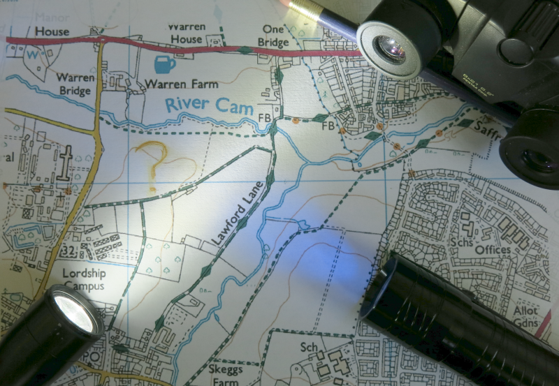
The Area
The cache trail lies within the area defined (approximately) by the waypoints NW, NE, SE, SS, SW. There is nothing at these points and they do not need to be visited. This area contains Fox Burrows Lane (part road, part public bridleway) and the bridleway which runs south from it towards Writtle, together with the large field to the north of Fox Burrows Lane. A public footpath runs along the north side of the field next to the river Can, and there is a permissive footpath (not shown on OS maps) in the wood down the field's western border. Apart from the final, all the stages are on (or very near) a bridleway or footpath.
Please navigate considerately within this area - in particular, if your next objective is on the other side of a field, don't trample across the middle but walk round on the footpath.
Health and Safety
You take part in this caching adventure at your own risk!
All of the route except for the last few metres is on level bridleways or footpaths, and in daylight none of the terrain would be rated higher than T2, or maybe 2.5 at the final. Nevertheless the same route at night may be more challenging so I have given it an overall rating of T3.
There are a number of hazards to be aware of, particularly if you have children with you:
- There is a busy road to the west of the cache area. You do not need to set foot on it.
- There is a river to the north of the cache area. In some places it is very close to the footpath. You do not need to set foot in it.
- There is a public-footpath signpost down a steep slope from the northern footpath and almost in the river, placed by someone with a misplaced sense of humour. It appears to show the path crossing the river. Do not go down the slope here or follow the sign! It is not part of this cache, but is marked as waypoint XX to help you avoid it.
- There may be cyclists on the bridleways at any time.
- You may also may encounter nettles, thistles, brambles etc. in season.
What to do
Stage 1 is at N 51 44.xxx E 000 25.yyy. To find xxx and yyy, at the listed starting coordinates (the trail head, waypoint 00) look around for two rows of reflectors. Decode them to get the three-digit decimal numbers xxx and yyy.
Subsequent stages each contain (in some form) the coordinates of the next stage. If there are only partial coordinates, assume N 51 E 000. Stages 1 and 3 are traditional micros; stages 2 and 4 are a little different, as you will see...
Stage 2 is (as you'll see) vulnerable to damage, either malicious or accidental. If you can't make sense of what you see, there is a backup in a black bison hanging behind the nearest black object, which contains the same information. If you need the backup, look out for barbed wire.
Happy caching!
Geocheckers:
Stage 1: 
Stage 2: 
Stage 3:
Stage 4: 
Final: 