Geological Time
The Earth formed approximately 4.6 billion years ago. Geologists have created a time scale which divides this time into intervals which represent distinct phases in the history of our planet. Below you can see a timescale with Eras on the top which are further divided into Periods on the bottom. The numbers represent the age in millions of years. This Earthcache series will take you on a journey through the Ordovician, Devonian, Carboniferous and Quaternary periods.

The time spans we are talking about can be daunting and difficult to visualise so I have represented them with their colour on a 24 hour clock. In other words all of Earth history is scaled down to one day. Below you can see that specific events can be given a time on this clock to help us better picture when they occurred. For example the oldest fossils date from 5:20 and humans only appeared at 23:59:56 which means we have only been on Earth for 4 seconds out of a full day. It is worth noting that the most change has occurred late in Earth history. As I introduce each Earthcache I will give the time range to which it corresponds on the 24 hour clock.

EarthCache #3
I recommend completing EarthCache #1 and 2 in this series before this one.
The Carboniferous Period lasted from 354 to 300 million years ago. This is equivalent to 22:07 – 22:26 on the 24 hour clock. During this time Scotland lay near the equator and had a hot climate. Sea level rose and fell many times.
At this location you will find sandstone that was formed from sands on the deltas. In the cliff face you can see how the sandstone is layered. The features that we want to look at however are on the fallen blocks at the bottom of the Quarry.
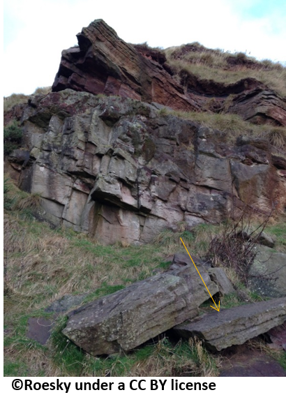
Two types of sedimentary structures can be seen on the surface of some of these sandstone slabs (yellow arrow in picture). Below I describe some common sedimentary structures. Your task is to figure out which two are visible on the surfaces of these slabs.
Ripple marks: Repeating wavelike pattern formed from a current or waves moving over sand.
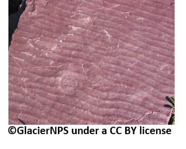
Bioturbation: Reworking of sand by biological organisms. Includes burrowing.
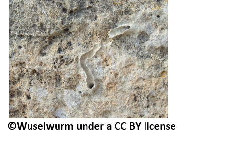
Desiccation cracks: Formed when sediment dries. Analogous to mud cracks.
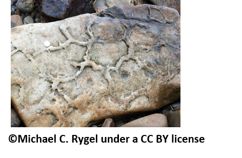
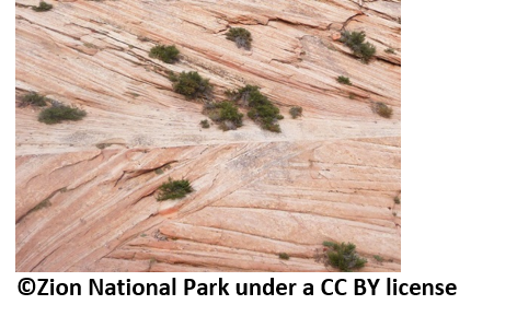
Cross bedding: The angle at which the beds are deposited changes resulting in non-parallel linear features.
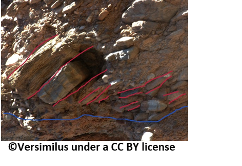
Imbrication: Clasts overlap each other in a specific direction which indicated flow direction.
You can send me the answers via the message center or by email on my profile page. Please do so before completing the log and do not include the answers in the log. Once you have drawn the sketch you can either scan or photograph it and send it along with the answers.
Series Task (Optional)
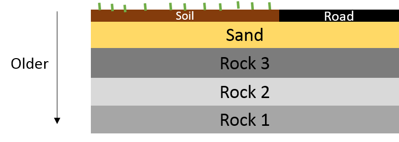
The series task is to construct a rock relation diagram. This is a sketch which shows the change in rock type over time. These are important to Geologists as they show the evolution of an area. In the example below you can see a road which is man made and soil at the top. Under this are sands followed by rock types 1-3. The oldest rocks are at the bottom and the youngest at the top. For this task you need to use this template to draw a sketch of the rock types and features encountered in this Earthcaching series. The most important aspect is to correctly represent the order of the rocks seen. Make sure to label your sketch with the Periods, the corresponding ages and the rock names.
Permission obtained from the Ranger Service.
My thanks to Lothian Borders GeoConservation Group for feedback.