
The Maryland Geocaching Society welcomes you to the 2017 edition of Cache Across Maryland! This is one of eleven geocaches placed throughout the ‘Old Line State’ in locations specifically chosen to showcase its diverse beauty. From the mountains of Western Maryland to the wetlands of the Eastern Shore, CAM 2017 will demonstrate that Maryland truly is ‘America in Miniature’.
Each Cache Across Maryland 2017 geocache contains a code which you will use to determine the location of the CAM 2017 Picnic to be held on May 6th. The code can be found on the inside of the cache container and on the inside front cover of the logbook. Don't forget to record this code! Any geocacher who has completed TEN of the eleven CAM 2017 geocaches and attends the CAM Picnic on May 6th will receive a Certificate of Completion and a CAM 2017 Geocoin. We hope you enjoy a very special CAM 2017!
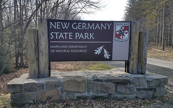
New Germany State Park
New Germany State Park is a public recreation area covering 483 acres nestled between the 2,900 ft. Big Savage Mountain to the east and the eastern Continental Divide along Meadow Mountain to the west. Named by early settlers due to its resemblance to their homeland, New Germany has diverse forests with ten miles of multi-use trails and a small lake suitable for fishing, swimming, and non-motorized boating.
New Germany has ten miles of multi-use trails. The trails wind their way through dense hemlock forest, colorful mixed hardwoods, rhododendron-choked stream valleys and towering pine and spruce plantation sites. Most trails are wide enough for two-way traffic, although several offer a narrower path typical of most hiking trails. Hiking, trail-running and biking are the most popular activities throughout the year. Whether walking along the lake or wetland, or hiking our scenic trails, visitors are sure to have an opportunity to view birds and wildlife. Abundant bird species can be found throughout the area, such as pileated woodpeckers, black-capped chickadees, barred owls, great blue herons and an occasional osprey.
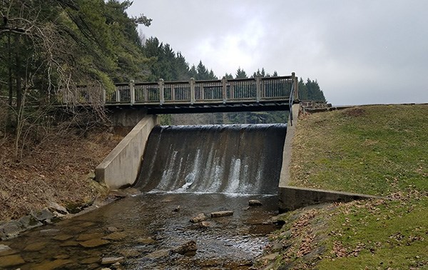
The park’s lake was created when settlers John and Charles Swauger dammed Poplar Lick Run to create water power for the operation of a sawmill and grist mill. The lake was expanded to thirteen acres when the Civilian Conservation Corps replaced the original dam with a larger one. The CCC was active in the park from 1933 until 1942, maintaining forest roads, planting trees, and adding day-use facilities including bathhouse, gazebo, and picnic shelters. The CCC also built cabins for overnight stays and slopes that created the state’s first ski resort. The CCC's recreation hall and officers quarters are still in use in the park.

When snow is adequate, the park staff will groom and track the trail surface for skiing. Snowshoeing is permitted but snowshoe users must stay off the ski tracks. Note: Motorized vehicles are not permitted on New Germany’s trails.
The Geocache
This geocache is not located at the listed coordinates. This is a two stage multi-cache. The first stage will lead you to the Swauger Mills information sign. Gather information from the sign to determine the location of the cache.
Stage 1
Begin at the listed coordinates. Complete the answers below using the information sign, then use the values to complete the coordinates for the final stage.
- A = # of pictures on the right hand side of the sign.
- B = Total # of paragraphs on the sign.
- C = # of rooms in the McAndrews' home, minus 4.
- D = # of levels the mill had (including the basement).
- E = # of grain types processed in the mill, minus 2.
- F = The last digit in the diameter of the overshot wheel that was at the mill.
The geocache is located at N39° 38.ABC, W079° 07.DEF
The checksum of A+B+C+D+E+F is 16.
Final
Proceed to the trailhead (waypoint provided) and follow the Orchard Loop (pink) trail to the geocache. The cache is located 25 feet from the trail.
New Germany State Park is open from 8am to sunset. Between Memorial Day and Labor Day, there is a charge for entrance into the park on weekends: $3-per-vehicle for Maryland residents, $5-per-vehicle for out-of-state visitors. There is no fee for park pass owners.
This geocache was placed by permission of the Maryland DNR Western Region. The MGS extends its thanks to the staff of New Germany State Park for approving this cache placement.