vsv #002 Traditional Geocache
-
Difficulty:
-

-
Terrain:
-
Size:  (micro)
Please note Use of geocaching.com services is subject to the terms and conditions
in our disclaimer.
Welcome on the Alpes d’Azur Power Trail!
You will find on this page some practical advices to help you organize your adventure on our power trail.
*********** Version française ICI ***********

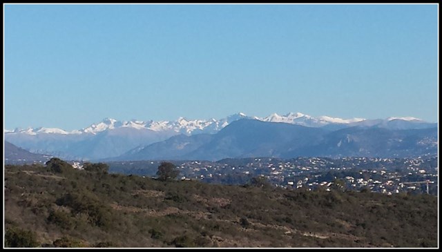
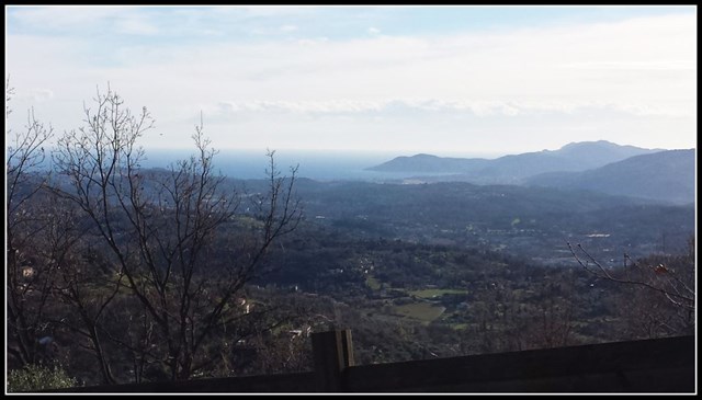
Between see and mountain, bathed with sun or snow, and with some awesome views on the coastline, we hope you will get a lot of pleasure and fun to walk through our country!
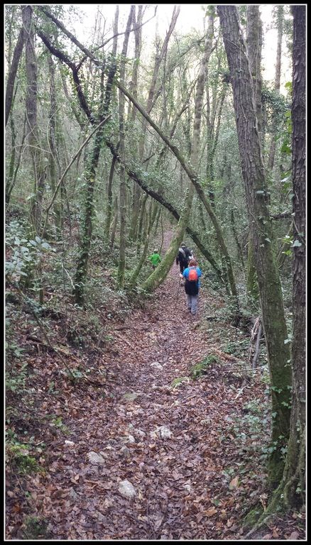
This is not a power trail like others. Forget about your car, you will use your shoes or maybe your mountain bike if you like such challenges.
However many intermediate points can be reached by car, so you will be able to split the way in smaller pieces.
Useful files to download for your aventure
Warning: you are about to download files that contain useful information to find these caches. As the owner of these caches, I declare that the download of these files does not present any risk for your computer, although neither Groundspeak nor the reviewer verified the files to detect problems. You download these files at your own risk.
GPX file for parking places
GPX file for all caches without spoiler pictures but with hints
PDF file with allspolier pictures (66 MB )
Itinerary and remarquable places
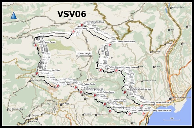
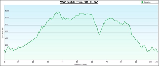
The trail loop is composed by 365 caches, and spreads along more than 105 kms of paths, with a total vertical extension over 2100m. It goes through many spots with very characteristic view points of our area.
Starting on the heights of Villeneuve-Loubet, the itinerary first crosses volcanic rocky hills, which is rare enough in our region, mostly karstic. Taking some altitude, the line of sight gets clear over Nice and its backcountry, all the way to the Mercantour mountains.
Then the path crosses the woodlands of Biot, Valbonne and Opio, to reach finally the nice village center of Le Rouret, then climbs the hillside towards Pré du Lac.
From there, the journey gains altitude and reaches the Plateau de la Malle, dominating the town of Grasse, then the submit of the Doublier, with its many antennas.
Here the path gets scarce and the track is much less marked, until we reach the Castellaras de la Malle; keeping on track is still relatively easy: just follow the ridge.
Reaching the hilltop that overlooks the Castellaras de la Malle, the view is awesome and you can see the coastline from the Cap Ferrat to the Esterel.
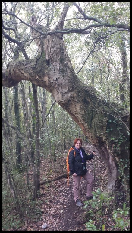
Then the itinerary turns north towards the Col du Ferrier, and take the track along the Vallon de Nans, where you may observe magnificent century-old trees.
When you arrive on the « Col de la Sine », the landscape changes drastically and becomes arid, this is the characteristic flaura of our karst plateaux.

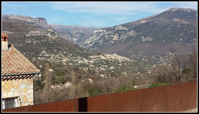
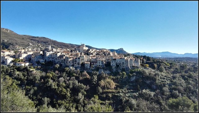
After a long walk in the « Haute Combe » valley, you reach the beautiful village of Cipières, from where you can see the valley of the Loup river, that you will have to cross before climbing back on the Saint Barnabé plateau.
The pass at the bottom of the Loup valley has a special treat waiting for you, as after the wooden bridge over the Loup river, the track crosses a rivulet, that you have to wade across. This should not be a problem in summer, but is not always possible during other seasons.
Follows a steep climb to the plateau of Saint Barnabé that you have to cross from one end to the other, leading over the village of Courmes. Moving towards the coastline, the view gets clear and offers you a sumptuous panorama.
After the Courmettes farm buildings, the path goes down towards the picturesque village of Tourettes.
Then the trail loop finishes through the woods to reach the Loup river. Here you have a small series of caches on the roadside, be very carefull the road is narrow and traffic may be dense. From there the path reaches Villeneuve-Loubet, again through volcanic grounds. The last descent offers you very nice perspectives on the mountains and the coastline, from the Baous to the Cap Ferrat and the Mount Agel.
Get equiped for a successful trail
Here are some advices for you to give yourselves the best chance:
- Have good hiking shoes, the path runs on more or less comfortable tracks.
- Carry a lot of water, the sun can be hard, and the pubs are scarce along the road...
- Prepare a good and detailed map (we have used the Openstreetmap during the making of the trail) and a well-charged GPS.
- Download all files before going out in the field, because the data network may not be available everywhere.
- Take your own pen(s) you will not find any in the caches.
Take care of the caches
This powertrail is the result of the hard work of a small team of passionate geocachers. As you can imagine, its making took us several months, and many visits. Please respect this work and obey the following rules, which may be obvious:
- Put back the box exactly at the same place, so that the spoiler picture remains valid for the next players.
- Sign the logbook in a respectful manner, no stamp right in the middle please.
- Put the logbook back in its ziplock bag, and close the box properly.
The VSV team
Ratapignata

|
Nimariel

|
Gueta

|
Nyphargus

|
Additional Hints
(Decrypt)
SE : Cvreer, à qebvgr
RA : Fgbar, ba gur evtug