My first addition to the Village Sign series, in the lovely village of Otterton
***************
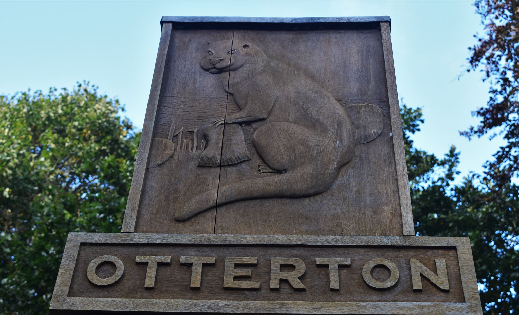
Below the sign there are two plaques. You will need the following information from the TOP PLAQUE
Number of lines = A
The date it was erected = BCth June 19DE
The date it was repaired and re-erected = 20th June 20FG
Number of letters in the first name of the person who designed the sign = H
Number of letters in the surname of the man who made the sign = J
The final cache is a short walk away at N50o3(E).(J)(A-F)(G) W003o1(B+C).(H+C)(E)(D)
To get to it, walk up the footpath and follow the arrow!
***************
The Saxons first settled in the Otter Valley about 680AD where the various mini-rivers ran into the wide Otter River Estuary. Otterton and East Budleigh had sufficient water in these harbours to take vessels of some size, especially at high tides, and both became mini ports in due time. 400 years later both places were prosperous trading ports. William the Conqueror granted Otterton to the Abbey of Mont St.Michel in Normandy for providing ships and men for his invasion of England.
By 1161 a Priory had been built to the north east of the Saxon Church with a Prior and 4 monks. 1415 the monks were evicted and the priory granted to the Abbey of Syon, Middlesex by Henry V, prior to his invasion of France. The priory buildings became ruins and the estate was managed for the Abbey by Stewards/Bailiffs who probably lived in the Barton. By the late 1400's Otterton Harbour was gradually silting up and only small fishing boats could dock there. However harbours lower down the Estuary were still used by trading vessels. Merchants mariners and shipowners were moving into the Lower Otter Valley building houses and farms in both East Budleigh and Otterton manors. Sheep farming became the most profitable occupation during the 15th & 16th. centuries.
At the Reformation 1539 both manors were bought by Richard Duke. In the meantime the Otter Estuary had silted up and a shingle bar was forming across its mouth. The Rolles took the two manors over in 1786. The Clintons in 1907.The centre of Otterton had developed around its harbor and Mill, with the Priory, Church and Barton on the higher ground above. After its silting up the harbour became the Village Green.
Development took place along Fore Street and many farmhouses and barns were built along it. Each farmer had his fields scattered throughout the Parish. Fore Street divided into Bell Street to Ladram Bay and Ottery Street to the north with more farms. By the 18th. & early 19th. centuries Otterton had become the principal "town" in the Lower Otter Valley. Eventually the village centre moved from the Green to the Fore Street,
Bell Street road junction. Blacksmiths, Wheelwrights, a Cooper, Saddler, Baker and Butchers moved their businesses there and a Post Office/Shop was opened.
The late 20th. century has seen the disappearance of all these facilities together with the working farms. (1843 Tithe there were 11 in the main street)
Today the centre of the village is now around the Kings Arms and Village Hall which have survived. The latter houses the Village Shop and a hairdressers shop next door. We still have the shops in the Mill.
***************
If anybody would like to expand this series please do. I would just ask that you let Smokeypugs know first so they can keep track of the Village Sign numbers and names to avoid duplication.
***************