
Cache information: Harris Neck NWR
Steward: 2Wolfes
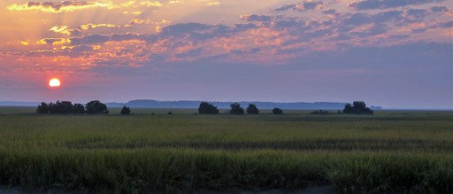
National Wildlife Refuge: HARRIS NECK
Cache type: Traditional
Starting Coordinates: N 31° 37.528 W 081° 17.319
Difficulty: 1.5
Terrain: 2
Hours: Refuge lands, including the fishing piers, wildlife drive and associated trails, are open during daylight hours, seven days a week. Visitors may access the refuge through the entrance gate, which is set to automatically open at sunrise each day. The entrance and exit gates both automatically close shortly after sunset.
You will follow along the Harris Neck National Wildlife Refuge wildlife drive to the listed waypoints for each of 4 stages of this multi-cache. Please obey all posted signs. You may park along the drive to find the required information at each stage. Do not drive your vehicle off of the posted roadways!
Harris Neck serves as an important link in the chain of refuges along the eastern seaboard, and is the inland base for two neighboring barrier island refuges, Blackbeard Island and Wolf Island.
Harris Neck National Wildlife Refuge is one of the seven refuges administered as part of the Savannah Coastal Refuges Complex. The refuge is located in McIntosh County, Georgia, 45 miles south of the port city of Savannah.
Archaeological and historical records show that many different populations have benefited from Harris Neck's resources over the centuries:
Guale Indians inhabited these areas, collecting fish, shellfish, and game, from 1500 - 1715 AD. Beginning in 1750, English and Scottish settlers farmed the land intensively, producing many crops including renowned, high-quality Sea Island cotton. African-American families established a farming and shell-fishing community following the Civil War. Their historic cemetery is still in use and can be visited from Barbour River Landing. In the early 20th century, tobacco magnate Pierre Lorillard founded an estate that had a large mansion, formal gardens, and a dock for yachts. During World War II, the U.S. military purchased the land for an airfield and pilot training facility. Remnants of the runways can still be seen today.
Since its designation as a wildlife refuge in 1962, Harris Neck has served as a premier nesting, foraging, and wintering habitat for many species of wildlife. Signature species include wood storks, which nest in a large colony on Woody Pond, and the colorful and uncommon painted bunting, which favors nesting habitat in the refuge's maritime scrub areas.
The refuge encompasses six man-made freshwater ponds, as well as extensive salt marsh, open fields, forested wetlands, and mixed hardwood/pine forest. This diversity of habitat makes the refuge an important resource for migratory birds (342 species of birds have been seen on the refuge and 83 species breed here).
The Cache
This is a 4 stage multi cache. Cache is located at the posted coordinates however you must visit each stage posted in the additional waypoint section below. At each stage you will gather a part of the 4 digit combination ("ABCD") that unlocks the cache.
Stage 1
At the posted coordinates you will find a kiosk with an information panel describing "Working With Wildlife". In the upper right hand corner there are the silhouettes of how many Anas platyrhynchos in flight? This number = "A".
Stage 2
This is a great spot! It would be a rare day not to spot 1 or more alligators and countless birds! Read the information panel. "Woody Pond is one of ___ freshwater pools created on Harris Neck National Wildlife Refuge to provide habitat for a variety of waterfowl and wading birds." The number of freshwater pools = "B".
Stage 3
Another information panel at the apex of what remains of the Airfield. Some really good history here! "Harris Neck Field reached it's zenith in September 1944. A total of 57___ enlisted personnel and 129 officers served at the base." The missing digit = "C".
Stage 4
STAGE 4 PARKING: N 31° 38.482 W 081° 15.430
A short walk down Historical Trail at Thomas Landing will bring you to a fountain that remains in remarkable condition considering it dates back to the late 1880's! Examine the rim of the fountain pond carefully. You will see where it appears there were a number of columns at one point. Count the "columns". The number of now missing columns + 5 = "D".

The Savannah Coastal Refuges GeoTrail:
Savannah area Geocachers, the U.S. Fish and Wildlife Service, the National Wildlife Refuge System, and the Savannah Coastal Refuges Complex are proud to present the Savannah Coastal Refuges GeoTrail! There are 7 special geocaches placed to help you learn more about the U.S. Fish and Wildlife Service, the National Wildlife Refuge System, and the Savannah Coastal Refuges Complex!
Steps to the Savannah Coastal Refuges GeoTrail:
1. Obtain a Savannah Coastal Refuges GeoTrail Passport from our Headquarters location or download a PDF from www.fws.gov/refuge/Savannah
2. Go to Geocaching.com create a log-in and find the GPS coordinates and more information for the Savannah Coastal Refuges GeoTrail locations.
3. Start your search and locate all 7 caches using a hand-held GPS unit. The cache containers are sealed boxes, labeled as a Savannah Coastal Refuges GeoTrail geocache. Caches are located near Savannah, Georgia, in both great states of Georgia and South Carolina.
4. When you find a GeoTrail cache, log your name and any comments on the logbook inside the cache and punch your Passport with the unique orienteering punch for that specific Refuge.
5. Be sure to follow the Leave No Trace guidelines
6. Complete all of the GeoTrail's caches to get a custom Geo-Coin created by the master and celebrated designer Christian Mackey! Bring your completed passport into the Savannah National Wildlife Refuge Visitor Center and receive your coin. (Coins will not be mailed )
The USFWS Savannah Coastal Refuges Complex:
The Savannah Coastal Refuges Complex (SCRC) is a group of 7 National Wildlife Refuges (NWRs) spanning over 100 miles along the coast of South Carolina and Georgia. Our Refuges include Savannah, Pinckney Island, Harris Neck, Wassaw, Blackbeard Island, Tybee, and Wolf Island National Wildlife Refuges. Our headquarters is located at the Savannah National Wildlife Refuge, near Hardeeville, South Carolina.
The U.S. Fish and Wildlife Service (USFWS) is the premier government agency dedicated to the conservation, protection and enhancement of fish, wildlife and plants, and their habitats. The USFWS also helps ensure a healthy environment for people by protecting such ecosystem services as clean air and water.
Since President Theodore Roosevelt designated the first wildlife Refuge in 1903, the National Wildlife Refuge System has grown to include more than 560 refuges, 38 wetland management districts and other protected areas encompassing 150 million acres of land and water from the Caribbean to the remote Pacific. There is at least one National Wildlife Refuge in every state and territory, and within an hour’s drive of most major metropolitan areas.
National wildlife refuges provide habitat for more than 700 species of birds, 220 species of mammals, 250 reptile and amphibian species, and more than 1,000 species of fish. More than 380 threatened or endangered plants or animals are protected on wildlife refuges. Each year, millions of migrating birds use refuges as stepping stones while they fly thousands of miles between their summer and winter homes.
Each of the Refuges across the nation has been created for their own special, specific reasons. This geocache series will help you learn more about each of the 7 Refuges that make up the Savannah Coastal Refuges Complex!
For more information about this series, please contact us at SCRC Ranger. For general questions about geocaching at USFWS National Wildlife Refuges, please contact USFWS Land Manager user IslandsAndOcean.
Disclaimer to New Geocachers:
Please join us in playing! All are welcome who observe and obey the rules. Please do not move or vandalize the container. Replace the cache like or better than you found it and when you leave, and make sure the cache is completely covered. Please do not remove the stamp from the geocache box, this is a essential game piece for cachers working on the GeoTour. The real treasure is in finding the container and sharing your thoughts with everyone who finds it. Pick up a GeoTrail Passport at the Savannah National Wildlife Refuge Visitor Center. DO NOT LEAVE SWAG/TRADE ITEMS OR TRAVEL BUGS/GEOCOINS BEHIND IN THE CACHES, PER USFWS PROGRAM REQUIREMENTS
PASSPORTS CAN BE DOWNLOADED HERE