l’aérodrome A-10 Banville
(A-10 Airfield Banville)
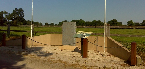
Le monument à la A-10 l'aérodrome est à la jonction de D 974, ex N13 vers Carentan; D 89, tourner à gauche vers Saint Pellerin. Le monument se trouve à 400 mètres sur la gauche - Rue de Banville.
(The monument to the A-10 Airfield is at the junction of D 974, ex N13 towards Carentan; D 89, turn left towards Saint Pellerin. The monument is 400 meters on the left - Rue de Banville).
Lors du débarquement de Normandie, Banville est situé à moins de 3 kilomètres de Juno Beach (secteur Mike), la zone de débarquement des troupes Canadiennes.
Le village est libéré dans la journée du 6 juin 1944 par les Royal Winnipeg Rifles.
(Banville is located less than 3 kilometres from Juno Beach (Mike sector), the Canadian troops landing zone. During the invasion of Normandy, the village was liberated on the day of 6 June 1944 by the Royal Winnipeg Rifles).
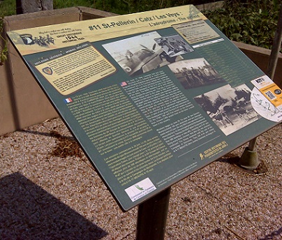
Carentan aérodrome est un aérodrome militaire de la Seconde Guerre mondiale abandonnée, qui est situé à proximité de Carentan dans la région Basse-Normandie dans le nord de la France. L'Armée de l'Air des États-Unis a établi un aérodrome temporaire le 15 Juin 1944, neuf jours après les premiers débarquements alliés en France sur D-Day et seulement trois jours après la prise de Carentan. L'aérodrome a été l'un des premiers mis en place dans la zone libérée de la Normandie. Connu comme avancée Landing Ground "A-10", l'aérodrome est composée d'un seul 5000 '(1500m) préfabriqué hessois Surfacing piste.
(Carentan Airfield is an abandoned World War II military airfield, which is located near Carentan in the Basse-Normandie region of northern France. The United States Army Air Force established a temporary airfield on 15 June 1944, nine days after the first Allied landings in France on D-Day and only three days after the capture of Carentan. The airfield was one of the first established in the liberated area of Normandy. Known as Advanced Landing Ground "A-10", the airfield consisted of a single 5000' (1500m) Prefabricated Hessian Surfacing runway).
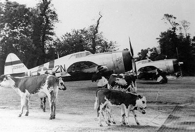
Après sa fermeture par les Américains le 4 Novembre 1944, l'aérodrome a été retourné aux terres agricoles.
(After its closure by the Americans on 4th November 1944, the airfield was returned to farmland).