Loch Lochy
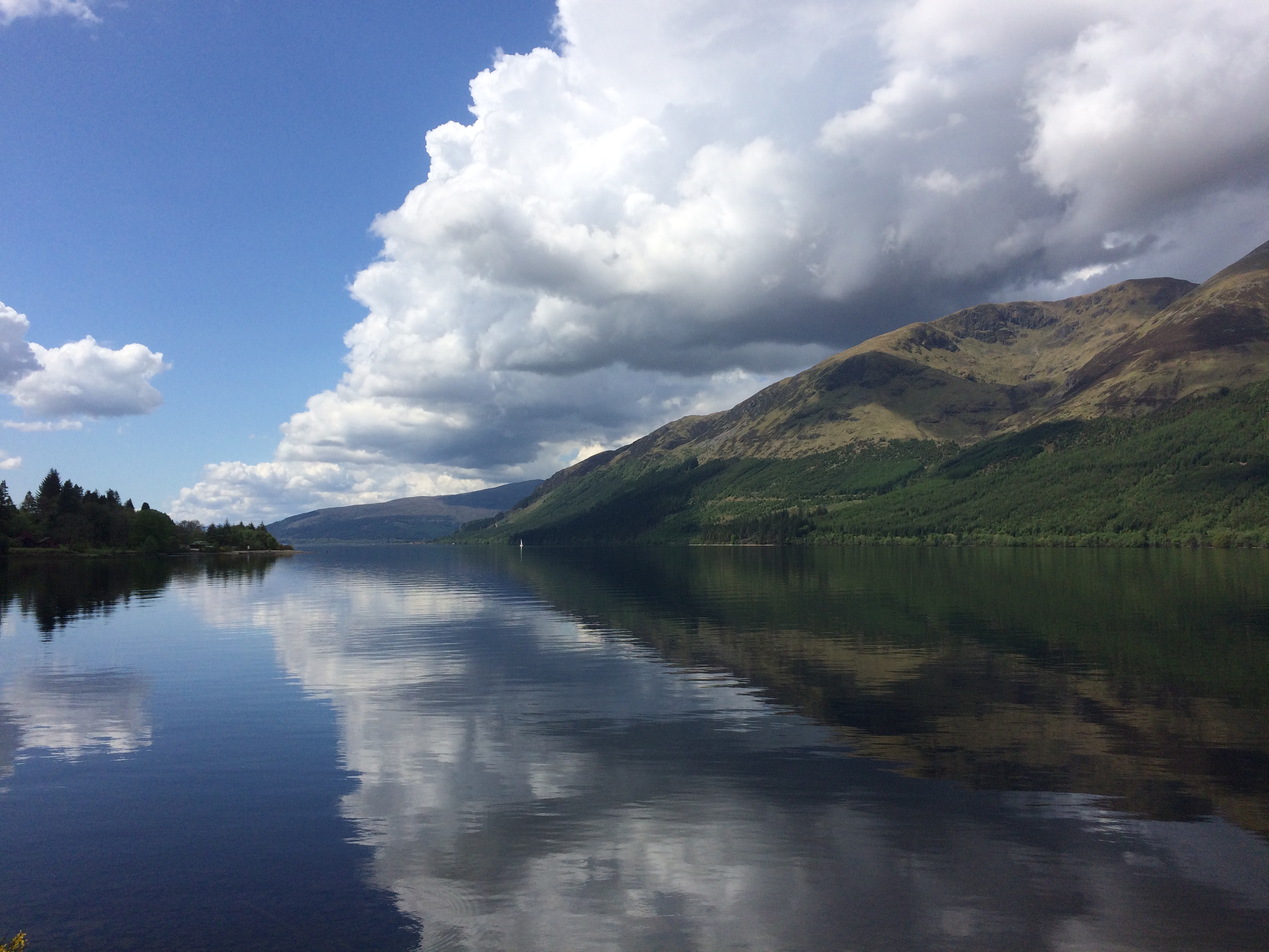
Loch Lochy is one of the lochs that can be found within the Great Glen; the others being Loch Ness and Loch Oich. Loch Lochy is 15km long with an average width of 1km. Loch Lochy is also the 3rd deepest Loch in Scotland (by mean depth) with a mean depth of 70m. Along with Scotland's deepest Loch, Loch Ness, Loch Lochy has the effects of glaciation to thank for its depth and the shape of the valley. The Great Glen was occupied by a large glacier up until about 10,000 years ago. The shattered rock of the Great Glen Fault was easier for the glacier to erode and, as a result, Loch Lochy and Loch Ness are particularly deep Lochs. From the posted coordinates you can also spot several other examples of the features of glacial erosion.
Features of Glacial Erosion
While valleys eroded solely by rivers normally have a 'V' shape, valleys eroded by glaciers have more of a 'U' shape. This is characterised by steep sides and a flatter valley floor. The glacial erosion affects more than just the shape of the valley. It cuts through the interlocking spurs (hills around which the river meanders) of the 'V' shaped valley, resulting in truncated spurs. These truncated spurs are the rounded remnants of these hills that one may find at the edge of a 'U' shaped valley.
During the period of glacial erosion, there may have been smaller, side glaciers adjacent to the main glacier. The erosion by these smaller glaciers create smaller, side valleys high above the main valley floor which are called 'Hanging' valleys.
On the floor of a 'U' shaped valley, one main find various water features; misfit streams, so called because they are much to small to have eroded than the valley they meander through, may weave their way across the valley floor. You may also spot a ribbon lake; this is a long, thin lake which has formed in a hollow where the glacier has eroded softer or more fragile rock more deeply.
Take a look around, you may spot some of these features right in front of you!
What is a Fault?
To quote the USGS, "A fault is a break in the rocks that make up the Earth’s crust, along which rocks on either side have moved past each other." Over time, the stress between different rocks becomes too much and the a fracture occurs between the rocks; this is called a fault. Faults are perhaps best known for their association with earthquakes which are the potential result of the shifting movement between the two sections of rock that make up the fault. Earthquakes are more common at active faults, such as the San Andreas Fault in California, but some slight tremors may occur at more inactive faults, such as the Great Glen Fault.
The Great Glen Fault
The Great Glen Fault cuts across the Highlands and is provided its name by the Great Glen that it runs through. The fault line itself formerly continued to the South West through what is today Canada and the United States. The fault line separates Scotland geologically with the rocks on either side of Loch Lochy being quite different in composition and age. Below the fault line are the Grampian mountains and, to the North-West, is are the Northwest Highlands. The Great Glen Fault was created 430 million years ago by the collision of two ancient continents; Laurentia and Avalonia. While some rocks were pushed up to form the Caledonian mountain range, some rocks were buried and recrystalized in a process known as metamorphism. The way in which the two continents collided caused fractures and thus the Great Glen Fault was born!
It's up to you to find out a bit more about the Great Glen Fault by taking a closer look at the information board and your surroundings. Just message or email your answers to us before logging your visit to the EarthCache. We'll be in touch if there are any questions or issues.
Happy EarthCaching!
Questions
1) From the posted coordinates, look out across the loch and try to spot some of the features of glacial erosion mentioned above. Tell us about a feature of glacial erosion that you can see and tell us briefly how it was formed.
2) How far have the rocks on the opposite side of Loch Lochy moved due to the fault line?
3) What direction have they moved (from your perspective)?
4) Which terrane can you see in front of you? What is the name given to the rocks that built it?
5) Which terrane is behind you? What is the name given to the rocks that built it?
6) What type of fault is the Great Glen Fault? Where can you find a fault of a similar type?
7) Optional- Include a photo from your visit to Loch Lochy!