La Earthcache / The Earthcache
► Définition d'une tourbière
Une tourbière est une zone humide bien particulière où les apports en eau (pluies, sources…) sont toujours supérieurs aux pertes. Elle se caractérise donc par un engorgement permanent en eau (dû au sous-sol rocheux, à la pluviométrie…) et une pauvreté en dioxygène (milieu de vie asphyxiant) sous un climat frais et humide, conditions très défavorables à la décomposition de la matière organique par les micro-organismes (bactéries et champignons).
Ces milieux très contraignants vont entraîner une accumulation progressive de la tourbe, un sol caractérisé par sa très forte teneur en matière organique d'origine végétale, peu ou pas décomposée, dont la teneur peut aller jusqu'à 80 à 90%.
L'apparition et le maintien des tourbières dépendent de certains facteurs, tels que :
- Le bilan hydrique, qui doit être nul ou positif, de sorte que le milieu soit presque constamment inondé ou gorgé d'eau. Cette abondance en eau peut être due au relief permettant une stagnation de l'eau, à une pluviométrie importante et à un sous-sol rocheux ou argileux imperméable limitant les pertes d'eau par infiltration.
- Les faibles températures qui ralentissent la dégradation de la matière organique.
- Une flore particulière qui stocke l'eau (sphaignes sur sols acides ou acidifiés).
- L'acidité du sol, naturelle par la nature du sous-sol ou auto-entretenue (par exemple par les sphaignes).
► Les différents types de tourbières
Le classement peut s'effectuer selon 2 critères principaux :
~ le pH
- les tourbières acides à sphaigne, de pH inférieur à 4.
- les tourbières alcalines à carex, de pH supérieur à 6.
~le mode d'alimentation en eau
- Tourbière soligène : ce sont les tourbières de pentes et de sources, elles sont situées sur une pente et sont alimentées par les eaux de ruissellement ou directement par une source adjacente.
- Bombées ou ombrogènes : Alimentées en eau uniquement par les précipitations, ces tourbières se reconnaissent à leur partie centrale plus élevée, d’où leur nom.
- Tourbière topogène : cette catégorie de tourbière est située en fond de vallon ou dans une cuvette ou dépression quelconque.
- Tourbière limnogène : ce type de tourbière se développe à partir des berges d'un lac, en colonisant progressivement la surface en eau jusqu'à complètement la recouvrir.
► La tourbière de Langazel
~ Contexte géologique et hydrologique
La zone humide de Langazel est En tête du bassin versant d'un petit fleuve côtier, l'Aber-Wrac'h, qui se jette dans la manche quelques dizaines de kilomètres plus loin.
Ce bassin versant large est alimenté par de nombreux cours d'eau, issus du niveau pluviométrique assez élevé sur la région (climat océanique).
Nous sommes sur un sous-sol granitique, roche plutonique acide, dont la forte dégradation de certaines de ces minéraux, dont les feldpaths, ont conduit à la mise en place d'une couche d'argile branche très fine, la kaolinite, produisant une zone imperméable et laissant le sol gorgé d'eau une bonne partie de l'année.
~ Caractéristiques et formation
L'ensemble de ces caractéristiques ont donné des circonstances favorables à la mise en place d'une zone humide puis d'une tourbière.
Site unique au niveau régional, Langazel est la plus ancienne tourbière de Bretagne. Le processus de formation de la tourbe a débuté il y a 11700 ans et depuis, petit a petit, la végétation a colonisé les étendues d’eau originelles.
Cette formation a suivi différentes étapes :
Etape 1 : Dans le sol de Langazel, la présence d'une couche limono-argileuse empêche l'infiltration de l'eau. La formation d’une tourbière est un processus naturel d’atterrissement d’une zone inondée.

Etape 2 : Le marais de Langazel n'est pas homogène, il existe plusieurs cuvettes plus ou moins profondes. Petit à petit, la végétation envahit l’étang initial.

Etape 3 :La tourbière de Langazel arrive à ce stade où les arbres progressent de manière spectaculaire.
Elle finit par combler totalement le lieu. Comme le milieu est privé d’air, les microorganismes qui y vivent, ne peuvent dégrader le matériel végétal mort. Celui-ci s’accumule de plus en plus et la profondeur de la tourbière ainsi formée augmente.

► Definition
A bog is a very special wetland where water inputs (rain, sources ...) are always greater than the losses. It is therefore characterized by a permanent water flooding (due to bedrock, to rainfall ...) and poverty in oxygen (living environment suffocating) under cool and humid climate, very unfavorable conditions for decomposition of matter organic by microorganisms (bacteria and fungi).
These very restrictive environments will lead to a gradual accumulation of peat, a soil characterized by its very high organic matter content of vegetable, little or no decomposed, the content can be up to 80 to 90%.
The appearance and maintaining peatlands depend on factors such as:
- The water balance, which must be zero or positive, so that the medium is almost constantly flooded or waterlogged. This abundant water may be due to the relief allowing water stagnation, with high rainfall and a rocky or impermeable clay subsoil limit water seepage.
- The low temperatures slowing down the degradation of organic matter.
- A special flora that stores water (sphagnum on acidified or acid soils).
- Soil acidity, naturally by the nature of the basement or self-sustained (eg Sphagnum).
► The different types of bogs
~ The PH
- Sphagnum bogs acids, pH less than 4.
- Alkaline bog sedge, pH greater than 6.
~ The water supply mode
- Bog soligenous: it is the bog slopes and sources, they are located on a slope and are fed by runoff or by an adjacent source.
- Curved or ombrogenous: Receive water only from precipitation, these peatlands are recognized by their higher central part, hence the name.
- Topogenous bog: bog this category is situated in small valley or in a bowl or any depression.
- Bog limnogène: this type of bog develops from the banks of a lake, gradually colonizing the surface water to completely cover it.
► Bog of Langazel
~ Geological and hydrological context
Wetland Langazel is Leading the watershed of a small coastal river, the Aber Wrac'h, which flows into the handle a few dozen kilometers away.
This large watershed is fed by numerous rivers, from the rather high level of rainfall on the region (oceanic climate).
We are on a granite basement igneous rock acid, the sharp deterioration of some of these minerals, including feldpaths, led to the establishment of a clay layer very thin branch, kaolinite, producing a impermeable zone and leaving the soil waterlogged much of the year.
~ Features and formation
All these features have given favorable circumstances for the establishment of a wetland and peatland.
single site at the regional level, Langazel is the oldest peat Britain. The peat formation process began years ago and since 11700, little by little, vegetation has colonized the original waters.
This installation followed steps:
Step 1: In the soil of Langazel, the presence of silty clay layer prevents water infiltration. The formation of a bog is a natural process of landing a flooded area.
Step 2: Marsh Langazel is not homogeneous, there are several more or less deep bowls. Gradually, the vegetation invades the initial pond.
Step 3: Bog Langazel gets to that stage where trees grew dramatically. She finally completely fill the place. As the medium is deprived of air, the microorganisms living there may degrade dead plant material. This builds up more and more and the depth of the peat thus formed increases.
► Sources bibliographiques / Bibliographical sources
Les Questions / The Questions
La lecture attentive du descriptif de la cache, ainsi qu'une observation des éléments de terrain et un peu de déduction sont normalement suffisants pour répondre aux questions de cette EarthCache.
A careful reading of the description of the cache, as well as observation of terrain features and some deduction is usually sufficient to answer questions of this EarthCache.
Questions pour valider :"La tourbière de Langazel"
Questions to validate: "Bog of Langazel"
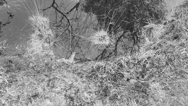
Vous vous trouverez au coeur de la tourbière, sur un sentier d’interprétation qui permet de comprendre l’évolution et la formation de cet espace pédologique particulier.
You will find yourself in the heart of the bog, on an interpretive trail for understanding the evolution and the formation of this particular area soil.
Point 1 : N 48° 30.842 W 004° 16.732
- Question 1 : Ce panneau présente les caractéristiques de la zone humide ; dans les espèces végétales citées, quelle plante participe le plus activement à la formation de la tourbe ?
Vous pouvez également vous aidez du descriptif pour répondre à cette question.
- Question 1 : This panel shows the features of the wetland; in the cited plants, which plant participates more actively in the formation of peat?
You can also use description to help you to answer this question.
Point 2 : N 48° 30.847 W 004° 16.720
- Question 2 : Ce panneau décrit le profil pédologique de la zone ou se situe la tourbière ; quelle est l'épaisseur d'argile ayant permis l'imperméabilisation de la zone ?
- Question 2 : This panel describes the soil profile of the area or is the bog; what is the thick clay that allowed the waterproofing of the area?
Point 3 : N 48° 30.838 W 004° 16.704
- Question 3 : Vous avez au niveau de cette nouvelle station du sentier un point de vue imprenable sur la tourbière.
En étudiant les caractéristiques décrites dans le descriptif et en observant l'environnement ou vous vous trouvez (pente, présence d'un lac ou d'un plan d'eau, caractéristique du réseau hydrographique), déterminer le type (classification) de la tourbière de Langazel selon les deux critères principaux du descriptif.
- Question 3 : You have at this new trail station a breathtaking view of the bog.
By studying the characteristics described in the description and observing the environment where you are (slope, presence of a lake or a pond, characteristic of the river system), characterize bog Langazel on both main criteria of description.
Point 4 : N 48° 30.829 W 004° 16.720
- Question 4 : Ce panneau décrit l'exploitation de la tourbe. Quelle est l'élément chimique intéressant l'homme qui justifie l'exploitation de la tourbe ? A quoi sert-elle ?
- Question 4 : This panel describes the exploitation of peat. What is the chemical element interesting man that justifies the exploitation of peat? What is it for?
Point 5 : N 48° 30.831 W 004° 16.730
Vous vous trouverez devant un spot permettant d'observer la tourbe de plus près ; sans tomber à l'eau, placer vous sur le spot de photo ci-dessous.
You will find yourself in front of a spot to observe the peat closer; without falling in the water, put you on the spot photo below.
- Question 5 : Prenez un peu de tourbe dans les mains. Quelle est sa texture ? Quelle est sa couleur ? Tater le sol sous vos pieds ; celui-ci vous semble t-il ferme ? En fonction du sol et de caractéristiques de pH, déduisez-en la nature de la plante à l'origine de cette tourbe.
- Question 5 : Take some peat in hands. What is its texture? What color is it? Tater the ground under your feet; it seems it closes ? Depending on the soil and pH characteristics, deduct-in nature of the plant to the origin of the peat.
Vous pouvez vous loguer sans attendre notre confirmation,
mais vous devez nous envoyer les réponses en même temps soit par mail via notre profil (
fafahakkai), soit via la messagerie geocaching.com (Message Center).
S'il y a des problèmes avec vos réponses nous vous en ferons part.
Les logs enregistrés sans réponses seront supprimés.Une photo de vous ou de votre GPS avec la tourbière en arrière plan sera la bienvenue, mais n'est pas obligatoire.
You can log this cache without waiting for our confirmation, but you must send us the answers at the same time, by e-mail via our profile (fafahakkai) or by the system of Message Center of geocaching.com.
If there is a problem with your answers we will notify you. The logs recorded without answers will be deleted.
A picture of you or your GPS with the bog in the background is welcome, but not mandatory.
Rappel concernant les « Earthcaches »: Il n'y a pas de conteneur à rechercher ni de logbook à renseigner. Il suffit de se rendre sur les lieux, de répondre aux questions ci-dessus et de nous renvoyer les réponses.
Reminder concerning "Earthcaches": there is neither a container to look for nor a logbook to sign. One need only go to the location, answer to the differents questions and send us the answers.