It is believed by many that within the cave here, far beneath the fortress above, Merlin lived while King Arthur grew up, eventually becoming his teacher. In one version of the legend, Arthur was found by Merlin washed ashore in a cave below the castle. But can this legend be true? It’s always hard to find evidence for legends from so long ago, and little has been found to prove or disprove the idea that Arthur once lived at Tintagel. New discoveries are made all the time, and indeed, a finding during an 1998 excavation increased the possibility of a connection with King Arthur: a slate of 20 by 30 cm with the inscription ARTOGNOV, the Latin version of the British name Arthnou. It is from the 6th century, which is most likely the time when Arthur lived.
Archeology is one approach, however, geology can perhaps also help to answer the question about whether Merlin could have lived here in the cave. One problem with this idea at the present time seems to be that the cave fills with water when the tide comes in, and it would have been a little damp for the wizard unless great magic was used to hold the tide back, in which case it would have been very tiring. But of course, the cave may have changed since the 6th century, and the question is, how different might it have looked?
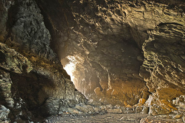
Below Tintagel Castle was a fault, it crosses all of Tintagel Head, the land on which the castle is built. It also crosses several other heads to the north and south, as can be seen from the castle. The rocks on the fault were eroded by the sea and so several irregular sea caves were formed, all in one row. Two caves are easy to access from the footpath to Tintagel Castle, by going down onto the beach. Both are high enough to walk through, both are going through the whole head to the other side.
Please note, this earthcache is tidal. You will not be able to access the caves when the tide is in. Please do not take any risks, the sea is very dangerous and there is no magic in modern times that will protect you from the immense power of the sea. Boscastle Tide Times
Formation of a Sea Cave
A sea cave, is a type of cave formed primarily by the wave action of the sea. The primary process involved is erosion. Sea caves are found throughout the world, actively forming along present coastlines and as relict sea caves on former coastlines.
Sea caves may be found in a wide variety of host rocks, ranging from sedimentary to metamorphic to igneous, but caves in the latter tend to be larger due to the greater strength of the host rock. In this instance, the rock at Tintagel is slate, a metamorphic rock, and igneous volcanic rock.
In order to form a sea cave, the host rock must first contain a weak zone. Here at Tintagel, that weak zone is the fault line between the volcanic igneous rock and the metamorphic slate, and the sea has taken advantage of this vulnerability and eroded away the weak zone to form the cave. The driving force in sea cave development is wave action. Erosion is ongoing anywhere that waves batter rocky coasts, but where sea cliffs contain zones of weakness, rock is removed at a greater rate along these zones.
As the sea reaches into the fissures thus formed, they begin to widen and deepen due to the tremendous force exerted within a confined space, not only by direct action of the surf and any rock particles that it bears, but also by compression of air within. Blowholes (partially submerged caves that eject large sprays of sea water as waves retreat and allow rapid re-expansion of air compressed within) attest to this process, and there is an excellent earthcache just a few miles away at Boscastle that examines a very lively blowhole.
Adding to the hydraulic power of the waves is the abrasive force of suspended sand and rock. Most sea-cave walls are irregular and chunky, reflecting an erosional process where the rock is fractured piece by piece. However, some caves have portions where the walls are rounded and smoothed, typically floored with cobbles, and result from the swirling motion of these cobbles in the surf zone.
Merlin's Face
At the entrance to Merlin’s Cave you will now find the face of Merlin looking out at you. Although you may perhaps think that his spirit lives on and the action of the waves on the rock has caused this face to appear, it was in fact not a natural or magical occurrence – it’s a man made addition, carved into the rock by English Heritage and unveiled on the 11th of February, 2016. Some have branded the carving as vandalism, while others think it’s quite good. As it is new we are going to use it to study the power of the waves and other erosion over the lifetime of the earthcache, as over time, the power of the waves will cause the face to completely disappear and the cliff face will look nature once again. People handling the face may also speed up the process. If the rock here was soft, this carving may erode away entirely within a few years, but if it's hard, it may last in good condition for many years.

The given co-ordinates take you to the beach just outside the cave, which is accessed from the coastal footpath. You will walk past the English Heritage ticket shop but you are still on the footpath, you only enter the castle grounds if you turn off up the path towards the bridge. A new bridge will soon be constructed up at the top and the entrance to the castle will move away from this area. Remember, the cave is tidal, if you can’t get onto the beach, you will not be able to reach the cave! (A link for tide times can be found above)
Both of the earthcaches here fall within the Tintagel Cliffs SSSI (a Site of Special Scientific Interest), designated for both its maritime heaths and geological features. Many thanks to Natural England and English Heritage for their support in the publication of these earthcaches. Please be aware of the protected state of this coastline and don’t interfere with the rocks or plantlife when you explore. Both earthcaches are on public footpaths/beaches, you do not need to pay to enter the castle.
Logging Requirements (Questions to Answer)
Please e-mail me the answer to the questions via my profile. I do read all answers and try to reply to them all; I may not reply immediately so please do not wait for a reply before posting your find. Ideally, please send your answers at the same time you submit your log, or within a few days of your visit. I do check answers have been sent for every log, if you do not send answers within a week your log may be deleted. You are not expected to have any previous geological knowledge, your best attempt at the answers is all that is required.
Firstly you need to find the image of Merlin’s face near the cave entrance.
In your online log – please examine the face closely. Please report it’s condition. February 2016 it was new. Does it still look new? Does it show any evidence of weathering or erosion? Why do you think this is the case? Feel free to include a photo of yourself/GPSr with the face (optional).
All remaining answers to be sent via message (click link at the top of the page to 'message the owner')
Q1 – Looking at the current erosion on the face, and also elsewhere on the surrounding cliffs, how long do you think the face may last? (Only a very rough estimate is required)
For the remaining questions, you need to enter Merlin’s Cave. This is the first cave you come to, accessed from beach level.
Q2 – Estimate the size of the entrance (height / width). Have a walk through the cave. The cave goes right under the castle and out of the other side of the island. Estimate the size of the other end (height / width). When it formed, the cave started on one side and slowly eroded all the way through the weakness of the fault, and out of the other side. From which side do you think it started? Why?
Q3 – Now the weaker rock from the fault has eroded away, how strong do you think the remaining rock is against the power of the waves? Does the presence of this cave pose a risk to the castle above?
Q4 – Look at the cliffs around the castle and try to think how it must have looked in the 6th century (less eroded). Do you think the cave was here then, perhaps it would have been smaller, in the earlier stages of development? Would it have always been tidal? Can you make any conclusion about whether you believe this cave would have been a suitable living space for Merlin in the 6th century?
We always like to see photographs of you and/or your GPS device with the geological features - plus this also provides additional proof of your visit, so please include one with your log if you wish, either with the face, or elsewhere in the cave.
Please enjoy your visit to Merlin's Cave.