SR 123 is a beautifully scenic roadway that leads to the southeast (Stevens Canyon) entrance to Mount Rainier National Park and the Ohanapecosh Visitor Center and Campground. Frequently, you see a creek beside the roadway or you cross one of these scenic creeks.
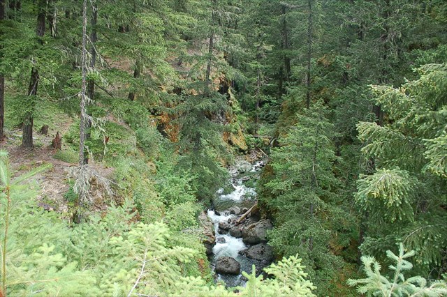
Just a short distance north from US Highway 12, approximately .7 mile, the combination of Summit Creek and Carlton Creek pass underneath SR 123. These creeks feed from the William O. Douglas Wilderness into the Gifford Pinchot National Forest, and here you'll find a beautiful, rock-filled creek - and this cache nearby.
Shortly after passing under SR 123, the creeks join the Ohanapecosh River and flow south until the Ohanapecosh River joins the Clear Fork Cowlitz River. Below this confluence, the stream is known simply as the Cowlitz River. Fishing and outdoor enthusiasts are frequent visitors to this area.
The cache: There is a small pullout just north of the bridge on SR 123 where you can park to seek this cache and to get a better view of the creek. Be VERY careful while walking on the roadside and bridge pathway/bike path, as it is not very wide, but worth the walk to fully view the creek. This road can be heavily traveled, especially in the summer months, so keep a close eye and/or hand on any small children or pets in your group.
2016 was the 100th anniversary of the National Park Service, and to celebrate, Visit Rainier and WSGA hosted the Visit Rainier Centennial GeoTour - 100 caches placed in and around Mount Rainier National Park. The geocaches highlighted the rich history, scenic wonders, quaint communities, and hidden gems of the Rainier region. Participants received geocoin and pathtag prizes for finding all the caches.

