Risnik
!PREVIDNO!
Risnik med Divačani oziroma kar med Kraševci ne potrebuje posebne predstavitve. Za mlajše predstavlja močno opozorilo: “Ne igraj se preblizu roba, dolga je pot navzdol!” Za starejše pa je del trim steze in lepe sprehajalne poti. Okoli udornice Risnik je namreč speljana zanimiva krasoslovno naravoslovna učna pot.
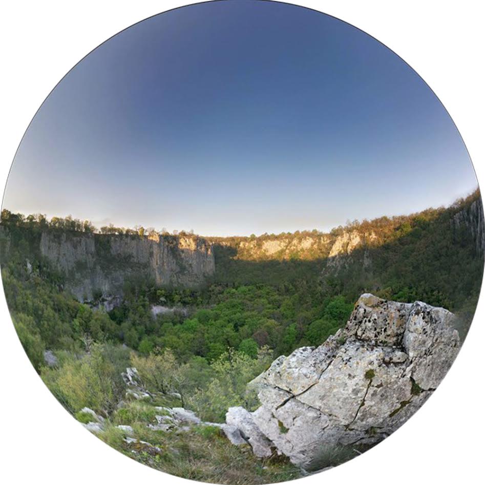
Risnik je torej udornica, ki je nastala z udrtjem stropa nekdanje jamske dvorane. Gre za mogocno in zelo slikovito udorno dolino s povprečnim premerom 220m in povprečno globino 72m. Dno udornice je presenetljivo ravno, proti obodu pa se dvigujejo melišča, ki preidejo v prepadne in previsne stene višine 30 – 45m. Po teh stenah so speljane plezalne smeri, v spodmolih pa gnezdijo številne ptice. Presenetljivo je tudi rastje, saj prihaja v udornici do temperaturne inverzije in tako v dolini uspeva posebna vegetacija.
Ob robu Divaškega krasa pod Škocjanom ponika v Škocjanskih jamah reka Reka, ostalo ozemlje pa je brez površinsko tekočih voda. Tudi Risnik je nastal zaradi reke Reke, ki je nekdaj podzemno tekla preko ozemlja. Ta je kasneje spremenila tok in sedaj teče blizu udornice, vendar globlje. Ali je udor Risnika s tem povezan ni znano, vsekakor pa ti kraški pojavi burijo domišljijo speleologom in raziskovalcem Krasa, sedaj jo bodo pa tudi vam ;-)
Avto lahko pustite ob Stopnji 1. Dobro si oglejte tablo in našli boste prvi set koordinat potrebnih za stopnjo 3. Priporočava kos papirja in svinčnik ali dober spomin ;-)
-----*****-----*****-----*****-----*****-----*****-----*****-----*****
Risnik
!CAUTION!
Risnik needs no special introduction among locals. For younger people it represents a strong warning: “Do not play to close to the edge, it is a long way down!” For older crowd, it is a part of a jogging trail. There is a nice and interesting karstological science learning path round the sinkhole.
Risnik is a collapsed valley, which was created through the collapse of the ceiling into an underground cave. It is a majestic and very picturesque sinkhole, which measures 220m in diameter and with average depth of 72m. The bottom is surprisingly leveled, towards the circumference the ground starts to rise and the rocks turn to solid cliffs 30 – 45m high. There is also a chance of organized rock climbing, but be aware of nesting birds in the cliffs and in small caves. Due to temperature inversion very specific vegetation is present in the sinkhole.
On the edge of Divača Karst, the river Reka disappears underground into Škocjan caves, the rest of the area has no flowing water on the surface. Even Risnik was formed because of river Reka, which used to flow underground. It changed the course and it now flows close to the sinkhole, but deeper. It is not known, if the collapse of Risnik is connected to this, but it is certainly one of the questions the speleologists and Karst researchers have been asking themselves, and now you will too ;-)
You can park the car by Stage 1. Take a very good look at the board and you will find the first set of coordinates needed for Stage 3. We recommend a piece of paper and pen, or a good memory ;-)
