
Le Neuné
Le Neuné prend sa source à Gerbépal, à 770 mètre d’altitude, au lieu-dit l’Equerre, dans le secteur des Fourmeaux, il se jette dans la Vologne à Laveline-devant-Bruyère, à 442 mètres d’altitude, après un long parcours . Par la Vologne, puis la Moselle, il fait partie du bassin du Rhin.
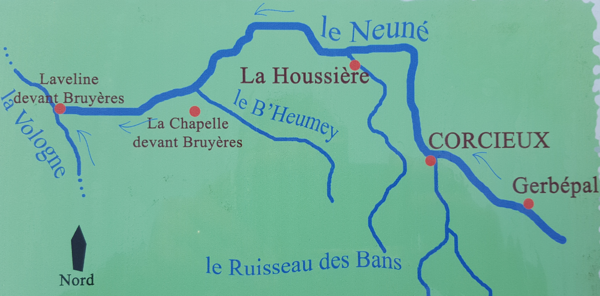
Le nom Neuné vient de « noisetier », un arbre abondant tout au long de mon cours. A Corcieux le Neuné reçoit les eaux du ruisseau de la Goule grossie du Rayrand, et plus en aval celles du ruisseau des Bans et du B’Heumey. Ce sont mes principaux affluents.
Validation de la earth cache
1- D’après le plan sur le panneau pédagogique aux coordonnées de la cache, Quels sont les deux principaux affluents du ruisseau avant Corcieux ?
2- Quelle est la longueur de la rivière ?
3- comment s’appelait le ruisseau avant « le Neuné » ? Pourquoi ?
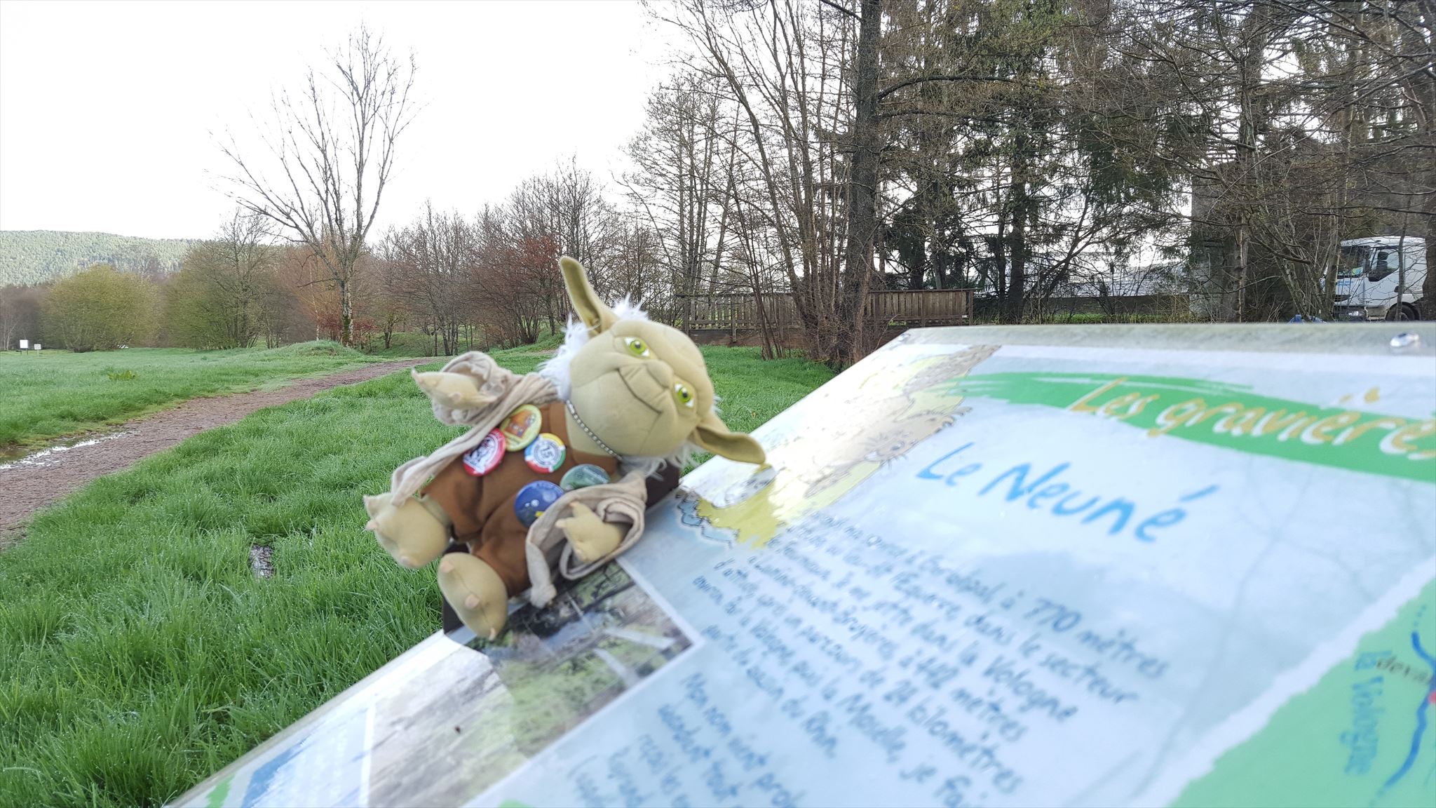
4- Que cache Yoda à la base du pont, en arrière-plan sur la photo ci-dessous ? Combien en comptez-vous?
5- Optionnel - Vous pouvez également ajouter à votre log une photo de vous ou de votre GPS sur place (ceci n'est pas obligatoire mais pourrait permettre de valider la cache en cas de réponses trop éloignées de la réalité en confirmant votre présence sur les lieux).
Loguez cette cache "Found it" et envoyez-moi vos propositions de réponses soit via mon profil, soit via la messagerie geocaching.com (Message Center), et je vous contacterai en cas de problème.

The Neuné
The Neune rises in Gerbépal 770 meters above sea level, at a place called the Square in Fourmeaux sector, it flows into the Vologne in Laveline-devant-Bruyère, at 442 meters, after a long journey. By the Vologne then the Moselle, it is part of the Rhine basin.
Neune the name comes from "hazel" abundant tree throughout my course. At Corcieux the Neune receives the creek Ghoul magnified the Rayrand, and those downstream of the Bans and B'Heumey stream. These are my main tributaries.
Validation of the earth hides
1- According to the plan on the educational panel to the coordinates of the cache, What are the two main tributaries of the creek before Corcieux ?
2- What is the length of the river ?
3- how the stream was called before "the Neune"? Why ?
4- Yoda hide at the base of the bridge in the background in the photo below? How many do you count?
5- Optional - you can added to your log a photo of you or your GPS on site (this is not mandatory but could help validate the cache in case of answers too far from reality confirming your presence at the scene).
Log in this cache "Found it" and send me your answers proposals either via my profile or via geocaching.com messaging (Message Center), and I will contact you in case of problems.