The Brisons (the name is French: brisant, 'reef, breaker') are 22 m (72 ft) and 27 m (89 ft) high and are the visible end to a reef of jagged rocks known as The Bridge. They are also known as 'Charles de Gaulle in the Bath' – it is a double peaked islet just over 1.5km from the shore of Cape Cornwall in England.
The Brisons (Cornish: An Gribow, meaning the reefs) consist of two peaks known as Brison Veor and Brison Vean... Cornish for great and little.
The rocks are connected to Gribba Point (Cornish: Pen an Gribow, meaning head of the reefs) by the Guthen Gwidden reef (Cornish: Kudhen Gwydn, meaning white hidden one).
The area was part of the mining industry in St Just... More information can be found here and a short stroll across the beach at Priest's Cove takes you to an adit close to the Lode.
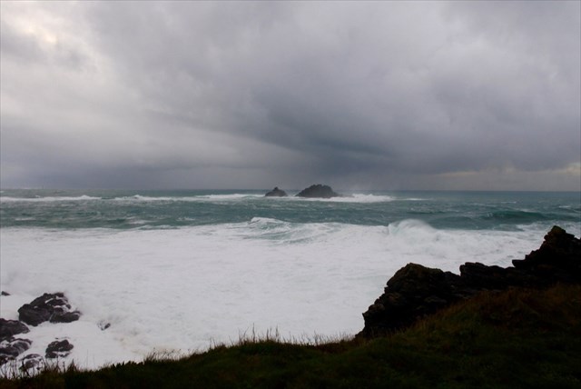
The reef has been responsible for the wrecking of many a ship over the centuries.It can be seen as a line of surf which stretches from the Brisons away to your left South East of the cape. One of the most famous wrecks was of the brig The New Commercial which saw the loss of all but two of her crew, including the loss of Mary Sanderson, buried at St Sennen Church, Sennen.
Granite is an igneous rock and started life as a liquid (hence the reason that it doesn't contain fossils). After the granite formed, it gained cracks (joints) running through it. Then mineral-rich gas rose through it and this condensed as it cooled, making the mineral veins through the granite. The feldspar crystals are one of the minerals which will be found in granite, along with quartz and mica. During this process molten minerals filled the cracks and fissures in the rock. In this area the minerals are quartz and Tourmaline, Tin (found in Cassiterite) and Copper. The discovery of tin led early communities to the create stronger metal objects, made from bronze.
On your walk you will spot rocks which contains feldspar. The crystaline structure within the granite is clear to see... it might look like fossils but it's Feldspar crystal. The granite usually appears granular and is pink in hue.
At Stage 1 you can see the twin peaks of the Brisons. Notice which direction the reef lies below the waves. NT car park. It won't tell you on the board but see if you can work out why there is a reef here...Q3 You will be charged to park here. Honesty Box out of Season.
At Stage 2 you will see some unusual rock... Q1 can you identify what is snaking through the rock and describe why you think it's like this? (There's a clue in the text)
At Stage 3 you will see some different rocks, the area where the rocks have been quarried...a great example of what is within the hillside... Q2 Describe the rock here. What does it remind you of? Why do you think this?
Stage 4 (optional, but you will get a better view of any basking sharks or seals if they are around) continue along the path and climb the steps to the Coast Watch station... Q3 The Brisons were formed from similarly mineral rich granite, already discovered. What do you think caused the gap between the Brisons and the Bridge (the reef), and the mainland?
Photographs are optional but a photo of your, or your GPSr with the Brisons in the background would be great to see.
Fascinating Facts... At the summit of Cape Cornwall is the Heinz Monument. It commemorates the purchase of Cape Cornwall for the nation by H. J. Heinz Company.
The ruins of St. Helens Oratory also can be seen nearby. Stories are told that Witches (wise women) were cast into the foaming sea nearby!
The two offshore rocks, called Brisons, are located approximately one mile southwest of the cape...
Local groups arrange an annual swim from the Brisons to the shore.
If you do make your way up to the Coast Watch station... Cornish Choughs have been spotted nearby, as have basking sharks, seals and gannets. In January 2016 there were also Blue whales spotted at nearby St Ives.
The Coast Watch Institution is a voluntary organisation which took over watching the coastal waters when the National Coastguard ended its watch here in 1996. Information can be found here
As always with caches on the Cornish coast Wear sensible shoes and TAKE CARE NEAR THE CLIFFS. We hope you enjoy your visit to this beautiful place.
Note: The CWI watch keeper has a defibrillator at the watch station and is trained in its use.
Please message or email your answers to the questions before you log a find of this Earthcache.
Placed with permission from The National Trust.
 Congratulations to JOE SMILE for First to Find